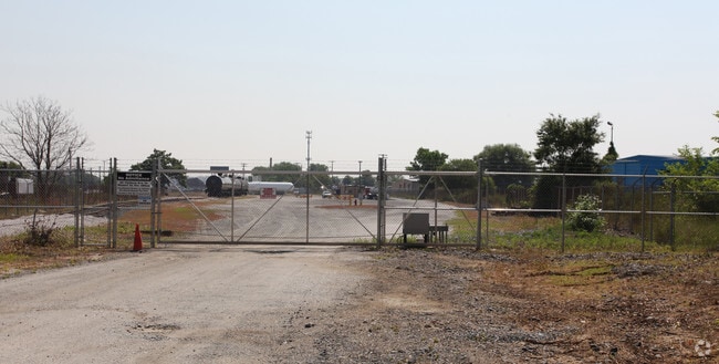
Property Record
3101 Shell Rd, Curtis Bay, MD 21226


Property Detail
3101 Shell Rd
7300-004
5.564 ACRES
Officebuilding
BALTIMORE CITY
MI
Maryland
B and X Area of moderate flood hazard, usually the area between the limits of the 100-year and 500-year floods.
4
2024
5.56 AC
2025
Baltimore SE
250600
Baltimore
448 SF
Baltimore-Columbia-Towson, MD
NEARBY LISTINGS FOR SALE OR LEASE
DEMOGRAPHICS near 3101 Shell Rd
1 mile
3 mile
5 mile
2025 Total Population
7,983
63,127
317,185
2030 Population
7,916
62,671
317,556
Pop Growth 2025-2030
(0.84%)
(0.72%)
+ 0.12%
Average Age
36
37
37
2025 Total Households
2,894
26,333
134,992
HH Growth 2025-2030
(0.97%)
(0.98%)
(0.06%)
Median Household Inc
$37,566
$85,336
$67,264
Avg Household Size
2.60
2.30
2.30
2025 Avg HH Vehicles
1.00
1.00
1.00
Median Home Value
$137,276
$303,328
$278,228
Median Year Built
1949
1951
1953
Nearby Places
Map Layers
Map Styles
 Street
 Aerial
Transit
 Traffic
 Biking
Places
Listings with unknown addresses are not visible on the map
- Restaurants
- Banks
- Shops
- Fitness
- Groceries
PUBLIC TRANSPORTATION
COMMUTER RAIL
Camden Station Marc (CAMDEN - WASHINGTON - Maryland Transit Administration)
Drive
Walk
Distance
Camden Station Marc (CAMDEN - WASHINGTON - Maryland Transit Administration)
11 min
4.9 mi
Penn Station (PENN - WASHINGTON - Maryland Area Regional Commuter Trains (The MARC), Penn Line - Maryland Area Regional Commuter Trains (The MARC), Penn Station & Camden Yards - Maryland Area Regional Commuter Trains (The MARC))
Drive
Walk
Distance
Penn Station (PENN - WASHINGTON - Maryland Area Regional Commuter Trains (The MARC), Penn Line - Maryland Area Regional Commuter Trains (The MARC), Penn Station & Camden Yards - Maryland Area Regional Commuter Trains (The MARC))
15 min
6.7 mi
AIRPORT
Baltimore/Washington International Thurgood Marshall
Drive
Walk
Distance
Baltimore/Washington International Thurgood Marshall
16 min
10.0 mi
Freight Ports
Port of Baltimore
Drive
Walk
Distance
Port of Baltimore
10 min
4.3 mi
Nearby Properties
Address
Land Use
TOTAL SIZE
Lot Size
Zoning
Address
Land Use
TOTAL SIZE
Lot Size
Zoning
3.89 AC
C-5DC
Address
Land Use
TOTAL SIZE
Lot Size
Zoning
833,702 SF
1.74 AC
C-5DC
Address
Land Use
TOTAL SIZE
Lot Size
Zoning
2.61 AC
C-5DE
Address
Land Use
TOTAL SIZE
Lot Size
Zoning
1,015,550 SF
64.95 AC
I-2
Address
Land Use
TOTAL SIZE
Lot Size
Zoning
642,817 SF
1.91 AC
PC-2
Address
Land Use
TOTAL SIZE
Lot Size
Zoning
520,407 SF
16.85 AC
H
Address
Land Use
TOTAL SIZE
Lot Size
Zoning
277,050 SF
1.27 AC
C-5DE
Address
Land Use
TOTAL SIZE
Lot Size
Zoning
263 AC
0M030
Address
Land Use
TOTAL SIZE
Lot Size
Zoning
522,990 SF
2.31 AC
TOD-4
Address
Land Use
TOTAL SIZE
Lot Size
Zoning
309,558 SF
3.01 AC
C-2
Address
Land Use
TOTAL SIZE
Lot Size
Zoning
528,399 SF
0.21 AC
TOD-4
Address
Land Use
TOTAL SIZE
Lot Size
Zoning
315,605 SF
1.80 AC
Address
Land Use
TOTAL SIZE
Lot Size
Zoning
417,025 SF
2.82 AC
C-2*
Address
Land Use
TOTAL SIZE
Lot Size
Zoning
442,145 SF
2.30 AC
C-2
Address
Land Use
TOTAL SIZE
Lot Size
Zoning
303,149 SF
0.97 AC
C-5DE
Address
Land Use
TOTAL SIZE
Lot Size
Zoning
277,887 SF
0.31 AC
OR-2
Address
Land Use
TOTAL SIZE
Lot Size
Zoning
522,274 SF
1.23 AC
C-3
Address
Land Use
TOTAL SIZE
Lot Size
Zoning
480,000 SF
2.33 AC
C-2*
Address
Land Use
TOTAL SIZE
Lot Size
Zoning
234,439 SF
1.02 AC
Address
Land Use
TOTAL SIZE
Lot Size
Zoning
290,000 SF
1.51 AC
PC-2
Address
Land Use
TOTAL SIZE
Lot Size
Zoning
238,166 SF
5.52 AC
Address
Land Use
TOTAL SIZE
Lot Size
Zoning
210,873 SF
12.28 AC
C-3
Address
Land Use
TOTAL SIZE
Lot Size
Zoning
132,655 SF
0.74 AC
Address
Land Use
TOTAL SIZE
Lot Size
Zoning
49,950 SF
28.31 AC
I-2
Address
Land Use
TOTAL SIZE
Lot Size
Zoning
263,024 SF
6.87 AC
C3
Address
Land Use
TOTAL SIZE
Lot Size
Zoning
227,700 SF
1.30 AC
C-2*
Address
Land Use
TOTAL SIZE
Lot Size
Zoning
249,000 SF
1.40 AC
R-8
Address
Land Use
TOTAL SIZE
Lot Size
Zoning
111.20 AC
W3
Address
Land Use
TOTAL SIZE
Lot Size
Zoning
406,569 SF
9.74 AC
C-2*
Address
Land Use
TOTAL SIZE
Lot Size
Zoning
173,735 SF
17.31 AC
PC-4
The World's #1 Commercial Real Estate Marketplace
Connect with us
© 2026 CoStar Group
The information above has been obtained from sources believed reliable. While we do not doubt its accuracy we have not verified it and make no guarantee, warranty or representation about it. It is your responsibility to independently confirm its accuracy and completeness. Any projections, opinions, assumptions, or estimates used are for example only and do not represent the current or future performance of the property. The value of this transaction to you depends on tax and other factors which should be evaluated by your tax, financial, and legal advisors. You and your advisors should conduct a careful, independent investigation of the property to determine to your satisfaction the suitability of the property for your needs.