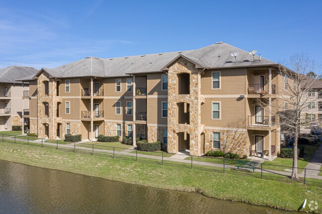
Property Record
31050 N La Hwy, , LA
Property Detail
31050 N La Hwy
Baton Rouge, LA
3.69 ACRES (BY SURVEY) SEC 40-6-3 & 46-6-3
0629436
LIVINGSTON
Commercialnec
Louisiana
B and X Area of moderate flood hazard, usually the area between the limits of the 100-year and 500-year floods.
12 AC
2025
Livingston Parish
2025
Baton Rouge
040501
NEARBY LISTINGS FOR SALE OR LEASE
-
-
View all listings for sale on LoopNet.com
DEMOGRAPHICS near 31050 N La Hwy
1 mile
3 mile
5 mile
2025 Total Population
4,727
31,445
68,491
2030 Population
5,065
32,947
71,333
Pop Growth 2025-2030
+ 7.15%
+ 4.78%
+ 4.15%
Average Age
37
39
38
2025 Total Households
1,796
11,736
25,354
HH Growth 2025-2030
+ 7.13%
+ 4.84%
+ 4.22%
Median Household Inc
$49,665
$75,259
$76,650
Avg Household Size
2.60
2.60
2.60
2025 Avg HH Vehicles
2.00
2.00
2.00
Median Home Value
$147,835
$237,991
$236,266
Median Year Built
2006
1998
1998
Nearby Places
Map Layers
Map Styles
 Street
 Aerial
Layers
 Traffic
 Biking
Places
Listings with unknown addresses are not visible on the map
- Restaurants
- Banks
- Shops
- Fitness
- Groceries
PUBLIC TRANSPORTATION
AIRPORT
Baton Rouge Metro Ryan Field
Drive
Walk
Distance
Baton Rouge Metro Ryan Field
24 min
14.4 mi
Freight Ports
Port of Greater Baton Rouge
Drive
Walk
Distance
Port of Greater Baton Rouge
33 min
22.3 mi
Nearby Properties
Address
Land Use
TOTAL SIZE
Lot Size
Zoning
Address
Land Use
TOTAL SIZE
Lot Size
Zoning
33.74 AC
Address
Land Use
TOTAL SIZE
Lot Size
Zoning
Address
Land Use
TOTAL SIZE
Lot Size
Zoning
Address
Land Use
TOTAL SIZE
Lot Size
Zoning
12.33 AC
Address
Land Use
TOTAL SIZE
Lot Size
Zoning
18.52 AC
Address
Land Use
TOTAL SIZE
Lot Size
Zoning
Address
Land Use
TOTAL SIZE
Lot Size
Zoning
13.92 AC
Address
Land Use
TOTAL SIZE
Lot Size
Zoning
Address
Land Use
TOTAL SIZE
Lot Size
Zoning
Address
Land Use
TOTAL SIZE
Lot Size
Zoning
115.37 AC
Address
Land Use
TOTAL SIZE
Lot Size
Zoning
6.21 AC
Address
Land Use
TOTAL SIZE
Lot Size
Zoning
Address
Land Use
TOTAL SIZE
Lot Size
Zoning
52,530 SF
29.23 AC
Address
Land Use
TOTAL SIZE
Lot Size
Zoning
Address
Land Use
TOTAL SIZE
Lot Size
Zoning
Address
Land Use
TOTAL SIZE
Lot Size
Zoning
17,046 SF
9.13 AC
Address
Land Use
TOTAL SIZE
Lot Size
Zoning
19.46 AC
Address
Land Use
TOTAL SIZE
Lot Size
Zoning
Address
Land Use
TOTAL SIZE
Lot Size
Zoning
Address
Land Use
TOTAL SIZE
Lot Size
Zoning
Address
Land Use
TOTAL SIZE
Lot Size
Zoning
Address
Land Use
TOTAL SIZE
Lot Size
Zoning
Address
Land Use
TOTAL SIZE
Lot Size
Zoning
Address
Land Use
TOTAL SIZE
Lot Size
Zoning
Address
Land Use
TOTAL SIZE
Lot Size
Zoning
Address
Land Use
TOTAL SIZE
Lot Size
Zoning
13,982 SF
2.63 AC
Address
Land Use
TOTAL SIZE
Lot Size
Zoning
2.73 AC
Address
Land Use
TOTAL SIZE
Lot Size
Zoning
The World's #1 Commercial Real Estate Marketplace
Connect with us
© 2026 CoStar Group
The information above has been obtained from sources believed reliable. While we do not doubt its accuracy we have not verified it and make no guarantee, warranty or representation about it. It is your responsibility to independently confirm its accuracy and completeness. Any projections, opinions, assumptions, or estimates used are for example only and do not represent the current or future performance of the property. The value of this transaction to you depends on tax and other factors which should be evaluated by your tax, financial, and legal advisors. You and your advisors should conduct a careful, independent investigation of the property to determine to your satisfaction the suitability of the property for your needs.