Property Record
3107 Clairmont Rd Ne, Brookhaven, GA 30329


NEARBY LISTINGS FOR SALE OR LEASE
-
-
-
-
-
-
-
-
-
No Photo
-
-
-
-
View all Brookhaven listings for lease on LoopNet.com
Property Detail
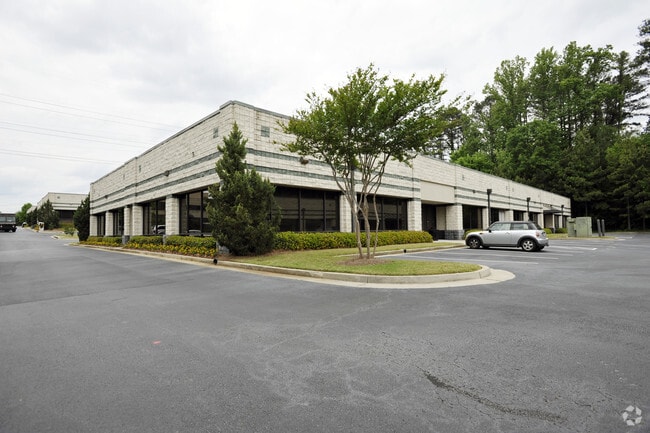
3107 Clairmont Rd Ne
Atlanta-Sandy Springs-Roswell, GA
Ashton Crossing
18-203-05-066
301 X 551 X 88 X 64 X 302 X 695
Officebuilding
DeKalb
X
Georgia
13089C0056K
66
2025
4.85 AC
2025
Chamblee/Dville/N D Hills
021410
Atlanta
52,134 SF
DEMOGRAPHICS near 3107 Clairmont Rd Ne
1 Mile
3 Mile
5 Mile
2024 Total Population
19,083
122,078
321,255
2029 Population
19,110
122,243
324,226
Pop Growth 2024-2029
+ 0.14%
+ 0.14%
+ 0.92%
Average Age
34
38
38
2024 Total Households
7,976
54,785
145,858
HH Growth 2024-2029
+ 0.03%
+ 0.21%
+ 1.23%
Median Household Inc
$77,053
$99,280
$96,549
Avg Household Size
2.30
2.20
2.10
2024 Avg HH Vehicles
1.00
2.00
2.00
Median Home Value
$459,859
$514,005
$515,126
Median Year Built
1983
1987
1986
Nearby Places
Map Layers
Map Styles
 Street
 Aerial
- Restaurants
- Banks
- Shops
- Fitness
- Groceries
PUBLIC TRANSPORTATION
COMMUTER RAIL
DRIVE
WALK
Distance
11 min
6.5 mi
AIRPORT
Hartsfield - Jackson Atlanta International
DRIVE
WALK
Distance
Hartsfield - Jackson Atlanta International
30 min
19.3 mi
SALE & LEASE HISTORY
LISTING DATE
SALE/LEASE

Jul 28, 2017
For Lease
Jul 27, 2023
For Lease
Jul 01, 2020
For Lease
Jan 30, 2017
For Lease
Dec 14, 2023
For Lease
Aug 06, 2020
For Lease
Nearby Properties
Address
Land Use
TOTAL SIZE
Lot Size
Zoning
Address
Land Use
TOTAL SIZE
Lot Size
Zoning
11,126,925 SF
43.33 AC
C3
Address
Land Use
TOTAL SIZE
Lot Size
Zoning
12,600 SF
508.30 AC
M
Address
Land Use
TOTAL SIZE
Lot Size
Zoning
3,356,268 SF
14.72 AC
C3
Address
Land Use
TOTAL SIZE
Lot Size
Zoning
169,435 SF
76.18 AC
M
Address
Land Use
TOTAL SIZE
Lot Size
Zoning
1,233,815 SF
2.18 AC
PDMU
Address
Land Use
TOTAL SIZE
Lot Size
Zoning
188,648 SF
4.39 AC
X
Address
Land Use
TOTAL SIZE
Lot Size
Zoning
589,761 SF
22.67 AC
RM-HD
Address
Land Use
TOTAL SIZE
Lot Size
Zoning
2,820,296 SF
9.58 AC
RG5
Address
Land Use
TOTAL SIZE
Lot Size
Zoning
458,822 SF
2.86 AC
RG2
Address
Land Use
TOTAL SIZE
Lot Size
Zoning
299,993 SF
4.72 AC
I1
Address
Land Use
TOTAL SIZE
Lot Size
Zoning
863,826 SF
3.79 AC
C4
Address
Land Use
TOTAL SIZE
Lot Size
Zoning
213,408 SF
6.35 AC
I1
Address
Land Use
TOTAL SIZE
Lot Size
Zoning
389,560 SF
4.01 AC
C1
Address
Land Use
TOTAL SIZE
Lot Size
Zoning
432,424 SF
3.87 AC
MC
Address
Land Use
TOTAL SIZE
Lot Size
Zoning
431,259 SF
48.90 AC
RM100
Address
Land Use
TOTAL SIZE
Lot Size
Zoning
386,058 SF
C3
Address
Land Use
TOTAL SIZE
Lot Size
Zoning
187,172 SF
7.22 AC
OI
Address
Land Use
TOTAL SIZE
Lot Size
Zoning
490,090 SF
2.27 AC
C3
Address
Land Use
TOTAL SIZE
Lot Size
Zoning
191,941 SF
3.02 AC
OCR
Address
Land Use
TOTAL SIZE
Lot Size
Zoning
257,989 SF
12.41 AC
OI
Address
Land Use
TOTAL SIZE
Lot Size
Zoning
713,717 SF
2.82 AC
R3
Address
Land Use
TOTAL SIZE
Lot Size
Zoning
131,793 SF
4.30 AC
X
Address
Land Use
TOTAL SIZE
Lot Size
Zoning
600,502 SF
4.46 AC
R3
Address
Land Use
TOTAL SIZE
Lot Size
Zoning
307,824 SF
16.40 AC
X
Address
Land Use
TOTAL SIZE
Lot Size
Zoning
729,294 SF
0.01 AC
X
Address
Land Use
TOTAL SIZE
Lot Size
Zoning
157,133 SF
5.03 AC
M
Address
Land Use
TOTAL SIZE
Lot Size
Zoning
166,377 SF
7.56 AC
X
Address
Land Use
TOTAL SIZE
Lot Size
Zoning
267,426 SF
6.90 AC
OI
Address
Land Use
TOTAL SIZE
Lot Size
Zoning
321,334 SF
12.70 AC
RM-HD
Address
Land Use
TOTAL SIZE
Lot Size
Zoning
150,894 SF
3.85 AC
C2
The World's #1 Commercial Real Estate Marketplace
Connect with us
© 2026 CoStar Group
The information above has been obtained from sources believed reliable. While we do not doubt its accuracy we have not verified it and make no guarantee, warranty or representation about it. It is your responsibility to independently confirm its accuracy and completeness. Any projections, opinions, assumptions, or estimates used are for example only and do not represent the current or future performance of the property. The value of this transaction to you depends on tax and other factors which should be evaluated by your tax, financial, and legal advisors. You and your advisors should conduct a careful, independent investigation of the property to determine to your satisfaction the suitability of the property for your needs.