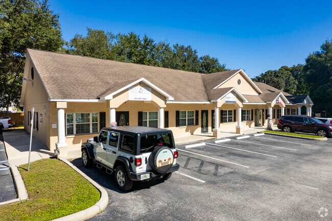
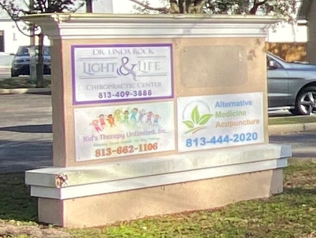
Property Record
3109 Lithia Pinecrest Rd, Valrico, FL 33596


Current Lease Availabilities
NEARBY LISTINGS FOR SALE OR LEASE
Property Detail
3109 Lithia Pinecrest Rd
Tampa-St. Petersburg-Clearwater, FL
Unplatted
U-06-30-21-ZZZ-000004-28190.0
THAT PART OF S 150 FT OF SW 1/4 OF NE 1/4 OF SW 1/4 LYING E OF MARVINA RD
Officebuilding
Hillsborough
X
Florida
12057C0415H
28190
2024
0.84 AC
2025
Eastern Outlying
013206
Tampa/St Petersburg
6,180 SF
DEMOGRAPHICS near 3109 Lithia Pinecrest Rd
1 Mile
3 Mile
5 Mile
2024 Total Population
7,471
71,673
182,462
2029 Population
8,208
77,660
198,350
Pop Growth 2024-2029
+ 9.86%
+ 8.35%
+ 8.71%
Average Age
43
42
40
2024 Total Households
2,637
25,544
65,987
HH Growth 2024-2029
+ 10.16%
+ 8.61%
+ 8.99%
Median Household Inc
$102,853
$95,084
$83,123
Avg Household Size
2.80
2.80
2.70
2024 Avg HH Vehicles
2.00
2.00
2.00
Median Home Value
$340,668
$331,486
$319,012
Median Year Built
1992
1990
1993
Nearby Places
Map Layers
Map Styles
 Street
 Aerial
- Restaurants
- Banks
- Shops
- Fitness
- Groceries
PUBLIC TRANSPORTATION
AIRPORT
Tampa International
DRIVE
WALK
Distance
Tampa International
38 min
23.1 mi
St Pete-Clearwater International
DRIVE
WALK
Distance
St Pete-Clearwater International
55 min
33.2 mi
Nearby Properties
Address
Land Use
TOTAL SIZE
Lot Size
Zoning
Address
Land Use
TOTAL SIZE
Lot Size
Zoning
379,023 SF
22.16 AC
PD
Address
Land Use
TOTAL SIZE
Lot Size
Zoning
288,270 SF
78.75 AC
PD
Address
Land Use
TOTAL SIZE
Lot Size
Zoning
113,979 SF
18.40 AC
PD
Address
Land Use
TOTAL SIZE
Lot Size
Zoning
182,688 SF
14.69 AC
PD
Address
Land Use
TOTAL SIZE
Lot Size
Zoning
185,184 SF
9.65 AC
PD
Address
Land Use
TOTAL SIZE
Lot Size
Zoning
190,080 SF
22.45 AC
PD
Address
Land Use
TOTAL SIZE
Lot Size
Zoning
134,594 SF
13.22 AC
PD
Address
Land Use
TOTAL SIZE
Lot Size
Zoning
140,058 SF
8.71 AC
RMC-20
Address
Land Use
TOTAL SIZE
Lot Size
Zoning
870.14 AC
AR
Address
Land Use
TOTAL SIZE
Lot Size
Zoning
141,626 SF
8.88 AC
PD
Address
Land Use
TOTAL SIZE
Lot Size
Zoning
163,427 SF
38.66 AC
RSC-6
Address
Land Use
TOTAL SIZE
Lot Size
Zoning
156,266 SF
9.27 AC
PD
Address
Land Use
TOTAL SIZE
Lot Size
Zoning
57,438 SF
12.28 AC
PD
Address
Land Use
TOTAL SIZE
Lot Size
Zoning
124,207 SF
28.64 AC
RSC-6
Address
Land Use
TOTAL SIZE
Lot Size
Zoning
101,727 SF
11.18 AC
PD
Address
Land Use
TOTAL SIZE
Lot Size
Zoning
158,777 SF
15.23 AC
TND
Address
Land Use
TOTAL SIZE
Lot Size
Zoning
315,568 SF
25.30 AC
PD
Address
Land Use
TOTAL SIZE
Lot Size
Zoning
107,525 SF
2.84 AC
PD
Address
Land Use
TOTAL SIZE
Lot Size
Zoning
85,972 SF
10.49 AC
PD
Address
Land Use
TOTAL SIZE
Lot Size
Zoning
97,587 SF
24.06 AC
PD
Address
Land Use
TOTAL SIZE
Lot Size
Zoning
90,441 SF
20.39 AC
AS-1
Address
Land Use
TOTAL SIZE
Lot Size
Zoning
165,601 SF
21.55 AC
PD
Address
Land Use
TOTAL SIZE
Lot Size
Zoning
71,488 SF
11.55 AC
PD
Address
Land Use
TOTAL SIZE
Lot Size
Zoning
113,930 SF
19.85 AC
ASC-1
Address
Land Use
TOTAL SIZE
Lot Size
Zoning
135,456 SF
18.76 AC
PD
Address
Land Use
TOTAL SIZE
Lot Size
Zoning
82,340 SF
11.12 AC
PD
Address
Land Use
TOTAL SIZE
Lot Size
Zoning
68,422 SF
9.14 AC
PD
Address
Land Use
TOTAL SIZE
Lot Size
Zoning
68,247 SF
16.80 AC
PD
Address
Land Use
TOTAL SIZE
Lot Size
Zoning
107,002 SF
17.80 AC
RSC-6
Address
Land Use
TOTAL SIZE
Lot Size
Zoning
68,000 SF
5.21 AC
PD
The World's #1 Commercial Real Estate Marketplace
Connect with us
© 2026 CoStar Group
The information above has been obtained from sources believed reliable. While we do not doubt its accuracy we have not verified it and make no guarantee, warranty or representation about it. It is your responsibility to independently confirm its accuracy and completeness. Any projections, opinions, assumptions, or estimates used are for example only and do not represent the current or future performance of the property. The value of this transaction to you depends on tax and other factors which should be evaluated by your tax, financial, and legal advisors. You and your advisors should conduct a careful, independent investigation of the property to determine to your satisfaction the suitability of the property for your needs.