Property Record
311 Bunting Ln, Mankato, MN 56001
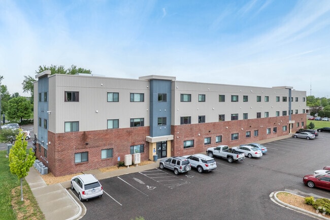

Property Detail
311 Bunting Ln
Mankato, MN
SOUTHEAST VILLAGE SUB #8 EXC S198.42' 001 003 1.18A
R01-09-20-153-014
Blue Earth
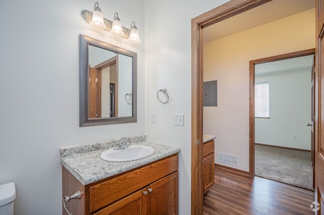
Apartment
Minnesota
B and X Area of moderate flood hazard, usually the area between the limits of the 100-year and 500-year floods.
1
2026
1.18 AC
2026
University
171202
Other Market Areas
NEARBY LISTINGS FOR SALE OR LEASE
DEMOGRAPHICS near 311 Bunting Ln
1 mile
3 mile
5 mile
2025 Total Population
14,936
49,673
65,598
2030 Population
15,120
50,192
66,225
Pop Growth 2025-2030
+ 1.23%
+ 1.04%
+ 0.96%
Average Age
30
35
36
2025 Total Households
5,459
19,571
25,895
HH Growth 2025-2030
+ 1.17%
+ 1.04%
+ 1.00%
Median Household Inc
$43,735
$62,898
$67,276
Avg Household Size
2.30
2.30
2.30
2025 Avg HH Vehicles
2.00
2.00
2.00
Median Home Value
$254,633
$257,954
$276,240
Median Year Built
1993
1977
1982
Nearby Places
Map Layers
Map Styles
 Street
 Aerial
Layers
 Traffic
 Biking
Places
Listings with unknown addresses are not visible on the map
- Restaurants
- Banks
- Shops
- Fitness
- Groceries
SALE & LEASE HISTORY
LISTING DATE
SALE/LEASE

Sep 27, 2019
For Sale
Apr 11, 2018
For Sale
Nearby Properties
Address
Land Use
TOTAL SIZE
Lot Size
Zoning
Address
Land Use
TOTAL SIZE
Lot Size
Zoning
666,816 SF
6.31 AC
Address
Land Use
TOTAL SIZE
Lot Size
Zoning
184,270 SF
79.30 AC
Address
Land Use
TOTAL SIZE
Lot Size
Zoning
616,099 SF
4.06 AC
Address
Land Use
TOTAL SIZE
Lot Size
Zoning
178,201 SF
64.49 AC
Address
Land Use
TOTAL SIZE
Lot Size
Zoning
191,916 SF
37.68 AC
Address
Land Use
TOTAL SIZE
Lot Size
Zoning
17.90 AC
Address
Land Use
TOTAL SIZE
Lot Size
Zoning
12.37 AC
Address
Land Use
TOTAL SIZE
Lot Size
Zoning
13.43 AC
Address
Land Use
TOTAL SIZE
Lot Size
Zoning
481,569 SF
31.57 AC
Address
Land Use
TOTAL SIZE
Lot Size
Zoning
287,085 SF
38 AC
Address
Land Use
TOTAL SIZE
Lot Size
Zoning
11.75 AC
Address
Land Use
TOTAL SIZE
Lot Size
Zoning
101,602 SF
20 AC
Address
Land Use
TOTAL SIZE
Lot Size
Zoning
331,604 SF
35.88 AC
Address
Land Use
TOTAL SIZE
Lot Size
Zoning
157,216 SF
31.67 AC
Address
Land Use
TOTAL SIZE
Lot Size
Zoning
137,968 SF
11.96 AC
Address
Land Use
TOTAL SIZE
Lot Size
Zoning
219,165 SF
24.49 AC
Address
Land Use
TOTAL SIZE
Lot Size
Zoning
4.26 AC
Address
Land Use
TOTAL SIZE
Lot Size
Zoning
3.73 AC
Address
Land Use
TOTAL SIZE
Lot Size
Zoning
83,917 SF
10.08 AC
Address
Land Use
TOTAL SIZE
Lot Size
Zoning
12,400 SF
60.45 AC
Address
Land Use
TOTAL SIZE
Lot Size
Zoning
168,908 SF
5.71 AC
Address
Land Use
TOTAL SIZE
Lot Size
Zoning
144,504 SF
3.87 AC
Address
Land Use
TOTAL SIZE
Lot Size
Zoning
5.67 AC
Address
Land Use
TOTAL SIZE
Lot Size
Zoning
26,500 SF
3.31 AC
Address
Land Use
TOTAL SIZE
Lot Size
Zoning
97,508 SF
44.54 AC
Address
Land Use
TOTAL SIZE
Lot Size
Zoning
63,880 SF
9.19 AC
Address
Land Use
TOTAL SIZE
Lot Size
Zoning
58,604 SF
1.19 AC
Address
Land Use
TOTAL SIZE
Lot Size
Zoning
6.44 AC
Address
Land Use
TOTAL SIZE
Lot Size
Zoning
6.91 AC
The World's #1 Commercial Real Estate Marketplace
Connect with us
© 2026 CoStar Group
The information above has been obtained from sources believed reliable. While we do not doubt its accuracy we have not verified it and make no guarantee, warranty or representation about it. It is your responsibility to independently confirm its accuracy and completeness. Any projections, opinions, assumptions, or estimates used are for example only and do not represent the current or future performance of the property. The value of this transaction to you depends on tax and other factors which should be evaluated by your tax, financial, and legal advisors. You and your advisors should conduct a careful, independent investigation of the property to determine to your satisfaction the suitability of the property for your needs.