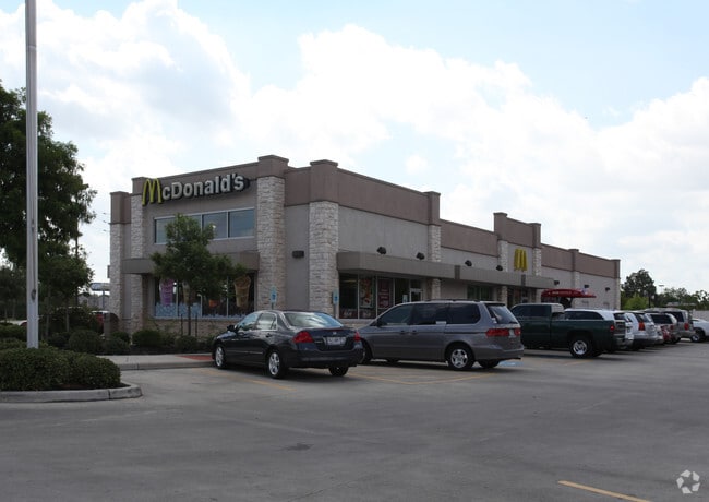
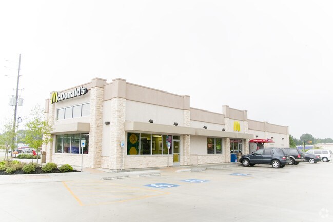
Property Record
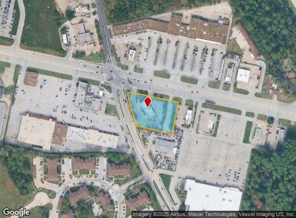
3110 Fm 1960 Rd W, Humble, TX 77338
NEARBY LISTINGS FOR SALE OR LEASE
Property Detail
3110 Fm 1960 Rd W
1252970010001
Mcdonalds At Aldine-Westfield And Fm 196
Restaurantdrivein
RES A BLK 1 MCDONALDS AT ALDINE-WESTFIELD AND FM 1960
X
Harris
48339C0700F
Texas
2024
1.59 AC
2025
North Belt/Greenspnt
240802
Houston
4,693 SF
Houston-The Woodlands-Sugar Land, TX
DEMOGRAPHICS near 3110 Fm 1960 Rd W
1 Mile
3 Mile
5 Mile
2024 Total Population
8,738
71,922
204,647
2029 Population
8,925
73,173
210,196
Pop Growth 2024-2029
+ 2.14%
+ 1.74%
+ 2.71%
Average Age
33
34
34
2024 Total Households
2,857
23,285
69,447
HH Growth 2024-2029
+ 2.17%
+ 1.79%
+ 2.73%
Median Household Inc
$53,234
$58,773
$55,869
Avg Household Size
3.00
3.00
2.90
2024 Avg HH Vehicles
2.00
2.00
2.00
Median Home Value
$171,107
$158,600
$180,006
Median Year Built
2004
1993
1993
Nearby Places
Map Layers
Map Styles
 Street
 Aerial
- Restaurants
- Banks
- Shops
- Fitness
- Groceries
PUBLIC TRANSPORTATION
AIRPORT
George Bush Intcntl/Houston
DRIVE
WALK
Distance
George Bush Intcntl/Houston
16 min
8.9 mi
William P Hobby
DRIVE
WALK
Distance
William P Hobby
52 min
32.9 mi
Freight Ports
Port of Houston
DRIVE
WALK
Distance
Port of Houston
40 min
26.8 mi
Nearby Properties
Address
Land Use
TOTAL SIZE
Lot Size
Zoning
Address
Land Use
TOTAL SIZE
Lot Size
Zoning
764,495 SF
54.15 AC
Address
Land Use
TOTAL SIZE
Lot Size
Zoning
276,324 SF
33.79 AC
Address
Land Use
TOTAL SIZE
Lot Size
Zoning
409,480 SF
27.32 AC
Address
Land Use
TOTAL SIZE
Lot Size
Zoning
417,597 SF
16.98 AC
Address
Land Use
TOTAL SIZE
Lot Size
Zoning
350,423 SF
122.83 AC
Address
Land Use
TOTAL SIZE
Lot Size
Zoning
280,283 SF
16.56 AC
Address
Land Use
TOTAL SIZE
Lot Size
Zoning
435,650 SF
Address
Land Use
TOTAL SIZE
Lot Size
Zoning
271,432 SF
35.81 AC
Address
Land Use
TOTAL SIZE
Lot Size
Zoning
318,000 SF
18.53 AC
Address
Land Use
TOTAL SIZE
Lot Size
Zoning
287,251 SF
18.12 AC
Address
Land Use
TOTAL SIZE
Lot Size
Zoning
259,000 SF
15.73 AC
Address
Land Use
TOTAL SIZE
Lot Size
Zoning
259,000 SF
14.73 AC
Address
Land Use
TOTAL SIZE
Lot Size
Zoning
357,485 SF
19.38 AC
Address
Land Use
TOTAL SIZE
Lot Size
Zoning
204,870 SF
13.40 AC
Address
Land Use
TOTAL SIZE
Lot Size
Zoning
203,013 SF
12.28 AC
Address
Land Use
TOTAL SIZE
Lot Size
Zoning
238,835 SF
9.98 AC
Address
Land Use
TOTAL SIZE
Lot Size
Zoning
249,296 SF
10.10 AC
Address
Land Use
TOTAL SIZE
Lot Size
Zoning
174,500 SF
9.83 AC
Address
Land Use
TOTAL SIZE
Lot Size
Zoning
175,495 SF
8.92 AC
Address
Land Use
TOTAL SIZE
Lot Size
Zoning
267,250 SF
11.83 AC
Address
Land Use
TOTAL SIZE
Lot Size
Zoning
127,260 SF
14 AC
Address
Land Use
TOTAL SIZE
Lot Size
Zoning
157,200 SF
10.16 AC
Address
Land Use
TOTAL SIZE
Lot Size
Zoning
159,775 SF
8.77 AC
Address
Land Use
TOTAL SIZE
Lot Size
Zoning
222,382 SF
10.44 AC
Address
Land Use
TOTAL SIZE
Lot Size
Zoning
159,514 SF
11.40 AC
Address
Land Use
TOTAL SIZE
Lot Size
Zoning
110,597 SF
9.06 AC
Address
Land Use
TOTAL SIZE
Lot Size
Zoning
132,102 SF
14.93 AC
Address
Land Use
TOTAL SIZE
Lot Size
Zoning
99,561 SF
11.60 AC
Address
Land Use
TOTAL SIZE
Lot Size
Zoning
101,399 SF
17.11 AC
Address
Land Use
TOTAL SIZE
Lot Size
Zoning
222,903 SF
8.46 AC
The World's #1 Commercial Real Estate Marketplace
Connect with us
© 2025 CoStar Group
The information above has been obtained from sources believed reliable. While we do not doubt its accuracy we have not verified it and make no guarantee, warranty or representation about it. It is your responsibility to independently confirm its accuracy and completeness. Any projections, opinions, assumptions, or estimates used are for example only and do not represent the current or future performance of the property. The value of this transaction to you depends on tax and other factors which should be evaluated by your tax, financial, and legal advisors. You and your advisors should conduct a careful, independent investigation of the property to determine to your satisfaction the suitability of the property for your needs.