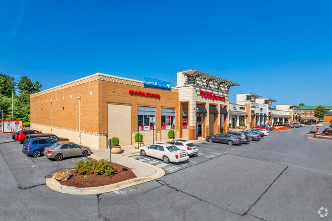
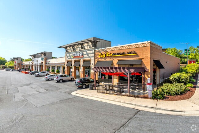
Property Record
3110 Olney Sandy Spring Rd, Olney, MD 20832

Property Detail
3110 Olney Sandy Spring Rd
08-02907423
OLNEY GARDENS
Regionalshoppingcenterormallwithanchorstore
Montgomery
CRT2.
Maryland
B and X Area of moderate flood hazard, usually the area between the limits of the 100-year and 500-year floods.
p14
2024
2.99 AC
2025
Outlying Montgmery Cnty E
701314
Washington, DC
34,658 SF
Washington-Arlington-Alexandria, DC-VA-MD-WV
NEARBY LISTINGS FOR SALE OR LEASE
DEMOGRAPHICS near 3110 Olney Sandy Spring Rd
1 mile
3 mile
5 mile
2025 Total Population
13,613
44,578
117,950
2030 Population
13,883
45,699
121,004
Pop Growth 2025-2030
+ 1.98%
+ 2.51%
+ 2.59%
Average Age
42
44
44
2025 Total Households
4,856
15,642
42,617
HH Growth 2025-2030
+ 1.85%
+ 2.47%
+ 2.60%
Median Household Inc
$156,431
$168,977
$132,365
Avg Household Size
2.80
2.80
2.70
2025 Avg HH Vehicles
2.00
2.00
2.00
Median Home Value
$610,928
$686,965
$645,592
Median Year Built
1984
1985
1981
Nearby Places
Map Layers
Map Styles
 Street
 Aerial
Layers
 Traffic
 Biking
Places
Listings with unknown addresses are not visible on the map
- Restaurants
- Banks
- Shops
- Fitness
- Groceries
PUBLIC TRANSPORTATION
COMMUTER RAIL
Rockville (BRUNSWICK - WASHINGTON - Maryland Area Regional Commuter Trains (The MARC), Brunswick Line - Maryland Area Regional Commuter Trains (The MARC))
Drive
Walk
Distance
Rockville (BRUNSWICK - WASHINGTON - Maryland Area Regional Commuter Trains (The MARC), Brunswick Line - Maryland Area Regional Commuter Trains (The MARC))
15 min
7.7 mi
AIRPORT
Ronald Reagan Washington Ntl
Drive
Walk
Distance
Ronald Reagan Washington Ntl
46 min
25.1 mi
Baltimore/Washington International Thurgood Marshall
Drive
Walk
Distance
Baltimore/Washington International Thurgood Marshall
43 min
28.2 mi
Washington Dulles International
Drive
Walk
Distance
Washington Dulles International
59 min
35.2 mi
Freight Ports
Port of Baltimore
Drive
Walk
Distance
Port of Baltimore
48 min
31.1 mi
SALE & LEASE HISTORY
LISTING DATE
SALE/LEASE

Sep 30, 2020
For Lease
Nearby Properties
Address
Land Use
TOTAL SIZE
Lot Size
Zoning
Address
Land Use
TOTAL SIZE
Lot Size
Zoning
233,735 SF
21.74 AC
RE2
Address
Land Use
TOTAL SIZE
Lot Size
Zoning
202,044 SF
17.69 AC
CRT2.
Address
Land Use
TOTAL SIZE
Lot Size
Zoning
235,762 SF
139.24 AC
RE2
Address
Land Use
TOTAL SIZE
Lot Size
Zoning
289,712 SF
19.79 AC
RNC
Address
Land Use
TOTAL SIZE
Lot Size
Zoning
135,878 SF
17.11 AC
RNC
Address
Land Use
TOTAL SIZE
Lot Size
Zoning
165,842 SF
16.90 AC
RE2
Address
Land Use
TOTAL SIZE
Lot Size
Zoning
209,897 SF
48.45 AC
RC
Address
Land Use
TOTAL SIZE
Lot Size
Zoning
96,941 SF
10.87 AC
CRT2.
Address
Land Use
TOTAL SIZE
Lot Size
Zoning
140,080 SF
6.48 AC
PD9
Address
Land Use
TOTAL SIZE
Lot Size
Zoning
136,736 SF
37.37 AC
RNC
Address
Land Use
TOTAL SIZE
Lot Size
Zoning
61,578 SF
4.80 AC
RE2
Address
Land Use
TOTAL SIZE
Lot Size
Zoning
115,000 SF
15.85 AC
RE2
Address
Land Use
TOTAL SIZE
Lot Size
Zoning
110,210 SF
3.92 AC
CRT2.
Address
Land Use
TOTAL SIZE
Lot Size
Zoning
124,099 SF
10.95 AC
RE2
Address
Land Use
TOTAL SIZE
Lot Size
Zoning
58,437 SF
3.55 AC
CRT2.
Address
Land Use
TOTAL SIZE
Lot Size
Zoning
78,271 SF
57.63 AC
RC
Address
Land Use
TOTAL SIZE
Lot Size
Zoning
28,072 SF
2.28 AC
NR0.7
Address
Land Use
TOTAL SIZE
Lot Size
Zoning
65,000 SF
19.80 AC
RE1
Address
Land Use
TOTAL SIZE
Lot Size
Zoning
53,664 SF
17.63 AC
R90
Address
Land Use
TOTAL SIZE
Lot Size
Zoning
68,190 SF
3.29 AC
CRT2.
Address
Land Use
TOTAL SIZE
Lot Size
Zoning
51,824 SF
10.49 AC
PCC
Address
Land Use
TOTAL SIZE
Lot Size
Zoning
30,221 SF
3.47 AC
R200
Address
Land Use
TOTAL SIZE
Lot Size
Zoning
47,870 SF
7.80 AC
R200
Address
Land Use
TOTAL SIZE
Lot Size
Zoning
56,300 SF
10.24 AC
R200
Address
Land Use
TOTAL SIZE
Lot Size
Zoning
63,992 SF
37.97 AC
RC
Address
Land Use
TOTAL SIZE
Lot Size
Zoning
55,972 SF
49.25 AC
Address
Land Use
TOTAL SIZE
Lot Size
Zoning
57,793 SF
10.85 AC
RE2
Address
Land Use
TOTAL SIZE
Lot Size
Zoning
90,759 SF
5.45 AC
RE2
Address
Land Use
TOTAL SIZE
Lot Size
Zoning
78,736 SF
35.96 AC
RE2
The World's #1 Commercial Real Estate Marketplace
Connect with us
© 2026 CoStar Group
The information above has been obtained from sources believed reliable. While we do not doubt its accuracy we have not verified it and make no guarantee, warranty or representation about it. It is your responsibility to independently confirm its accuracy and completeness. Any projections, opinions, assumptions, or estimates used are for example only and do not represent the current or future performance of the property. The value of this transaction to you depends on tax and other factors which should be evaluated by your tax, financial, and legal advisors. You and your advisors should conduct a careful, independent investigation of the property to determine to your satisfaction the suitability of the property for your needs.