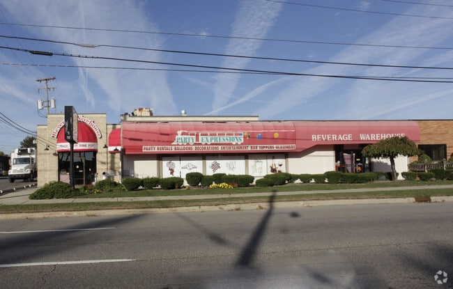
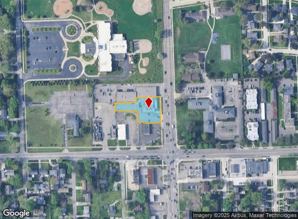
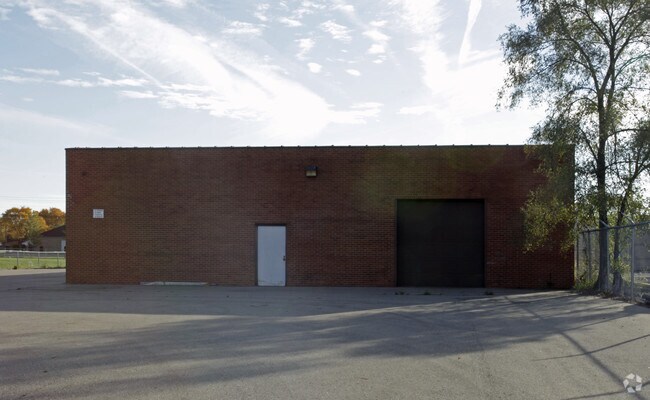
Property Record
31109 Greenfield Rd, Franklin, MI 48025
NEARBY LISTINGS FOR SALE OR LEASE
Property Detail
31109 Greenfield Rd
Detroit-Warren-Dearborn, MI
Greenfield Villa's Sub
24-01-477-025
T1N, R10E, SEC 1 GREENFIELD VILLA'S SUB S 30 FT OF E 140 FT OF LOT 28, ALSO N 123 FT OF LOT 1 EXC S 6 FT OF W 30 FT, ALSO N 50 FT OF LOT 2 12-16-91 FR 015 & 018
Storebuilding
Oakland
X
Michigan
26125C0539F
28
2024
0.62 AC
2024
Troy Area West
158000
Detroit
8,410 SF
DEMOGRAPHICS near 31109 Greenfield Rd
1 Mile
3 Mile
5 Mile
2024 Total Population
14,166
117,116
271,073
2029 Population
14,017
115,903
268,532
Pop Growth 2024-2029
(1.05%)
(1.04%)
(0.94%)
Average Age
41
42
42
2024 Total Households
6,533
52,500
120,285
HH Growth 2024-2029
(0.99%)
(1.02%)
(0.93%)
Median Household Inc
$86,835
$94,657
$90,044
Avg Household Size
2.10
2.20
2.20
2024 Avg HH Vehicles
2.00
2.00
2.00
Median Home Value
$289,900
$295,954
$289,494
Median Year Built
1957
1959
1960
Nearby Places
Map Layers
Map Styles
 Street
 Aerial
- Restaurants
- Banks
- Shops
- Fitness
- Groceries
PUBLIC TRANSPORTATION
COMMUTER RAIL
Troy Amtrak Station (Wolverine - Amtrak)
DRIVE
WALK
Distance
Troy Amtrak Station (Wolverine - Amtrak)
7 min
3.3 mi
Royal Oak Amtrak (Wolverine - Amtrak)
DRIVE
WALK
Distance
Royal Oak Amtrak (Wolverine - Amtrak)
9 min
4.2 mi
AIRPORT
Windsor International
DRIVE
WALK
Distance
Windsor International
48 min
26.9 mi
Detroit Metro Wayne County
DRIVE
WALK
Distance
Detroit Metro Wayne County
46 min
29.2 mi
Freight Ports
Port of Toledo
DRIVE
WALK
Distance
Port of Toledo
94 min
71.2 mi
Nearby Properties
Address
Land Use
TOTAL SIZE
Lot Size
Zoning
Address
Land Use
TOTAL SIZE
Lot Size
Zoning
350,140 SF
37.78 AC
RC
Address
Land Use
TOTAL SIZE
Lot Size
Zoning
111,030 SF
0.97 AC
BI
Address
Land Use
TOTAL SIZE
Lot Size
Zoning
187,801 SF
5.49 AC
RM-2
Address
Land Use
TOTAL SIZE
Lot Size
Zoning
149,395 SF
1.02 AC
BI
Address
Land Use
TOTAL SIZE
Lot Size
Zoning
143,160 SF
0.84 AC
BI
Address
Land Use
TOTAL SIZE
Lot Size
Zoning
15.32 AC
GEN BUS
Address
Land Use
TOTAL SIZE
Lot Size
Zoning
99,661 SF
0.62 AC
Address
Land Use
TOTAL SIZE
Lot Size
Zoning
236,140 SF
1.67 AC
BI
Address
Land Use
TOTAL SIZE
Lot Size
Zoning
170,465 SF
4.84 AC
BV
Address
Land Use
TOTAL SIZE
Lot Size
Zoning
83,244 SF
0.38 AC
Address
Land Use
TOTAL SIZE
Lot Size
Zoning
72,457 SF
5.60 AC
OFFICE SVC
Address
Land Use
TOTAL SIZE
Lot Size
Zoning
84,711 SF
5.05 AC
BI
Address
Land Use
TOTAL SIZE
Lot Size
Zoning
79,935 SF
1.02 AC
BI
Address
Land Use
TOTAL SIZE
Lot Size
Zoning
109,570 SF
0.68 AC
BI
Address
Land Use
TOTAL SIZE
Lot Size
Zoning
245,740 SF
1.06 AC
BI
Address
Land Use
TOTAL SIZE
Lot Size
Zoning
301,276 SF
13.58 AC
AI
Address
Land Use
TOTAL SIZE
Lot Size
Zoning
80,334 SF
0.57 AC
BI
Address
Land Use
TOTAL SIZE
Lot Size
Zoning
24.30 AC
GEN BUS
Address
Land Use
TOTAL SIZE
Lot Size
Zoning
56,867 SF
3.80 AC
BI
Address
Land Use
TOTAL SIZE
Lot Size
Zoning
212 SF
16.59 AC
RM
Address
Land Use
TOTAL SIZE
Lot Size
Zoning
417,880 SF
6.76 AC
RM-2
Address
Land Use
TOTAL SIZE
Lot Size
Zoning
52,787 SF
0.34 AC
BI
Address
Land Use
TOTAL SIZE
Lot Size
Zoning
183,090 SF
15.25 AC
RM
Address
Land Use
TOTAL SIZE
Lot Size
Zoning
290,448 SF
9.01 AC
O
Address
Land Use
TOTAL SIZE
Lot Size
Zoning
152,827 SF
24 AC
B3
Address
Land Use
TOTAL SIZE
Lot Size
Zoning
73,689 SF
0.60 AC
BI
Address
Land Use
TOTAL SIZE
Lot Size
Zoning
100,036 SF
1.32 AC
BI
Address
Land Use
TOTAL SIZE
Lot Size
Zoning
87,062 SF
8.74 AC
R-4
Address
Land Use
TOTAL SIZE
Lot Size
Zoning
32,688 SF
1.85 AC
Address
Land Use
TOTAL SIZE
Lot Size
Zoning
75,743 SF
0.67 AC
BI
The World's #1 Commercial Real Estate Marketplace
Connect with us
© 2025 CoStar Group
The information above has been obtained from sources believed reliable. While we do not doubt its accuracy we have not verified it and make no guarantee, warranty or representation about it. It is your responsibility to independently confirm its accuracy and completeness. Any projections, opinions, assumptions, or estimates used are for example only and do not represent the current or future performance of the property. The value of this transaction to you depends on tax and other factors which should be evaluated by your tax, financial, and legal advisors. You and your advisors should conduct a careful, independent investigation of the property to determine to your satisfaction the suitability of the property for your needs.