Property Record
3111 Port Cobb Dr, Manchester, GA 03111


NEARBY LISTINGS FOR SALE OR LEASE
Property Detail
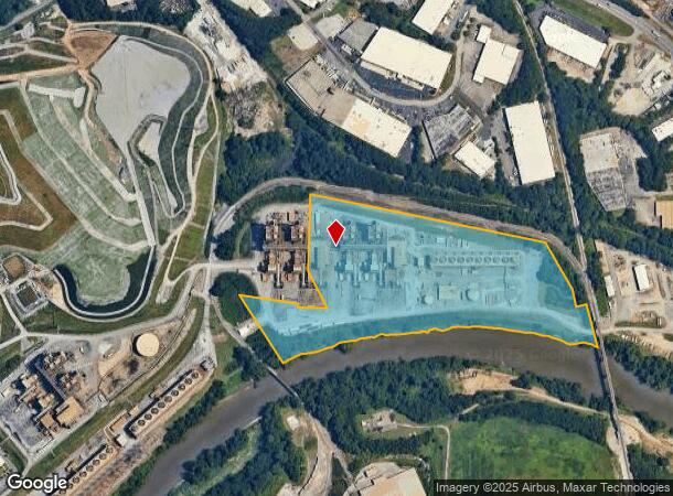
3111 Port Cobb Dr
17-0899-008
Cobb
Miningfacilityoilgasmineralpreciousmetals
Georgia
AE
24.06 AC
13121C0229F
Chattahoochee
0
Atlanta
2025
Atlanta-Sandy Springs-Roswell, GA
002600
DEMOGRAPHICS near 3111 Port Cobb Dr
1 Mile
3 Mile
5 Mile
2024 Total Population
4,477
70,797
227,255
2029 Population
4,589
73,077
234,514
Pop Growth 2024-2029
+ 2.50%
+ 3.22%
+ 3.19%
Average Age
37
38
38
2024 Total Households
2,166
33,207
106,623
HH Growth 2024-2029
+ 2.40%
+ 3.30%
+ 3.26%
Median Household Inc
$120,961
$101,707
$89,459
Avg Household Size
2.10
2.10
2.00
2024 Avg HH Vehicles
2.00
2.00
2.00
Median Home Value
$367,207
$453,484
$423,610
Median Year Built
1997
1996
1993
Nearby Places
Map Layers
Map Styles
 Street
 Aerial
- Restaurants
- Banks
- Shops
- Fitness
- Groceries
PUBLIC TRANSPORTATION
COMMUTER RAIL
Atlanta (Crescent - Amtrak)
DRIVE
WALK
Distance
Atlanta (Crescent - Amtrak)
16 min
6.1 mi
AIRPORT
Hartsfield - Jackson Atlanta International
DRIVE
WALK
Distance
Hartsfield - Jackson Atlanta International
34 min
19.6 mi
Freight Ports
Georgia Ports - Savannah
DRIVE
WALK
Distance
Georgia Ports - Savannah
297 min
258.9 mi
Nearby Properties
Address
Land Use
TOTAL SIZE
Lot Size
Zoning
Address
Land Use
TOTAL SIZE
Lot Size
Zoning
3,929,999 SF
32.70 AC
OHR
Address
Land Use
TOTAL SIZE
Lot Size
Zoning
485,185 SF
3.76 AC
I2
Address
Land Use
TOTAL SIZE
Lot Size
Zoning
173,430 SF
13.83 AC
PVC
Address
Land Use
TOTAL SIZE
Lot Size
Zoning
394,294 SF
21.56 AC
OHR
Address
Land Use
TOTAL SIZE
Lot Size
Zoning
5.36 AC
RRC
Address
Land Use
TOTAL SIZE
Lot Size
Zoning
468,079 SF
31.79 AC
RMR
Address
Land Use
TOTAL SIZE
Lot Size
Zoning
467,671 SF
4.82 AC
C1
Address
Land Use
TOTAL SIZE
Lot Size
Zoning
296,698 SF
8.99 AC
RG2
Address
Land Use
TOTAL SIZE
Lot Size
Zoning
16,408 SF
8.97 AC
PVC
Address
Land Use
TOTAL SIZE
Lot Size
Zoning
914,424 SF
56.61 AC
OI
Address
Land Use
TOTAL SIZE
Lot Size
Zoning
354,766 SF
11.32 AC
RG3
Address
Land Use
TOTAL SIZE
Lot Size
Zoning
3.25 AC
MU
Address
Land Use
TOTAL SIZE
Lot Size
Zoning
452,107 SF
37.95 AC
RM-12
Address
Land Use
TOTAL SIZE
Lot Size
Zoning
695,481 SF
11.66 AC
RG3
Address
Land Use
TOTAL SIZE
Lot Size
Zoning
1,770,090 SF
23.90 AC
RG2
Address
Land Use
TOTAL SIZE
Lot Size
Zoning
511,640 SF
5.56 AC
OIC
Address
Land Use
TOTAL SIZE
Lot Size
Zoning
354,710 SF
25.27 AC
R5
Address
Land Use
TOTAL SIZE
Lot Size
Zoning
115 AC
I2
Address
Land Use
TOTAL SIZE
Lot Size
Zoning
469,880 SF
8.90 AC
OI
Address
Land Use
TOTAL SIZE
Lot Size
Zoning
347,150 SF
19.99 AC
RM-16
Address
Land Use
TOTAL SIZE
Lot Size
Zoning
329,385 SF
15.29 AC
RHR
Address
Land Use
TOTAL SIZE
Lot Size
Zoning
936,997 SF
39.91 AC
OIC
Address
Land Use
TOTAL SIZE
Lot Size
Zoning
651,741 SF
3.66 AC
OI
Address
Land Use
TOTAL SIZE
Lot Size
Zoning
374,698 SF
30.72 AC
RM-12
Address
Land Use
TOTAL SIZE
Lot Size
Zoning
439,167 SF
41.13 AC
RM-12
Address
Land Use
TOTAL SIZE
Lot Size
Zoning
445,848 SF
2.54 AC
OI
Address
Land Use
TOTAL SIZE
Lot Size
Zoning
281,632 SF
27.12 AC
RM-12
Address
Land Use
TOTAL SIZE
Lot Size
Zoning
403,687 SF
42.37 AC
RM-12
Address
Land Use
TOTAL SIZE
Lot Size
Zoning
538,535 SF
32.40 AC
I2
Address
Land Use
TOTAL SIZE
Lot Size
Zoning
918,639 SF
7.92 AC
OI
The World's #1 Commercial Real Estate Marketplace
Connect with us
© 2025 CoStar Group
The information above has been obtained from sources believed reliable. While we do not doubt its accuracy we have not verified it and make no guarantee, warranty or representation about it. It is your responsibility to independently confirm its accuracy and completeness. Any projections, opinions, assumptions, or estimates used are for example only and do not represent the current or future performance of the property. The value of this transaction to you depends on tax and other factors which should be evaluated by your tax, financial, and legal advisors. You and your advisors should conduct a careful, independent investigation of the property to determine to your satisfaction the suitability of the property for your needs.