Property Record
3111 W Prospect Ave, Appleton, WI 54914
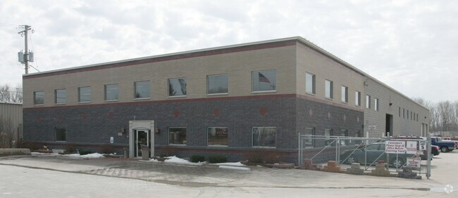
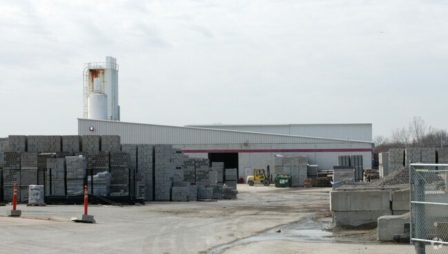
Property Detail
3111 W Prospect Ave
008-008402
THAT PT NE NW FRAC LYG SELY OF C & NW RR 10.30 A.
Commercialnec
WINNEBAGO
M2
Wisconsin
AE The base floodplain where base flood elevations are provided. AE Zones are now used on new format FIRMs instead of A1-A30 Zones.
10.30 AC
2024
Appleton/Oshkosh
2024
Other Market Areas
011104
Oshkosh-Neenah, WI
NEARBY LISTINGS FOR SALE OR LEASE
DEMOGRAPHICS near 3111 W Prospect Ave
1 mile
3 mile
5 mile
2025 Total Population
5,492
64,355
146,222
2030 Population
5,611
65,202
148,770
Pop Growth 2025-2030
+ 2.17%
+ 1.32%
+ 1.74%
Average Age
42
40
40
2025 Total Households
2,454
28,026
61,694
HH Growth 2025-2030
+ 2.12%
+ 1.36%
+ 1.81%
Median Household Inc
$74,369
$65,804
$75,986
Avg Household Size
2.20
2.20
2.30
2025 Avg HH Vehicles
2.00
2.00
2.00
Median Home Value
$281,921
$204,805
$233,139
Median Year Built
1979
1972
1974
Nearby Places
Map Layers
Map Styles
 Street
 Aerial
Transit
 Traffic
 Biking
Places
Listings with unknown addresses are not visible on the map
- Restaurants
- Banks
- Shops
- Fitness
- Groceries
PUBLIC TRANSPORTATION
AIRPORT
Appleton International
Drive
Walk
Distance
Appleton International
10 min
4.3 mi
Green Bay/Austin Straubel International
Drive
Walk
Distance
Green Bay/Austin Straubel International
41 min
32.2 mi
Freight Ports
Port Milwaukee
Drive
Walk
Distance
Port Milwaukee
124 min
106.0 mi
Nearby Properties
Address
Land Use
TOTAL SIZE
Lot Size
Zoning
Address
Land Use
TOTAL SIZE
Lot Size
Zoning
68.77 AC
Address
Land Use
TOTAL SIZE
Lot Size
Zoning
645,392 SF
25.87 AC
Address
Land Use
TOTAL SIZE
Lot Size
Zoning
8.61 AC
R5
Address
Land Use
TOTAL SIZE
Lot Size
Zoning
11.99 AC
Address
Land Use
TOTAL SIZE
Lot Size
Zoning
120.73 AC
M2
Address
Land Use
TOTAL SIZE
Lot Size
Zoning
11.22 AC
Address
Land Use
TOTAL SIZE
Lot Size
Zoning
11,340 SF
0.92 AC
C2
Address
Land Use
TOTAL SIZE
Lot Size
Zoning
267,069 SF
26.76 AC
Address
Land Use
TOTAL SIZE
Lot Size
Zoning
278,801 SF
20.94 AC
Address
Land Use
TOTAL SIZE
Lot Size
Zoning
37,900 SF
0.67 AC
Address
Land Use
TOTAL SIZE
Lot Size
Zoning
53,321 SF
2.51 AC
CBD
Address
Land Use
TOTAL SIZE
Lot Size
Zoning
44,164 SF
0.62 AC
CBD
Address
Land Use
TOTAL SIZE
Lot Size
Zoning
15.73 AC
B5
Address
Land Use
TOTAL SIZE
Lot Size
Zoning
148,743 SF
17.58 AC
Address
Land Use
TOTAL SIZE
Lot Size
Zoning
81,252 SF
8.32 AC
Address
Land Use
TOTAL SIZE
Lot Size
Zoning
34,232 SF
18.18 AC
Address
Land Use
TOTAL SIZE
Lot Size
Zoning
25.62 AC
I2
Address
Land Use
TOTAL SIZE
Lot Size
Zoning
20.92 AC
R5
Address
Land Use
TOTAL SIZE
Lot Size
Zoning
4.33 AC
Address
Land Use
TOTAL SIZE
Lot Size
Zoning
249,444 SF
18.81 AC
Address
Land Use
TOTAL SIZE
Lot Size
Zoning
20,874 SF
11.57 AC
R4
Address
Land Use
TOTAL SIZE
Lot Size
Zoning
82,199 SF
6.97 AC
Address
Land Use
TOTAL SIZE
Lot Size
Zoning
5,394 SF
0.30 AC
CBD
Address
Land Use
TOTAL SIZE
Lot Size
Zoning
21,540 SF
0.79 AC
CBD
Address
Land Use
TOTAL SIZE
Lot Size
Zoning
194,738 SF
19.73 AC
Address
Land Use
TOTAL SIZE
Lot Size
Zoning
7.29 AC
Address
Land Use
TOTAL SIZE
Lot Size
Zoning
25,705 SF
2.03 AC
PDR3
Address
Land Use
TOTAL SIZE
Lot Size
Zoning
78,268 SF
7.80 AC
C3
Address
Land Use
TOTAL SIZE
Lot Size
Zoning
1.91 AC
B5
Address
Land Use
TOTAL SIZE
Lot Size
Zoning
18.18 AC
I1
The World's #1 Commercial Real Estate Marketplace
Connect with us
© 2026 CoStar Group
The information above has been obtained from sources believed reliable. While we do not doubt its accuracy we have not verified it and make no guarantee, warranty or representation about it. It is your responsibility to independently confirm its accuracy and completeness. Any projections, opinions, assumptions, or estimates used are for example only and do not represent the current or future performance of the property. The value of this transaction to you depends on tax and other factors which should be evaluated by your tax, financial, and legal advisors. You and your advisors should conduct a careful, independent investigation of the property to determine to your satisfaction the suitability of the property for your needs.