Property Record
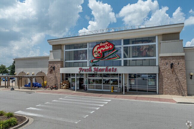
3115 111Th St, Naperville, IL 60564


NEARBY LISTINGS FOR SALE OR LEASE
Property Detail
3115 111Th St
Chicago-Naperville-Elgin, IL-IN-WI
Commercial
07-01-16-405-012
LOT 2 IN NAPERVILLE MARKETPLACE, BEING A RESUB OF LOT 1 IN CONTINENTAL PLAISANCE, BEING A SUB PRT OF THE SE1/4 OF SEC 16, T37
Supermarket
Will
X
Illinois
17197C0037G
2
2024
7.49 AC
2024
Joliet/Central Will
880322
Chicago
326,156 SF
DEMOGRAPHICS near 3115 111Th St
1 Mile
3 Mile
5 Mile
2024 Total Population
9,160
63,967
174,880
2029 Population
9,140
63,822
175,657
Pop Growth 2024-2029
(0.22%)
(0.23%)
+ 0.44%
Average Age
38
38
38
2024 Total Households
2,703
20,025
56,147
HH Growth 2024-2029
(0.11%)
(0.20%)
+ 0.42%
Median Household Inc
$180,870
$157,291
$129,123
Avg Household Size
3.30
3.10
3.10
2024 Avg HH Vehicles
2.00
2.00
2.00
Median Home Value
$467,359
$445,910
$353,779
Median Year Built
1997
2000
1997
Nearby Places
Map Layers
Map Styles
 Street
 Aerial
- Restaurants
- Banks
- Shops
- Fitness
- Groceries
PUBLIC TRANSPORTATION
COMMUTER RAIL
Route 59 Station (Burlington Northern-Santa Fe Railway Line - Northeast Illinois Regional Commuter Railroad (Metra))
DRIVE
WALK
Distance
Route 59 Station (Burlington Northern-Santa Fe Railway Line - Northeast Illinois Regional Commuter Railroad (Metra))
15 min
7.7 mi
AIRPORT
Chicago Midway International
DRIVE
WALK
Distance
Chicago Midway International
42 min
28.7 mi
Chicago O'Hare International
DRIVE
WALK
Distance
Chicago O'Hare International
57 min
37.7 mi
Freight Ports
Port Milwaukee
DRIVE
WALK
Distance
Port Milwaukee
138 min
109.4 mi
Nearby Properties
Address
Land Use
TOTAL SIZE
Lot Size
Zoning
Address
Land Use
TOTAL SIZE
Lot Size
Zoning
952,135 SF
21.86 AC
Address
Land Use
TOTAL SIZE
Lot Size
Zoning
22.35 AC
Address
Land Use
TOTAL SIZE
Lot Size
Zoning
24.91 AC
Address
Land Use
TOTAL SIZE
Lot Size
Zoning
13.71 AC
Address
Land Use
TOTAL SIZE
Lot Size
Zoning
252,909 SF
5.81 AC
Address
Land Use
TOTAL SIZE
Lot Size
Zoning
448,352 SF
15.67 AC
Address
Land Use
TOTAL SIZE
Lot Size
Zoning
232,964 SF
28.66 AC
Address
Land Use
TOTAL SIZE
Lot Size
Zoning
416,129 SF
9.55 AC
Address
Land Use
TOTAL SIZE
Lot Size
Zoning
160,039 SF
3.67 AC
Address
Land Use
TOTAL SIZE
Lot Size
Zoning
643,468 SF
14.77 AC
Address
Land Use
TOTAL SIZE
Lot Size
Zoning
409,695 SF
9.41 AC
Address
Land Use
TOTAL SIZE
Lot Size
Zoning
521,457 SF
11.97 AC
Address
Land Use
TOTAL SIZE
Lot Size
Zoning
445,837 SF
10.24 AC
Address
Land Use
TOTAL SIZE
Lot Size
Zoning
406,938 SF
9.34 AC
Address
Land Use
TOTAL SIZE
Lot Size
Zoning
345,727 SF
7.94 AC
Address
Land Use
TOTAL SIZE
Lot Size
Zoning
331,557 SF
7.61 AC
Address
Land Use
TOTAL SIZE
Lot Size
Zoning
308,884 SF
7.09 AC
Address
Land Use
TOTAL SIZE
Lot Size
Zoning
263,102 SF
6.04 AC
Address
Land Use
TOTAL SIZE
Lot Size
Zoning
352,226 SF
8.09 AC
Address
Land Use
TOTAL SIZE
Lot Size
Zoning
236,531 SF
5.43 AC
Address
Land Use
TOTAL SIZE
Lot Size
Zoning
85.50 AC
Address
Land Use
TOTAL SIZE
Lot Size
Zoning
331,797 SF
2.85 AC
Address
Land Use
TOTAL SIZE
Lot Size
Zoning
275,343 SF
6.32 AC
Address
Land Use
TOTAL SIZE
Lot Size
Zoning
109,336 SF
2.51 AC
Address
Land Use
TOTAL SIZE
Lot Size
Zoning
225,641 SF
5.03 AC
Address
Land Use
TOTAL SIZE
Lot Size
Zoning
19.25 AC
Address
Land Use
TOTAL SIZE
Lot Size
Zoning
171,670 SF
3.94 AC
Address
Land Use
TOTAL SIZE
Lot Size
Zoning
56,933 SF
1.31 AC
Address
Land Use
TOTAL SIZE
Lot Size
Zoning
157,252 SF
3.61 AC
The World's #1 Commercial Real Estate Marketplace
Connect with us
© 2025 CoStar Group
The information above has been obtained from sources believed reliable. While we do not doubt its accuracy we have not verified it and make no guarantee, warranty or representation about it. It is your responsibility to independently confirm its accuracy and completeness. Any projections, opinions, assumptions, or estimates used are for example only and do not represent the current or future performance of the property. The value of this transaction to you depends on tax and other factors which should be evaluated by your tax, financial, and legal advisors. You and your advisors should conduct a careful, independent investigation of the property to determine to your satisfaction the suitability of the property for your needs.