Property Record
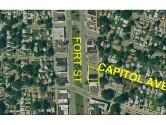
3115 Fort St, Lincoln Park, MI 48146

NEARBY LISTINGS FOR SALE OR LEASE
Property Detail
3115 Fort St
Detroit-Warren-Dearborn, MI
Washington Park
45-012-03-0243-301
JH243A TO 247A LOTS 243 TO 247 INCL. EXCEPT THE W 17 FT THEROF WASHINGTON PARK SUB PC 48 L33 P95 WCR
Conveniencestore
Wayne
X
Michigan
26163C0406E
243-247
2025
0.19 AC
2025
Downriver South
577500
Detroit
3,160 SF
DEMOGRAPHICS near 3115 Fort St
1 Mile
3 Mile
5 Mile
2024 Total Population
20,018
124,751
215,263
2029 Population
19,239
120,128
207,086
Pop Growth 2024-2029
(3.89%)
(3.71%)
(3.80%)
Average Age
39
40
40
2024 Total Households
7,626
51,049
87,449
HH Growth 2024-2029
(3.93%)
(3.76%)
(3.83%)
Median Household Inc
$59,971
$56,974
$58,177
Avg Household Size
2.60
2.40
2.40
2024 Avg HH Vehicles
2.00
2.00
2.00
Median Home Value
$125,984
$135,332
$140,880
Median Year Built
1953
1954
1955
Nearby Places
Map Layers
Map Styles
 Street
 Aerial
- Restaurants
- Banks
- Shops
- Fitness
- Groceries
PUBLIC TRANSPORTATION
COMMUTER RAIL
DRIVE
WALK
Distance
17 min
7.9 mi
AIRPORT
Detroit Metro Wayne County
DRIVE
WALK
Distance
Detroit Metro Wayne County
26 min
14.3 mi
Windsor International
DRIVE
WALK
Distance
Windsor International
36 min
19.1 mi
Nearby Properties
Address
Land Use
TOTAL SIZE
Lot Size
Zoning
Address
Land Use
TOTAL SIZE
Lot Size
Zoning
1,025,154 SF
233.15 AC
Address
Land Use
TOTAL SIZE
Lot Size
Zoning
357,640 SF
13.89 AC
C 6C
Address
Land Use
TOTAL SIZE
Lot Size
Zoning
492,289 SF
34.84 AC
RM-1
Address
Land Use
TOTAL SIZE
Lot Size
Zoning
7,320 SF
226.49 AC
Address
Land Use
TOTAL SIZE
Lot Size
Zoning
479,851 SF
16.90 AC
RM MULTI F
Address
Land Use
TOTAL SIZE
Lot Size
Zoning
187,395 SF
Address
Land Use
TOTAL SIZE
Lot Size
Zoning
3,261 SF
23.39 AC
RM MULTI F
Address
Land Use
TOTAL SIZE
Lot Size
Zoning
114,157 SF
Address
Land Use
TOTAL SIZE
Lot Size
Zoning
637,176 SF
39.11 AC
C 6C
Address
Land Use
TOTAL SIZE
Lot Size
Zoning
287,791 SF
17.98 AC
RM MULTI F
Address
Land Use
TOTAL SIZE
Lot Size
Zoning
163,944 SF
17.51 AC
RM MULTI F
Address
Land Use
TOTAL SIZE
Lot Size
Zoning
262,170 SF
15.27 AC
RM MULTI F
Address
Land Use
TOTAL SIZE
Lot Size
Zoning
356,200 SF
21.66 AC
I-2
Address
Land Use
TOTAL SIZE
Lot Size
Zoning
912 SF
2.80 AC
RM MULTI F
Address
Land Use
TOTAL SIZE
Lot Size
Zoning
196,801 SF
38.32 AC
M5
Address
Land Use
TOTAL SIZE
Lot Size
Zoning
111,402 SF
3.17 AC
Address
Land Use
TOTAL SIZE
Lot Size
Zoning
182,840 SF
11.70 AC
C 6C
Address
Land Use
TOTAL SIZE
Lot Size
Zoning
193,650 SF
18.39 AC
Address
Land Use
TOTAL SIZE
Lot Size
Zoning
209,412 SF
13.63 AC
C-2 GEN BU
Address
Land Use
TOTAL SIZE
Lot Size
Zoning
299,752 SF
7.50 AC
M-1 LIGHT
Address
Land Use
TOTAL SIZE
Lot Size
Zoning
76,350 SF
0.69 AC
Address
Land Use
TOTAL SIZE
Lot Size
Zoning
138,000 SF
29.84 AC
RD RESEARC
Address
Land Use
TOTAL SIZE
Lot Size
Zoning
94,260 SF
12.22 AC
M-1 LIGHT
Address
Land Use
TOTAL SIZE
Lot Size
Zoning
130,968 SF
0.84 AC
Address
Land Use
TOTAL SIZE
Lot Size
Zoning
135,843 SF
18.48 AC
C-2 GEN BU
Address
Land Use
TOTAL SIZE
Lot Size
Zoning
105,425 SF
7.41 AC
RM MULTI F
Address
Land Use
TOTAL SIZE
Lot Size
Zoning
660 SF
41.97 AC
R1 1 FA
Address
Land Use
TOTAL SIZE
Lot Size
Zoning
64,220 SF
5 AC
M-1 LIGHT
Address
Land Use
TOTAL SIZE
Lot Size
Zoning
105,920 SF
12.46 AC
Address
Land Use
TOTAL SIZE
Lot Size
Zoning
45,400 SF
R1 1 FA
The World's #1 Commercial Real Estate Marketplace
Connect with us
© 2026 CoStar Group
The information above has been obtained from sources believed reliable. While we do not doubt its accuracy we have not verified it and make no guarantee, warranty or representation about it. It is your responsibility to independently confirm its accuracy and completeness. Any projections, opinions, assumptions, or estimates used are for example only and do not represent the current or future performance of the property. The value of this transaction to you depends on tax and other factors which should be evaluated by your tax, financial, and legal advisors. You and your advisors should conduct a careful, independent investigation of the property to determine to your satisfaction the suitability of the property for your needs.