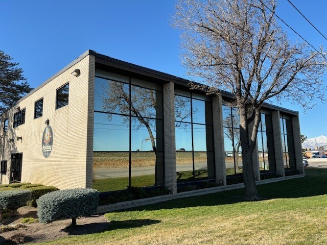
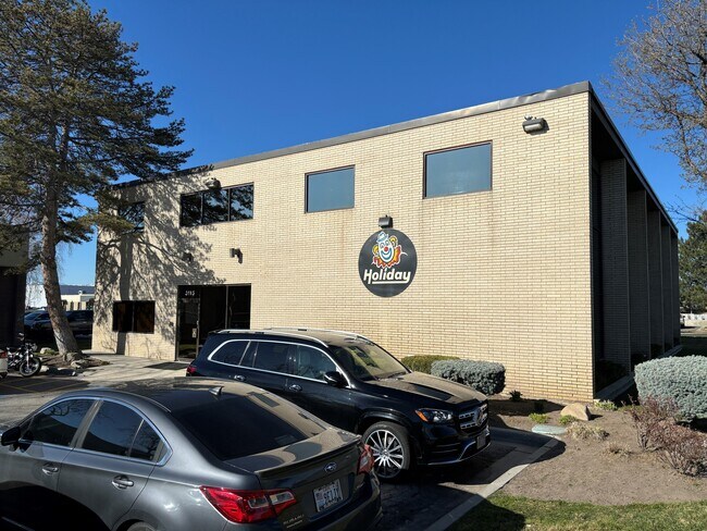
Property Record
3115 W 2100 S, West Valley City, UT 84119


Current Lease Availabilities
NEARBY LISTINGS FOR SALE OR LEASE
Property Detail
3115 W 2100 S
15-21-102-001-0000
BEG N 89^44 E 470 FT & S 0^0210 E 50 FT FR NW COR OF SEC 21, T 1S, R 1W, S L M; N 89^44 E 276.86 FT; S 0^0210 E 84.3 FT; S 89^44 W 41.17 FT; S 54^2239 W 15.985 FT; S 89^44 W 106.005 FT; S 0^0210 E 14.45 FT; S 89^44 W 116.685 FT; N 0^0210 W 108 FT TO
Officebuilding
Salt Lake
X
Utah
49035C0280E
0.62 AC
2024
West Valley/Lake Park
2025
Salt Lake City
113307
Salt Lake City, UT
4,960 SF
DEMOGRAPHICS near 3115 W 2100 S
1 Mile
3 Mile
5 Mile
2024 Total Population
569
71,259
272,564
2029 Population
568
71,431
276,398
Pop Growth 2024-2029
(0.18%)
+ 0.24%
+ 1.41%
Average Age
33
35
36
2024 Total Households
157
21,658
95,364
HH Growth 2024-2029
0.00%
+ 0.19%
+ 1.75%
Median Household Inc
$63,166
$60,686
$61,950
Avg Household Size
3.40
3.10
2.70
2024 Avg HH Vehicles
2.00
2.00
2.00
Median Home Value
$310,000
$302,459
$340,259
Median Year Built
1967
1978
1980
Nearby Places
Map Layers
Map Styles
 Street
 Aerial
- Restaurants
- Banks
- Shops
- Fitness
- Groceries
PUBLIC TRANSPORTATION
COMMUTER RAIL
DRIVE
WALK
Distance
13 min
7.4 mi
DRIVE
WALK
Distance
14 min
8.8 mi
AIRPORT
Salt Lake City International
DRIVE
WALK
Distance
Salt Lake City International
9 min
5.3 mi
Nearby Properties
Address
Land Use
TOTAL SIZE
Lot Size
Zoning
Address
Land Use
TOTAL SIZE
Lot Size
Zoning
673,062 SF
15.84 AC
RM
Address
Land Use
TOTAL SIZE
Lot Size
Zoning
185,436 SF
25.23 AC
RM
Address
Land Use
TOTAL SIZE
Lot Size
Zoning
690,542 SF
35.75 AC
M-1
Address
Land Use
TOTAL SIZE
Lot Size
Zoning
322,076 SF
16.32 AC
PL
Address
Land Use
TOTAL SIZE
Lot Size
Zoning
432,730 SF
13.03 AC
R-M
Address
Land Use
TOTAL SIZE
Lot Size
Zoning
76,096 SF
17.30 AC
RM
Address
Land Use
TOTAL SIZE
Lot Size
Zoning
429,554 SF
24.49 AC
M1
Address
Land Use
TOTAL SIZE
Lot Size
Zoning
505,079 SF
30.07 AC
M-1
Address
Land Use
TOTAL SIZE
Lot Size
Zoning
1,932 SF
33.44 AC
TSAMUC
Address
Land Use
TOTAL SIZE
Lot Size
Zoning
482,870 SF
31.13 AC
M-1
Address
Land Use
TOTAL SIZE
Lot Size
Zoning
401,887 SF
3.51 AC
RM
Address
Land Use
TOTAL SIZE
Lot Size
Zoning
475,592 SF
24.09 AC
M-1
Address
Land Use
TOTAL SIZE
Lot Size
Zoning
505,079 SF
25.87 AC
M-1
Address
Land Use
TOTAL SIZE
Lot Size
Zoning
29.13 AC
C-2
Address
Land Use
TOTAL SIZE
Lot Size
Zoning
426,280 SF
19.84 AC
M1
Address
Land Use
TOTAL SIZE
Lot Size
Zoning
491,507 SF
28.48 AC
M-1
Address
Land Use
TOTAL SIZE
Lot Size
Zoning
289,725 SF
8.42 AC
1108
Address
Land Use
TOTAL SIZE
Lot Size
Zoning
491,507 SF
28.28 AC
M-1
Address
Land Use
TOTAL SIZE
Lot Size
Zoning
116,268 SF
8.07 AC
RMF-45
Address
Land Use
TOTAL SIZE
Lot Size
Zoning
89,239 SF
14.78 AC
RM
Address
Land Use
TOTAL SIZE
Lot Size
Zoning
436,903 SF
27.09 AC
M-1
Address
Land Use
TOTAL SIZE
Lot Size
Zoning
137,209 SF
38.90 AC
FLEX
Address
Land Use
TOTAL SIZE
Lot Size
Zoning
436,875 SF
26.95 AC
M-1
Address
Land Use
TOTAL SIZE
Lot Size
Zoning
431,400 SF
23.99 AC
IP-M-1
Address
Land Use
TOTAL SIZE
Lot Size
Zoning
5,953 SF
225.72 AC
M-1
Address
Land Use
TOTAL SIZE
Lot Size
Zoning
381,105 SF
2.88 AC
CC
Address
Land Use
TOTAL SIZE
Lot Size
Zoning
482,768 SF
22.90 AC
M-1
Address
Land Use
TOTAL SIZE
Lot Size
Zoning
750,887 SF
28 AC
M1
Address
Land Use
TOTAL SIZE
Lot Size
Zoning
304,366 SF
2.71 AC
M
Address
Land Use
TOTAL SIZE
Lot Size
Zoning
180,383 SF
4.77 AC
MXD
The World's #1 Commercial Real Estate Marketplace
Connect with us
© 2025 CoStar Group
The information above has been obtained from sources believed reliable. While we do not doubt its accuracy we have not verified it and make no guarantee, warranty or representation about it. It is your responsibility to independently confirm its accuracy and completeness. Any projections, opinions, assumptions, or estimates used are for example only and do not represent the current or future performance of the property. The value of this transaction to you depends on tax and other factors which should be evaluated by your tax, financial, and legal advisors. You and your advisors should conduct a careful, independent investigation of the property to determine to your satisfaction the suitability of the property for your needs.