Property Record
3117 E State Road 60 Hwy, Valrico, FL 33594


NEARBY LISTINGS FOR SALE OR LEASE
Property Detail
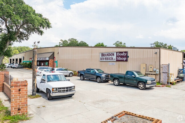
3117 E State Road 60 Hwy
Tampa-St. Petersburg-Clearwater, FL
Unplatted
U-29-29-21-ZZZ-000004-14040.0
THAT PART OF W 1/4 OF NE 1/4 OF NW 1/4 N OF RR LESS SR
Autorepair
Hillsborough
X
Florida
12057C0415H
14040
2024
1.71 AC
2024
Eastern Outlying
013203
Tampa/St Petersburg
21,100 SF
DEMOGRAPHICS near 3117 E State Road 60 Hwy
1 Mile
3 Mile
5 Mile
2024 Total Population
11,523
58,811
145,839
2029 Population
12,447
63,718
158,162
Pop Growth 2024-2029
+ 8.02%
+ 8.34%
+ 8.45%
Average Age
42
41
40
2024 Total Households
4,669
21,155
52,332
HH Growth 2024-2029
+ 8.27%
+ 8.59%
+ 8.71%
Median Household Inc
$70,920
$83,927
$79,767
Avg Household Size
2.40
2.70
2.70
2024 Avg HH Vehicles
2.00
2.00
2.00
Median Home Value
$279,984
$299,215
$294,869
Median Year Built
1996
1991
1989
Nearby Places
Map Layers
Map Styles
 Street
 Aerial
- Restaurants
- Banks
- Shops
- Fitness
- Groceries
PUBLIC TRANSPORTATION
AIRPORT
Tampa International
DRIVE
WALK
Distance
Tampa International
37 min
23.3 mi
St Pete-Clearwater International
DRIVE
WALK
Distance
St Pete-Clearwater International
54 min
32.6 mi
Freight Ports
Port of Tampa Bay
DRIVE
WALK
Distance
Port of Tampa Bay
26 min
15.5 mi
Nearby Properties
Address
Land Use
TOTAL SIZE
Lot Size
Zoning
Address
Land Use
TOTAL SIZE
Lot Size
Zoning
88,895 SF
587.01 AC
AR
Address
Land Use
TOTAL SIZE
Lot Size
Zoning
105,409 SF
18.40 AC
PD
Address
Land Use
TOTAL SIZE
Lot Size
Zoning
185,184 SF
9.65 AC
PD
Address
Land Use
TOTAL SIZE
Lot Size
Zoning
123,646 SF
16.10 AC
RSC-6
Address
Land Use
TOTAL SIZE
Lot Size
Zoning
134,594 SF
13.22 AC
PD
Address
Land Use
TOTAL SIZE
Lot Size
Zoning
140,058 SF
8.71 AC
RMC-20
Address
Land Use
TOTAL SIZE
Lot Size
Zoning
141,626 SF
8.88 AC
PD
Address
Land Use
TOTAL SIZE
Lot Size
Zoning
156,266 SF
9.27 AC
PD
Address
Land Use
TOTAL SIZE
Lot Size
Zoning
361,657 SF
24.15 AC
PD
Address
Land Use
TOTAL SIZE
Lot Size
Zoning
124,207 SF
28.64 AC
RSC-6
Address
Land Use
TOTAL SIZE
Lot Size
Zoning
209,392 SF
27.16 AC
PD
Address
Land Use
TOTAL SIZE
Lot Size
Zoning
158,777 SF
15.23 AC
TND
Address
Land Use
TOTAL SIZE
Lot Size
Zoning
107,525 SF
2.84 AC
PD
Address
Land Use
TOTAL SIZE
Lot Size
Zoning
85,972 SF
10.49 AC
PD
Address
Land Use
TOTAL SIZE
Lot Size
Zoning
147,527 SF
9.25 AC
PD
Address
Land Use
TOTAL SIZE
Lot Size
Zoning
113,930 SF
19.85 AC
ASC-1
Address
Land Use
TOTAL SIZE
Lot Size
Zoning
90,441 SF
20.39 AC
AS-1
Address
Land Use
TOTAL SIZE
Lot Size
Zoning
135,456 SF
18.76 AC
PD
Address
Land Use
TOTAL SIZE
Lot Size
Zoning
65,616 SF
43.50 AC
ASC-1
Address
Land Use
TOTAL SIZE
Lot Size
Zoning
165,601 SF
21.55 AC
PD
Address
Land Use
TOTAL SIZE
Lot Size
Zoning
107,002 SF
17.80 AC
RSC-6
Address
Land Use
TOTAL SIZE
Lot Size
Zoning
68,247 SF
16.80 AC
PD
Address
Land Use
TOTAL SIZE
Lot Size
Zoning
104,890 SF
15.03 AC
ASC-1
Address
Land Use
TOTAL SIZE
Lot Size
Zoning
68,000 SF
5.21 AC
PD
Address
Land Use
TOTAL SIZE
Lot Size
Zoning
90,250 SF
11 AC
PD
Address
Land Use
TOTAL SIZE
Lot Size
Zoning
59,406 SF
11.04 AC
CG
Address
Land Use
TOTAL SIZE
Lot Size
Zoning
76,776 SF
3.64 AC
PD
Address
Land Use
TOTAL SIZE
Lot Size
Zoning
52,448 SF
9.37 AC
PD
Address
Land Use
TOTAL SIZE
Lot Size
Zoning
108,934 SF
12.40 AC
PD
Address
Land Use
TOTAL SIZE
Lot Size
Zoning
53,960 SF
5.47 AC
PD
The World's #1 Commercial Real Estate Marketplace
Connect with us
© 2025 CoStar Group
The information above has been obtained from sources believed reliable. While we do not doubt its accuracy we have not verified it and make no guarantee, warranty or representation about it. It is your responsibility to independently confirm its accuracy and completeness. Any projections, opinions, assumptions, or estimates used are for example only and do not represent the current or future performance of the property. The value of this transaction to you depends on tax and other factors which should be evaluated by your tax, financial, and legal advisors. You and your advisors should conduct a careful, independent investigation of the property to determine to your satisfaction the suitability of the property for your needs.