Property Record
31195 N Redwood Hwy, Cloverdale, CA 95425


NEARBY LISTINGS FOR SALE OR LEASE
Property Detail
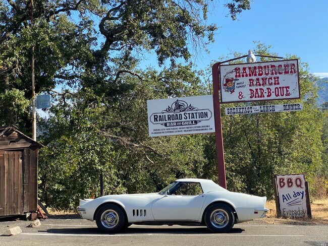
31195 N Redwood Hwy
Santa Rosa-Petaluma, CA
As Shown On Parcel Map No. 2621
116-010-011
1972 FORM PT OF 116-010-07
Restaurantbuilding
Sonoma
X
California
06045C2050F
1
2024
1.09 AC
2025
Healdsburg/Cloverdale
154202
North Bay/Santa Rosa
2,216 SF
DEMOGRAPHICS near 31195 N Redwood Hwy
1 Mile
3 Mile
5 Mile
2024 Total Population
3,206
10,517
11,105
2029 Population
3,183
10,435
11,002
Pop Growth 2024-2029
(0.72%)
(0.78%)
(0.93%)
Average Age
43
43
44
2024 Total Households
1,254
3,964
4,204
HH Growth 2024-2029
(0.88%)
(0.88%)
(1.05%)
Median Household Inc
$100,578
$94,709
$96,311
Avg Household Size
2.60
2.60
2.60
2024 Avg HH Vehicles
2.00
2.00
2.00
Median Home Value
$642,461
$667,773
$678,592
Median Year Built
1967
1977
1977
Nearby Places
Map Layers
Map Styles
 Street
 Aerial
- Restaurants
- Banks
- Shops
- Fitness
- Groceries
PUBLIC TRANSPORTATION
AIRPORT
Charles M Schulz - Sonoma County
DRIVE
WALK
Distance
Charles M Schulz - Sonoma County
36 min
28.3 mi
SALE & LEASE HISTORY
LISTING DATE
SALE/LEASE

May 01, 2023
For Sale
Aug 31, 2021
For Sale
Aug 18, 2022
For Sale
Nearby Properties
Address
Land Use
TOTAL SIZE
Lot Size
Zoning
Address
Land Use
TOTAL SIZE
Lot Size
Zoning
99,570 SF
4.41 AC
Address
Land Use
TOTAL SIZE
Lot Size
Zoning
62,655 SF
16.74 AC
M2
Address
Land Use
TOTAL SIZE
Lot Size
Zoning
2.56 AC
Address
Land Use
TOTAL SIZE
Lot Size
Zoning
240.83 AC
Address
Land Use
TOTAL SIZE
Lot Size
Zoning
10.28 AC
CITYCL
Address
Land Use
TOTAL SIZE
Lot Size
Zoning
15,756 SF
1.45 AC
Address
Land Use
TOTAL SIZE
Lot Size
Zoning
43,987 SF
1.52 AC
Address
Land Use
TOTAL SIZE
Lot Size
Zoning
63,840 SF
4.09 AC
Address
Land Use
TOTAL SIZE
Lot Size
Zoning
40,832 SF
0.20 AC
Address
Land Use
TOTAL SIZE
Lot Size
Zoning
6,684 SF
20.42 AC
1NDL
Address
Land Use
TOTAL SIZE
Lot Size
Zoning
Address
Land Use
TOTAL SIZE
Lot Size
Zoning
4.69 AC
Address
Land Use
TOTAL SIZE
Lot Size
Zoning
28,610 SF
1.36 AC
Address
Land Use
TOTAL SIZE
Lot Size
Zoning
21,826 SF
30.68 AC
RRDW20
Address
Land Use
TOTAL SIZE
Lot Size
Zoning
15,841 SF
0.72 AC
Address
Land Use
TOTAL SIZE
Lot Size
Zoning
1,334 SF
84 AC
RRDB8FRZN
Address
Land Use
TOTAL SIZE
Lot Size
Zoning
2.64 AC
Address
Land Use
TOTAL SIZE
Lot Size
Zoning
Address
Land Use
TOTAL SIZE
Lot Size
Zoning
13,896 SF
40 AC
RRD240
Address
Land Use
TOTAL SIZE
Lot Size
Zoning
53,692 SF
3.23 AC
Address
Land Use
TOTAL SIZE
Lot Size
Zoning
2,250 SF
9.30 AC
LIA20
Address
Land Use
TOTAL SIZE
Lot Size
Zoning
3,288 SF
160 AC
RRD240
Address
Land Use
TOTAL SIZE
Lot Size
Zoning
25,520 SF
1.56 AC
CITYCL
Address
Land Use
TOTAL SIZE
Lot Size
Zoning
42,822 SF
12.17 AC
M1B8FRZN
Address
Land Use
TOTAL SIZE
Lot Size
Zoning
Address
Land Use
TOTAL SIZE
Lot Size
Zoning
30,142 SF
2.05 AC
Address
Land Use
TOTAL SIZE
Lot Size
Zoning
72,420 SF
3.58 AC
MP
Address
Land Use
TOTAL SIZE
Lot Size
Zoning
6,469 SF
14.68 AC
Address
Land Use
TOTAL SIZE
Lot Size
Zoning
115,200 SF
7.85 AC
MP
Address
Land Use
TOTAL SIZE
Lot Size
Zoning
9,600 SF
3.25 AC
M1B8FRZN
The World's #1 Commercial Real Estate Marketplace
Connect with us
© 2026 CoStar Group
The information above has been obtained from sources believed reliable. While we do not doubt its accuracy we have not verified it and make no guarantee, warranty or representation about it. It is your responsibility to independently confirm its accuracy and completeness. Any projections, opinions, assumptions, or estimates used are for example only and do not represent the current or future performance of the property. The value of this transaction to you depends on tax and other factors which should be evaluated by your tax, financial, and legal advisors. You and your advisors should conduct a careful, independent investigation of the property to determine to your satisfaction the suitability of the property for your needs.