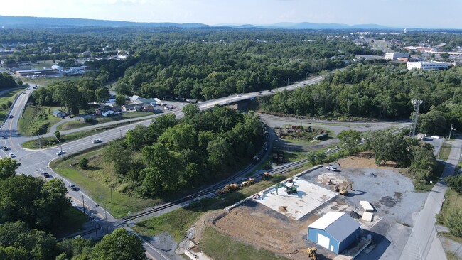
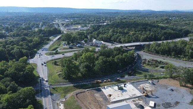
Property Record
312 Adams St, Martinsburg, WV 25404
NEARBY LISTINGS FOR SALE OR LEASE
-
-
-
TownePlace Suites Martinsburg - LAND Development
Martinsburg, WV 25401
Rent Upon Request
3.50 AC Lots
Land
-
-
-
-
View all Martinsburg listings for sale on LoopNet.com
Property Detail
312 Adams St
06-1-01060000
1.61 AC SURVEY PLAT OF WILBER HEIRS
Residentialacreage
Berkeley
X
West Virginia
54037C0005E
1.61 AC
2025
Berkeley County
2025
Washington, DC
971600
Hagerstown-Martinsburg, MD-WV
DEMOGRAPHICS near 312 Adams St
1 Mile
3 Mile
5 Mile
2024 Total Population
11,296
42,383
65,050
2029 Population
12,990
48,583
74,723
Pop Growth 2024-2029
+ 15.00%
+ 14.63%
+ 14.87%
Average Age
39
39
39
2024 Total Households
4,865
17,241
25,747
HH Growth 2024-2029
+ 15.64%
+ 15.25%
+ 15.47%
Median Household Inc
$42,331
$55,887
$64,909
Avg Household Size
2.20
2.40
2.40
2024 Avg HH Vehicles
1.00
2.00
2.00
Median Home Value
$165,736
$193,756
$221,870
Median Year Built
1976
1989
1993
Nearby Places
Map Layers
Map Styles
 Street
 Aerial
- Restaurants
- Banks
- Shops
- Fitness
- Groceries
PUBLIC TRANSPORTATION
TRANSIT/SUBWAY
Martinsburg (Brunswick Line - Maryland Area Regional Commuter Trains (The MARC))
DRIVE
WALK
Distance
Martinsburg (Brunswick Line - Maryland Area Regional Commuter Trains (The MARC))
3 min
18 min
0.9 mi
COMMUTER RAIL
DRIVE
WALK
Distance
2 min
14 min
0.7 mi
Martinsburg (Brunswick Line - Maryland Area Regional Commuter Trains (The MARC))
DRIVE
WALK
Distance
Martinsburg (Brunswick Line - Maryland Area Regional Commuter Trains (The MARC))
3 min
18 min
0.9 mi
AIRPORT
Hagerstown Regional/Richard A Henson Field
DRIVE
WALK
Distance
Hagerstown Regional/Richard A Henson Field
30 min
23.0 mi
SALE & LEASE HISTORY
LISTING DATE
SALE/LEASE

Sep 09, 2020
For Sale
Nearby Properties
Address
Land Use
TOTAL SIZE
Lot Size
Zoning
Address
Land Use
TOTAL SIZE
Lot Size
Zoning
Address
Land Use
TOTAL SIZE
Lot Size
Zoning
18.46 AC
Address
Land Use
TOTAL SIZE
Lot Size
Zoning
139.91 AC
Address
Land Use
TOTAL SIZE
Lot Size
Zoning
Address
Land Use
TOTAL SIZE
Lot Size
Zoning
849.14 AC
Address
Land Use
TOTAL SIZE
Lot Size
Zoning
Address
Land Use
TOTAL SIZE
Lot Size
Zoning
56.33 AC
Address
Land Use
TOTAL SIZE
Lot Size
Zoning
15.61 AC
Address
Land Use
TOTAL SIZE
Lot Size
Zoning
25.69 AC
Address
Land Use
TOTAL SIZE
Lot Size
Zoning
59.34 AC
Address
Land Use
TOTAL SIZE
Lot Size
Zoning
9.11 AC
Address
Land Use
TOTAL SIZE
Lot Size
Zoning
Address
Land Use
TOTAL SIZE
Lot Size
Zoning
17.02 AC
Address
Land Use
TOTAL SIZE
Lot Size
Zoning
Address
Land Use
TOTAL SIZE
Lot Size
Zoning
18.45 AC
Address
Land Use
TOTAL SIZE
Lot Size
Zoning
8.47 AC
Address
Land Use
TOTAL SIZE
Lot Size
Zoning
4.31 AC
Address
Land Use
TOTAL SIZE
Lot Size
Zoning
Address
Land Use
TOTAL SIZE
Lot Size
Zoning
Address
Land Use
TOTAL SIZE
Lot Size
Zoning
Address
Land Use
TOTAL SIZE
Lot Size
Zoning
5.35 AC
Address
Land Use
TOTAL SIZE
Lot Size
Zoning
Address
Land Use
TOTAL SIZE
Lot Size
Zoning
4.40 AC
Address
Land Use
TOTAL SIZE
Lot Size
Zoning
2.46 AC
Address
Land Use
TOTAL SIZE
Lot Size
Zoning
10.74 AC
Address
Land Use
TOTAL SIZE
Lot Size
Zoning
4.40 AC
Address
Land Use
TOTAL SIZE
Lot Size
Zoning
Address
Land Use
TOTAL SIZE
Lot Size
Zoning
17.40 AC
Address
Land Use
TOTAL SIZE
Lot Size
Zoning
0.14 AC
Address
Land Use
TOTAL SIZE
Lot Size
Zoning
6.16 AC
The World's #1 Commercial Real Estate Marketplace
Connect with us
© 2025 CoStar Group
The information above has been obtained from sources believed reliable. While we do not doubt its accuracy we have not verified it and make no guarantee, warranty or representation about it. It is your responsibility to independently confirm its accuracy and completeness. Any projections, opinions, assumptions, or estimates used are for example only and do not represent the current or future performance of the property. The value of this transaction to you depends on tax and other factors which should be evaluated by your tax, financial, and legal advisors. You and your advisors should conduct a careful, independent investigation of the property to determine to your satisfaction the suitability of the property for your needs.