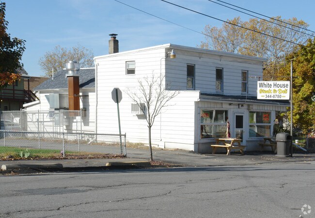
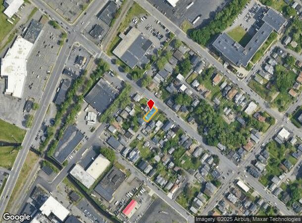
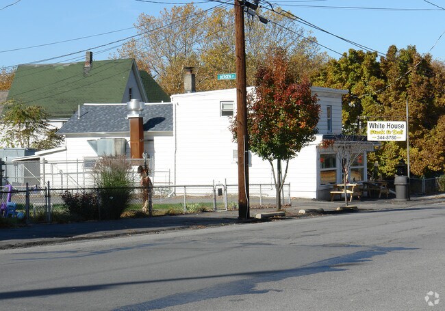
Property Record
312 E Elm St, Scranton, PA 18505
NEARBY LISTINGS FOR SALE OR LEASE
Property Detail
312 E Elm St
Scranton--Wilkes-Barre, PA
Plot Of Remingtons Add-Scranto
15619010029
30X90 BLDG & LAND W-11 B-0200 L-0252 P-00300
Commercialofficeresidentialmixeduse
Lackawanna
X
Pennsylvania
42069C0218D
252
2025
0.06 AC
2025
I-81 Corridor
102500
Philadelphia
DEMOGRAPHICS near 312 E Elm St
1 Mile
3 Mile
5 Mile
2024 Total Population
18,693
84,612
116,989
2029 Population
18,706
83,881
115,935
Pop Growth 2024-2029
+ 0.07%
(0.86%)
(0.90%)
Average Age
39
40
41
2024 Total Households
7,639
33,864
47,860
HH Growth 2024-2029
+ 0.13%
(0.90%)
(0.93%)
Median Household Inc
$41,911
$51,135
$54,646
Avg Household Size
2.30
2.20
2.20
2024 Avg HH Vehicles
1.00
1.00
2.00
Median Home Value
$93,766
$139,856
$147,752
Median Year Built
1947
1948
1948
Nearby Places
Map Layers
Map Styles
 Street
 Aerial
- Restaurants
- Banks
- Shops
- Fitness
- Groceries
PUBLIC TRANSPORTATION
AIRPORT
Wilkes-Barre/Scranton International
DRIVE
WALK
Distance
Wilkes-Barre/Scranton International
15 min
7.4 mi
Freight Ports
Maher Terminal
DRIVE
WALK
Distance
Maher Terminal
145 min
115.9 mi
Nearby Properties
Address
Land Use
TOTAL SIZE
Lot Size
Zoning
Address
Land Use
TOTAL SIZE
Lot Size
Zoning
2.62 AC
Address
Land Use
TOTAL SIZE
Lot Size
Zoning
Address
Land Use
TOTAL SIZE
Lot Size
Zoning
Address
Land Use
TOTAL SIZE
Lot Size
Zoning
Address
Land Use
TOTAL SIZE
Lot Size
Zoning
2.40 AC
Address
Land Use
TOTAL SIZE
Lot Size
Zoning
2.30 AC
Address
Land Use
TOTAL SIZE
Lot Size
Zoning
4.20 AC
Address
Land Use
TOTAL SIZE
Lot Size
Zoning
15.50 AC
Address
Land Use
TOTAL SIZE
Lot Size
Zoning
3.86 AC
Address
Land Use
TOTAL SIZE
Lot Size
Zoning
0.99 AC
Address
Land Use
TOTAL SIZE
Lot Size
Zoning
12.88 AC
Address
Land Use
TOTAL SIZE
Lot Size
Zoning
Address
Land Use
TOTAL SIZE
Lot Size
Zoning
4.85 AC
Address
Land Use
TOTAL SIZE
Lot Size
Zoning
21.66 AC
Address
Land Use
TOTAL SIZE
Lot Size
Zoning
18.34 AC
Address
Land Use
TOTAL SIZE
Lot Size
Zoning
Address
Land Use
TOTAL SIZE
Lot Size
Zoning
Address
Land Use
TOTAL SIZE
Lot Size
Zoning
42.39 AC
Address
Land Use
TOTAL SIZE
Lot Size
Zoning
2.65 AC
Address
Land Use
TOTAL SIZE
Lot Size
Zoning
0.27 AC
Address
Land Use
TOTAL SIZE
Lot Size
Zoning
36.41 AC
Address
Land Use
TOTAL SIZE
Lot Size
Zoning
Address
Land Use
TOTAL SIZE
Lot Size
Zoning
Address
Land Use
TOTAL SIZE
Lot Size
Zoning
3.86 AC
Address
Land Use
TOTAL SIZE
Lot Size
Zoning
Address
Land Use
TOTAL SIZE
Lot Size
Zoning
26.80 AC
Address
Land Use
TOTAL SIZE
Lot Size
Zoning
47.24 AC
Address
Land Use
TOTAL SIZE
Lot Size
Zoning
Address
Land Use
TOTAL SIZE
Lot Size
Zoning
3.11 AC
Address
Land Use
TOTAL SIZE
Lot Size
Zoning
9.55 AC
The World's #1 Commercial Real Estate Marketplace
Connect with us
© 2026 CoStar Group
The information above has been obtained from sources believed reliable. While we do not doubt its accuracy we have not verified it and make no guarantee, warranty or representation about it. It is your responsibility to independently confirm its accuracy and completeness. Any projections, opinions, assumptions, or estimates used are for example only and do not represent the current or future performance of the property. The value of this transaction to you depends on tax and other factors which should be evaluated by your tax, financial, and legal advisors. You and your advisors should conduct a careful, independent investigation of the property to determine to your satisfaction the suitability of the property for your needs.