Property Record
312 Rabon Rd, Columbia, SC 29223

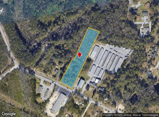
This Property Is For Sale
NEARBY LISTINGS FOR SALE OR LEASE
Property Detail
312 Rabon Rd
Columbia, SC
Pinnacle Point Property Management
17116-01-22
PARCELS A & B 174.5X330.1X30.9X418.9X145.8X 765 #SU
Commercialnec
Richland
X
South Carolina
45079C0256L
a
2025
2.62 AC
2024
Northeast Columbia
011420
Columbia
DEMOGRAPHICS near 312 Rabon Rd
1 Mile
3 Mile
5 Mile
2024 Total Population
5,962
45,061
113,446
2029 Population
6,029
45,681
115,076
Pop Growth 2024-2029
+ 1.12%
+ 1.38%
+ 1.44%
Average Age
39
39
39
2024 Total Households
2,393
19,079
46,371
HH Growth 2024-2029
+ 1.13%
+ 1.43%
+ 1.51%
Median Household Inc
$56,658
$51,266
$58,110
Avg Household Size
2.40
2.30
2.40
2024 Avg HH Vehicles
2.00
2.00
2.00
Median Home Value
$164,896
$178,623
$183,735
Median Year Built
1987
1991
1992
Nearby Places
Map Layers
Map Styles
 Street
 Aerial
- Restaurants
- Banks
- Shops
- Fitness
- Groceries
PUBLIC TRANSPORTATION
AIRPORT
Columbia Metro
DRIVE
WALK
Distance
Columbia Metro
37 min
21.7 mi
Freight Ports
North Charleston Terminal
DRIVE
WALK
Distance
North Charleston Terminal
133 min
117.3 mi
Nearby Properties
Address
Land Use
TOTAL SIZE
Lot Size
Zoning
Address
Land Use
TOTAL SIZE
Lot Size
Zoning
144,849 SF
26.14 AC
OI
Address
Land Use
TOTAL SIZE
Lot Size
Zoning
456,536 SF
42.16 AC
M-1
Address
Land Use
TOTAL SIZE
Lot Size
Zoning
3,293 SF
20.78 AC
GC
Address
Land Use
TOTAL SIZE
Lot Size
Zoning
83,808 SF
95.58 AC
PDD
Address
Land Use
TOTAL SIZE
Lot Size
Zoning
354,813 SF
20.66 AC
RM-HD
Address
Land Use
TOTAL SIZE
Lot Size
Zoning
338,744 SF
21.28 AC
RM-HD
Address
Land Use
TOTAL SIZE
Lot Size
Zoning
325,344 SF
71.41 AC
HI
Address
Land Use
TOTAL SIZE
Lot Size
Zoning
172,390 SF
19.87 AC
GC
Address
Land Use
TOTAL SIZE
Lot Size
Zoning
234,990 SF
16.50 AC
RM-HD
Address
Land Use
TOTAL SIZE
Lot Size
Zoning
333,825 SF
17.75 AC
GC
Address
Land Use
TOTAL SIZE
Lot Size
Zoning
313,244 SF
12.75 AC
RM-HD
Address
Land Use
TOTAL SIZE
Lot Size
Zoning
278,001 SF
28.82 AC
GC
Address
Land Use
TOTAL SIZE
Lot Size
Zoning
260,572 SF
15 AC
GC
Address
Land Use
TOTAL SIZE
Lot Size
Zoning
301,627 SF
25.08 AC
PDD
Address
Land Use
TOTAL SIZE
Lot Size
Zoning
288,000 SF
17.34 AC
OI
Address
Land Use
TOTAL SIZE
Lot Size
Zoning
285,368 SF
16.09 AC
GC
Address
Land Use
TOTAL SIZE
Lot Size
Zoning
155,314 SF
26.04 AC
OI
Address
Land Use
TOTAL SIZE
Lot Size
Zoning
140,567 SF
16.98 AC
M-1
Address
Land Use
TOTAL SIZE
Lot Size
Zoning
62,878 SF
8.43 AC
RM-HD
Address
Land Use
TOTAL SIZE
Lot Size
Zoning
299,909 SF
14.49 AC
RM-HD
Address
Land Use
TOTAL SIZE
Lot Size
Zoning
200,609 SF
17.97 AC
GC
Address
Land Use
TOTAL SIZE
Lot Size
Zoning
179,652 SF
14.98 AC
RM-HD
Address
Land Use
TOTAL SIZE
Lot Size
Zoning
341,550 SF
20.66 AC
RM-HD
Address
Land Use
TOTAL SIZE
Lot Size
Zoning
239,450 SF
16.85 AC
GC
Address
Land Use
TOTAL SIZE
Lot Size
Zoning
183,237 SF
13.65 AC
GC
Address
Land Use
TOTAL SIZE
Lot Size
Zoning
147,062 SF
13.20 AC
GC
Address
Land Use
TOTAL SIZE
Lot Size
Zoning
51,803 SF
11.99 AC
M-1
Address
Land Use
TOTAL SIZE
Lot Size
Zoning
242,894 SF
14.97 AC
RM-HD
Address
Land Use
TOTAL SIZE
Lot Size
Zoning
50,000 SF
18.71 AC
RS-MD
Address
Land Use
TOTAL SIZE
Lot Size
Zoning
113,510 SF
11.60 AC
GC
The World's #1 Commercial Real Estate Marketplace
Connect with us
© 2025 CoStar Group
The information above has been obtained from sources believed reliable. While we do not doubt its accuracy we have not verified it and make no guarantee, warranty or representation about it. It is your responsibility to independently confirm its accuracy and completeness. Any projections, opinions, assumptions, or estimates used are for example only and do not represent the current or future performance of the property. The value of this transaction to you depends on tax and other factors which should be evaluated by your tax, financial, and legal advisors. You and your advisors should conduct a careful, independent investigation of the property to determine to your satisfaction the suitability of the property for your needs.