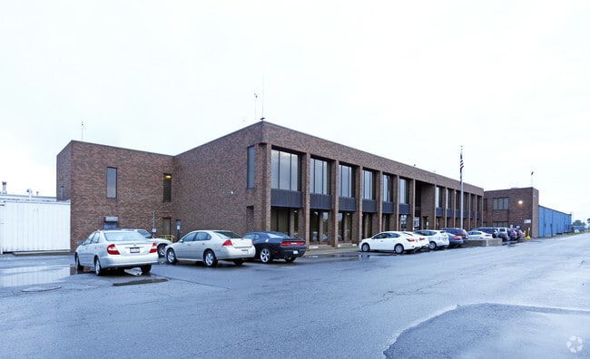
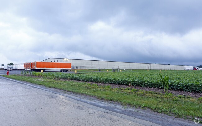
Property Record
312 Rader Rd, Mc Comb, OH 45858
Property Detail
312 Rader Rd
41-0001029786
T2N R09 S23 PT SW1/4 SW1/4
Foodprocessing
Hancock
B and X Area of moderate flood hazard, usually the area between the limits of the 100-year and 500-year floods.
Ohio
2024
44.33 AC
2024
Hancock County
000302
Toledo
322,698 SF
Findlay, OH
NEARBY LISTINGS FOR SALE OR LEASE
-
-
View all Mc Comb listings for sale on LoopNet.com
DEMOGRAPHICS near 312 Rader Rd
1 mile
3 mile
5 mile
2025 Total Population
1,337
1,990
3,153
2030 Population
1,292
1,928
3,067
Pop Growth 2025-2030
(3.37%)
(3.12%)
(2.73%)
Average Age
39
39
40
2025 Total Households
485
723
1,152
HH Growth 2025-2030
(3.30%)
(3.18%)
(2.78%)
Median Household Inc
$70,714
$70,849
$76,250
Avg Household Size
2.80
2.80
2.70
2025 Avg HH Vehicles
2.00
2.00
2.00
Median Home Value
$178,612
$183,536
$202,600
Median Year Built
1969
1969
1968
Nearby Places
Map Layers
Map Styles
 Street
 Aerial
Transit
 Traffic
 Biking
Places
Listings with unknown addresses are not visible on the map
- Restaurants
- Banks
- Shops
- Fitness
- Groceries
PUBLIC TRANSPORTATION
AIRPORT
Eugene F Kranz Toledo Express
Drive
Walk
Distance
Eugene F Kranz Toledo Express
75 min
50.0 mi
Nearby Properties
Address
Land Use
TOTAL SIZE
Lot Size
Zoning
Address
Land Use
TOTAL SIZE
Lot Size
Zoning
24,960 SF
8.70 AC
Address
Land Use
TOTAL SIZE
Lot Size
Zoning
2,880 SF
2.51 AC
Address
Land Use
TOTAL SIZE
Lot Size
Zoning
5,881 SF
6 AC
Address
Land Use
TOTAL SIZE
Lot Size
Zoning
64,000 SF
44.33 AC
Address
Land Use
TOTAL SIZE
Lot Size
Zoning
125.62 AC
Address
Land Use
TOTAL SIZE
Lot Size
Zoning
768 SF
11.68 AC
Address
Land Use
TOTAL SIZE
Lot Size
Zoning
9,388 SF
1.73 AC
Address
Land Use
TOTAL SIZE
Lot Size
Zoning
1,240 SF
18.09 AC
Address
Land Use
TOTAL SIZE
Lot Size
Zoning
6,944 SF
1.62 AC
Address
Land Use
TOTAL SIZE
Lot Size
Zoning
Address
Land Use
TOTAL SIZE
Lot Size
Zoning
77.03 AC
Address
Land Use
TOTAL SIZE
Lot Size
Zoning
24,830 SF
2.05 AC
Address
Land Use
TOTAL SIZE
Lot Size
Zoning
30.67 AC
Address
Land Use
TOTAL SIZE
Lot Size
Zoning
34.22 AC
Address
Land Use
TOTAL SIZE
Lot Size
Zoning
160 AC
Address
Land Use
TOTAL SIZE
Lot Size
Zoning
8,714 SF
0.38 AC
Address
Land Use
TOTAL SIZE
Lot Size
Zoning
2,912 SF
1.48 AC
Address
Land Use
TOTAL SIZE
Lot Size
Zoning
118.46 AC
Address
Land Use
TOTAL SIZE
Lot Size
Zoning
77.73 AC
Address
Land Use
TOTAL SIZE
Lot Size
Zoning
3,236 SF
3.94 AC
Address
Land Use
TOTAL SIZE
Lot Size
Zoning
3,315 SF
0.56 AC
Address
Land Use
TOTAL SIZE
Lot Size
Zoning
137.44 AC
Address
Land Use
TOTAL SIZE
Lot Size
Zoning
8,133 SF
2.37 AC
Address
Land Use
TOTAL SIZE
Lot Size
Zoning
1,957 SF
0.34 AC
Address
Land Use
TOTAL SIZE
Lot Size
Zoning
34,024 SF
1.35 AC
Address
Land Use
TOTAL SIZE
Lot Size
Zoning
109.82 AC
Address
Land Use
TOTAL SIZE
Lot Size
Zoning
119.52 AC
Address
Land Use
TOTAL SIZE
Lot Size
Zoning
120 AC
Address
Land Use
TOTAL SIZE
Lot Size
Zoning
126.14 AC
The World's #1 Commercial Real Estate Marketplace
Connect with us
© 2026 CoStar Group
The information above has been obtained from sources believed reliable. While we do not doubt its accuracy we have not verified it and make no guarantee, warranty or representation about it. It is your responsibility to independently confirm its accuracy and completeness. Any projections, opinions, assumptions, or estimates used are for example only and do not represent the current or future performance of the property. The value of this transaction to you depends on tax and other factors which should be evaluated by your tax, financial, and legal advisors. You and your advisors should conduct a careful, independent investigation of the property to determine to your satisfaction the suitability of the property for your needs.