No Photo
Property Record
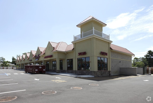
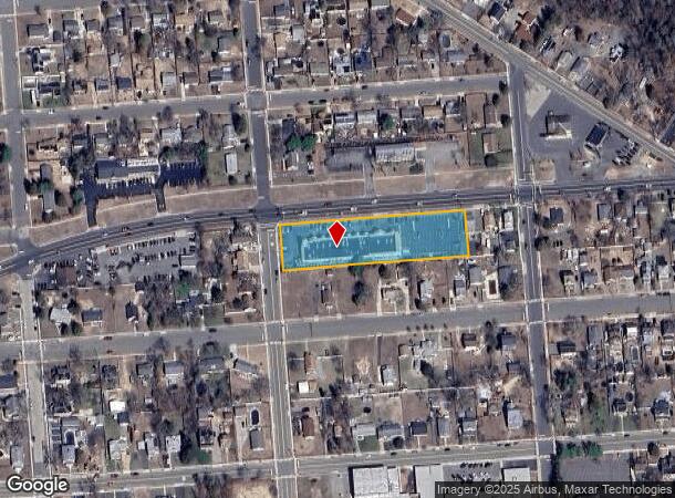
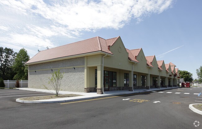
312 Route 70, Lakehurst, NJ 08733
NEARBY LISTINGS FOR SALE OR LEASE
Property Detail
312 Route 70
New York-Jersey City-White Plains, NY-NJ
Property/Mrs Elizabeth C Torre
14-00052-0000-00001-01
500X125
Commercialnec
Ocean
X
New Jersey
34029C0164F
1.1
2024
1.44 AC
2025
Ocean County
721000
Northern New Jersey
18,250 SF
DEMOGRAPHICS near 312 Route 70
1 Mile
3 Mile
5 Mile
2024 Total Population
2,930
16,246
62,041
2029 Population
3,093
16,799
64,763
Pop Growth 2024-2029
+ 5.56%
+ 3.40%
+ 4.39%
Average Age
39
53
53
2024 Total Households
1,021
7,900
30,006
HH Growth 2024-2029
+ 4.80%
+ 2.32%
+ 3.51%
Median Household Inc
$68,648
$60,709
$53,021
Avg Household Size
2.80
2.00
2.00
2024 Avg HH Vehicles
2.00
2.00
2.00
Median Home Value
$244,495
$208,798
$210,315
Median Year Built
1967
1981
1979
Nearby Places
Map Layers
Map Styles
 Street
 Aerial
- Restaurants
- Banks
- Shops
- Fitness
- Groceries
SALE & LEASE HISTORY
LISTING DATE
SALE/LEASE

Jan 07, 2020
For Lease
Jan 05, 2024
For Lease
Nearby Properties
Address
Land Use
TOTAL SIZE
Lot Size
Zoning
Address
Land Use
TOTAL SIZE
Lot Size
Zoning
1,065.50 AC
MI
Address
Land Use
TOTAL SIZE
Lot Size
Zoning
17,952 SF
103.18 AC
PRA
Address
Land Use
TOTAL SIZE
Lot Size
Zoning
75,558 SF
43.30 AC
R15
Address
Land Use
TOTAL SIZE
Lot Size
Zoning
123,881 SF
93.73 AC
FAAF
Address
Land Use
TOTAL SIZE
Lot Size
Zoning
1,973 SF
22.84 AC
PRCD
Address
Land Use
TOTAL SIZE
Lot Size
Zoning
12,383 SF
39.07 AC
HD-3
Address
Land Use
TOTAL SIZE
Lot Size
Zoning
19,509 SF
717.61 AC
RC2
Address
Land Use
TOTAL SIZE
Lot Size
Zoning
52.06 AC
TC
Address
Land Use
TOTAL SIZE
Lot Size
Zoning
61,142 SF
23.53 AC
R40
Address
Land Use
TOTAL SIZE
Lot Size
Zoning
21,441 SF
54.88 AC
PORL
Address
Land Use
TOTAL SIZE
Lot Size
Zoning
38,172 SF
7.36 AC
MF
Address
Land Use
TOTAL SIZE
Lot Size
Zoning
48,688 SF
9.60 AC
TC
Address
Land Use
TOTAL SIZE
Lot Size
Zoning
3.73 AC
R-2
Address
Land Use
TOTAL SIZE
Lot Size
Zoning
78,980 SF
4.88 AC
R40
Address
Land Use
TOTAL SIZE
Lot Size
Zoning
158 SF
23.51 AC
MP
Address
Land Use
TOTAL SIZE
Lot Size
Zoning
18,024 SF
5.94 AC
MF
Address
Land Use
TOTAL SIZE
Lot Size
Zoning
38,172 SF
10.61 AC
MF
Address
Land Use
TOTAL SIZE
Lot Size
Zoning
72.96 AC
PR40
Address
Land Use
TOTAL SIZE
Lot Size
Zoning
18,024 SF
6.96 AC
MF
Address
Land Use
TOTAL SIZE
Lot Size
Zoning
44,765 SF
5.46 AC
PORL
Address
Land Use
TOTAL SIZE
Lot Size
Zoning
2,520 SF
30.59 AC
PR40
Address
Land Use
TOTAL SIZE
Lot Size
Zoning
35.32 AC
HD-3
Address
Land Use
TOTAL SIZE
Lot Size
Zoning
28,098 SF
3.61 AC
MF
Address
Land Use
TOTAL SIZE
Lot Size
Zoning
19.84 AC
MP
Address
Land Use
TOTAL SIZE
Lot Size
Zoning
16,392 SF
10.79 AC
R-1
Address
Land Use
TOTAL SIZE
Lot Size
Zoning
73,630 SF
13.08 AC
PORL
Address
Land Use
TOTAL SIZE
Lot Size
Zoning
25,990 SF
52.66 AC
RC
Address
Land Use
TOTAL SIZE
Lot Size
Zoning
54,095 SF
4.40 AC
HD-3
Address
Land Use
TOTAL SIZE
Lot Size
Zoning
113.88 AC
PR40
Address
Land Use
TOTAL SIZE
Lot Size
Zoning
17,776 SF
1.04 AC
R-OP
The World's #1 Commercial Real Estate Marketplace
Connect with us
© 2025 CoStar Group
The information above has been obtained from sources believed reliable. While we do not doubt its accuracy we have not verified it and make no guarantee, warranty or representation about it. It is your responsibility to independently confirm its accuracy and completeness. Any projections, opinions, assumptions, or estimates used are for example only and do not represent the current or future performance of the property. The value of this transaction to you depends on tax and other factors which should be evaluated by your tax, financial, and legal advisors. You and your advisors should conduct a careful, independent investigation of the property to determine to your satisfaction the suitability of the property for your needs.