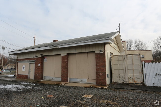
Property Record
312 W Union Ave, Bound Brook, NJ 08805

NEARBY LISTINGS FOR SALE OR LEASE
Property Detail
312 W Union Ave
04-00062-0000-00001
Somerset
Vacantlandnec
New Jersey
X
1
34035C0158E
0.43 AC
2024
Route 287 West
2025
Northern New Jersey
051100
Lakewood-New Brunswick, NJ
DEMOGRAPHICS near 312 W Union Ave
1 Mile
3 Mile
5 Mile
2024 Total Population
13,283
60,329
166,838
2029 Population
13,047
60,016
166,539
Pop Growth 2024-2029
(1.78%)
(0.52%)
(0.18%)
Average Age
39
41
42
2024 Total Households
4,681
21,857
60,782
HH Growth 2024-2029
(1.73%)
(0.50%)
(0.14%)
Median Household Inc
$75,584
$103,481
$107,386
Avg Household Size
2.80
2.70
2.60
2024 Avg HH Vehicles
2.00
2.00
2.00
Median Home Value
$347,601
$379,939
$392,761
Median Year Built
1956
1967
1970
Nearby Places
Map Layers
Map Styles
 Street
 Aerial
- Restaurants
- Banks
- Shops
- Fitness
- Groceries
PUBLIC TRANSPORTATION
COMMUTER RAIL
Bound Brook (Raritan Valley Line - NJ Transit Commuter Rail (NJ Transit))
DRIVE
WALK
Distance
Bound Brook (Raritan Valley Line - NJ Transit Commuter Rail (NJ Transit))
3 min
17 min
0.9 mi
Bridgewater (Raritan Valley Line - NJ Transit Commuter Rail (NJ Transit))
DRIVE
WALK
Distance
Bridgewater (Raritan Valley Line - NJ Transit Commuter Rail (NJ Transit))
4 min
1.2 mi
AIRPORT
Newark Liberty International
DRIVE
WALK
Distance
Newark Liberty International
36 min
37.4 mi
Freight Ports
New York Container Terminal
DRIVE
WALK
Distance
New York Container Terminal
1 min
19.5 mi
SALE & LEASE HISTORY
LISTING DATE
SALE/LEASE

Sep 25, 2016
For Lease
Mar 31, 2017
For Sale
Mar 09, 2017
For Sale
Jul 26, 2017
For Sale
Jan 20, 2017
For Sale
Apr 03, 2017
For Lease
Nearby Properties
Address
Land Use
TOTAL SIZE
Lot Size
Zoning
Address
Land Use
TOTAL SIZE
Lot Size
Zoning
13.59 AC
H
Address
Land Use
TOTAL SIZE
Lot Size
Zoning
6,625 SF
22.51 AC
B-I
Address
Land Use
TOTAL SIZE
Lot Size
Zoning
70.22 AC
B-I
Address
Land Use
TOTAL SIZE
Lot Size
Zoning
17.01 AC
B-I
Address
Land Use
TOTAL SIZE
Lot Size
Zoning
19.46 AC
B-I
Address
Land Use
TOTAL SIZE
Lot Size
Zoning
39.10 AC
C3
Address
Land Use
TOTAL SIZE
Lot Size
Zoning
31.50 AC
B-I
Address
Land Use
TOTAL SIZE
Lot Size
Zoning
22.36 AC
PAC
Address
Land Use
TOTAL SIZE
Lot Size
Zoning
2,450 SF
26.84 AC
B-I
Address
Land Use
TOTAL SIZE
Lot Size
Zoning
22.75 AC
LC
Address
Land Use
TOTAL SIZE
Lot Size
Zoning
153 AC
Address
Land Use
TOTAL SIZE
Lot Size
Zoning
26.23 AC
B-I
Address
Land Use
TOTAL SIZE
Lot Size
Zoning
32.92 AC
B-I
Address
Land Use
TOTAL SIZE
Lot Size
Zoning
Address
Land Use
TOTAL SIZE
Lot Size
Zoning
Address
Land Use
TOTAL SIZE
Lot Size
Zoning
24.34 AC
IND
Address
Land Use
TOTAL SIZE
Lot Size
Zoning
82.79 AC
M-2
Address
Land Use
TOTAL SIZE
Lot Size
Zoning
2,488 SF
16.46 AC
PAC
Address
Land Use
TOTAL SIZE
Lot Size
Zoning
26.53 AC
B-I
Address
Land Use
TOTAL SIZE
Lot Size
Zoning
4.05 AC
Address
Land Use
TOTAL SIZE
Lot Size
Zoning
13.38 AC
B2
Address
Land Use
TOTAL SIZE
Lot Size
Zoning
7,475 SF
20.98 AC
B-I
Address
Land Use
TOTAL SIZE
Lot Size
Zoning
17.65 AC
B-I
Address
Land Use
TOTAL SIZE
Lot Size
Zoning
235,855 SF
14.48 AC
B-I
Address
Land Use
TOTAL SIZE
Lot Size
Zoning
19.90 AC
IND
Address
Land Use
TOTAL SIZE
Lot Size
Zoning
19.63 AC
B-I
Address
Land Use
TOTAL SIZE
Lot Size
Zoning
7,580 SF
22 AC
B-I
Address
Land Use
TOTAL SIZE
Lot Size
Zoning
34.20 AC
B-I
Address
Land Use
TOTAL SIZE
Lot Size
Zoning
394 SF
36.05 AC
M105
Address
Land Use
TOTAL SIZE
Lot Size
Zoning
43.63 AC
M1B
The World's #1 Commercial Real Estate Marketplace
Connect with us
© 2026 CoStar Group
The information above has been obtained from sources believed reliable. While we do not doubt its accuracy we have not verified it and make no guarantee, warranty or representation about it. It is your responsibility to independently confirm its accuracy and completeness. Any projections, opinions, assumptions, or estimates used are for example only and do not represent the current or future performance of the property. The value of this transaction to you depends on tax and other factors which should be evaluated by your tax, financial, and legal advisors. You and your advisors should conduct a careful, independent investigation of the property to determine to your satisfaction the suitability of the property for your needs.