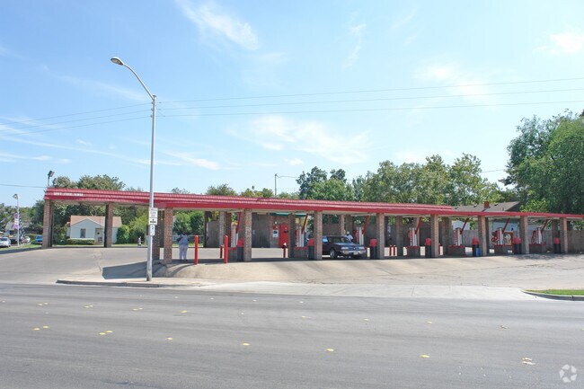
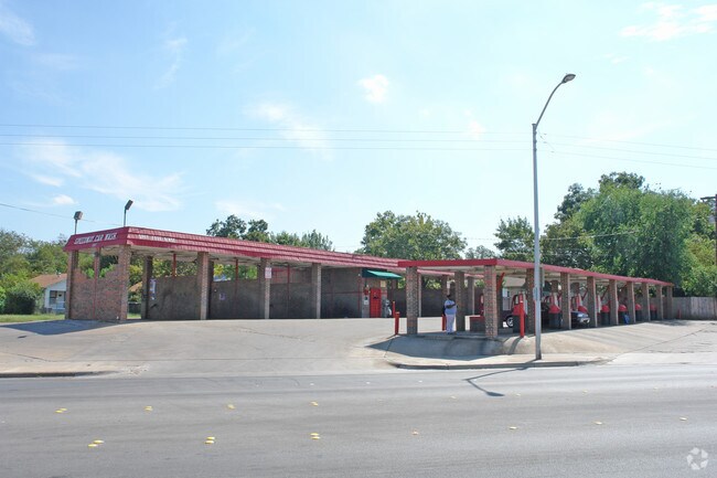
Property Record
3122 Gordon Ave, Fort Worth, TX 76110
NEARBY LISTINGS FOR SALE OR LEASE
Property Detail
3122 Gordon Ave
Dallas-Fort Worth-Arlington, TX
Byers & Mccart Addition
04647882
NORTH FORT WORTH BLOCK 67 LOT 15 & 16
Residentialacreage
Tarrant
X
Texas
48439C0305L
15,16
2024
0.14 AC
2025
West Southwest Ft Worth
100800
Dallas/Ft Worth
2,600 SF
DEMOGRAPHICS near 3122 Gordon Ave
1 Mile
3 Mile
5 Mile
2024 Total Population
23,042
124,519
309,884
2029 Population
24,254
132,400
329,090
Pop Growth 2024-2029
+ 5.26%
+ 6.33%
+ 6.20%
Average Age
32
35
37
2024 Total Households
7,068
44,105
117,750
HH Growth 2024-2029
+ 6.21%
+ 6.75%
+ 6.55%
Median Household Inc
$57,106
$57,865
$57,372
Avg Household Size
2.70
2.60
2.50
2024 Avg HH Vehicles
2.00
2.00
2.00
Median Home Value
$296,222
$238,613
$240,258
Median Year Built
1955
1962
1976
Nearby Places
- Restaurants
- Banks
- Shops
- Fitness
- Groceries
PUBLIC TRANSPORTATION
COMMUTER RAIL
Texas And Pacific (T&P) (Trinity Railway Express - Dallas Area Rapid Transit (DART))
DRIVE
WALK
Distance
Texas And Pacific (T&P) (Trinity Railway Express - Dallas Area Rapid Transit (DART))
10 min
4.1 mi
Fort Worth (Heartland Flyer - Amtrak, Texas Eagle - Amtrak)
DRIVE
WALK
Distance
Fort Worth (Heartland Flyer - Amtrak, Texas Eagle - Amtrak)
9 min
5.1 mi
AIRPORT
Dallas-Fort Worth International
DRIVE
WALK
Distance
Dallas-Fort Worth International
39 min
29.2 mi
Freight Ports
Port of Shreveport
DRIVE
WALK
Distance
Port of Shreveport
250 min
231.3 mi
Nearby Properties
Address
Land Use
TOTAL SIZE
Lot Size
Zoning
Address
Land Use
TOTAL SIZE
Lot Size
Zoning
802,865 SF
17.38 AC
Address
Land Use
TOTAL SIZE
Lot Size
Zoning
1,135,360 SF
7.30 AC
Address
Land Use
TOTAL SIZE
Lot Size
Zoning
2,168,050 SF
16.28 AC
Address
Land Use
TOTAL SIZE
Lot Size
Zoning
1,545,212 SF
8.90 AC
Address
Land Use
TOTAL SIZE
Lot Size
Zoning
616,686 SF
2.82 AC
Address
Land Use
TOTAL SIZE
Lot Size
Zoning
438,943 SF
3.77 AC
Address
Land Use
TOTAL SIZE
Lot Size
Zoning
928,562 SF
17.47 AC
Address
Land Use
TOTAL SIZE
Lot Size
Zoning
1,259,660 SF
52.13 AC
Address
Land Use
TOTAL SIZE
Lot Size
Zoning
482,938 SF
22.22 AC
Address
Land Use
TOTAL SIZE
Lot Size
Zoning
407,056 SF
17.20 AC
Address
Land Use
TOTAL SIZE
Lot Size
Zoning
509,560 SF
3.06 AC
Address
Land Use
TOTAL SIZE
Lot Size
Zoning
433,672 SF
6.37 AC
Address
Land Use
TOTAL SIZE
Lot Size
Zoning
948,833 SF
64.37 AC
Address
Land Use
TOTAL SIZE
Lot Size
Zoning
1,054,538 SF
6.23 AC
Address
Land Use
TOTAL SIZE
Lot Size
Zoning
353,842 SF
101.26 AC
Address
Land Use
TOTAL SIZE
Lot Size
Zoning
498,381 SF
5.26 AC
Address
Land Use
TOTAL SIZE
Lot Size
Zoning
348,025 SF
26.33 AC
Address
Land Use
TOTAL SIZE
Lot Size
Zoning
382,376 SF
21.61 AC
Address
Land Use
TOTAL SIZE
Lot Size
Zoning
1,129,204 SF
74.34 AC
Address
Land Use
TOTAL SIZE
Lot Size
Zoning
386,125 SF
3.54 AC
Address
Land Use
TOTAL SIZE
Lot Size
Zoning
525,051 SF
6.87 AC
Address
Land Use
TOTAL SIZE
Lot Size
Zoning
283,106 SF
11.17 AC
Address
Land Use
TOTAL SIZE
Lot Size
Zoning
446,116 SF
12.50 AC
Address
Land Use
TOTAL SIZE
Lot Size
Zoning
642,632 SF
27.73 AC
Address
Land Use
TOTAL SIZE
Lot Size
Zoning
102,490 SF
4.21 AC
Address
Land Use
TOTAL SIZE
Lot Size
Zoning
276,500 SF
7.21 AC
Address
Land Use
TOTAL SIZE
Lot Size
Zoning
294,193 SF
59.09 AC
Address
Land Use
TOTAL SIZE
Lot Size
Zoning
477,750 SF
1.72 AC
Address
Land Use
TOTAL SIZE
Lot Size
Zoning
222,764 SF
1.67 AC
Address
Land Use
TOTAL SIZE
Lot Size
Zoning
183,899 SF
9.23 AC
The World's #1 Commercial Real Estate Marketplace
Connect with us
© 2025 CoStar Group
The information above has been obtained from sources believed reliable. While we do not doubt its accuracy we have not verified it and make no guarantee, warranty or representation about it. It is your responsibility to independently confirm its accuracy and completeness. Any projections, opinions, assumptions, or estimates used are for example only and do not represent the current or future performance of the property. The value of this transaction to you depends on tax and other factors which should be evaluated by your tax, financial, and legal advisors. You and your advisors should conduct a careful, independent investigation of the property to determine to your satisfaction the suitability of the property for your needs.