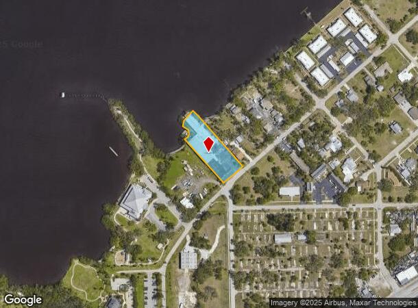
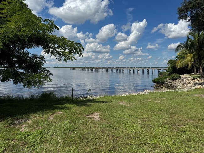
Property Record
3131 E Riverside Dr, Fort Myers, FL 33916
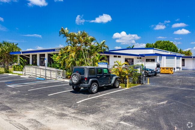


Current Lease Availabilities
NEARBY LISTINGS FOR SALE OR LEASE
Property Detail
3131 E Riverside Dr
Cape Coral-Fort Myers, FL
Edgewood
07-44-25-P4-00109.0080
TRAVERS + HENDRYS SUB BLK 9 PB 1 PG 32 LOTS 8 + 9
Commercialnec
Lee
AE
Florida
12071C0286G
8,9
2024
1.06 AC
2025
City of Ft Myers
000304
Southwest Florida
27,302 SF
DEMOGRAPHICS near 3131 E Riverside Dr
1 Mile
3 Mile
5 Mile
2024 Total Population
5,839
55,388
138,792
2029 Population
6,971
65,659
164,941
Pop Growth 2024-2029
+ 19.39%
+ 18.54%
+ 18.84%
Average Age
41
43
43
2024 Total Households
2,516
22,360
57,887
HH Growth 2024-2029
+ 19.28%
+ 18.47%
+ 18.62%
Median Household Inc
$50,371
$38,661
$47,545
Avg Household Size
2.20
2.30
2.20
2024 Avg HH Vehicles
1.00
1.00
1.00
Median Home Value
$219,949
$163,187
$189,779
Median Year Built
1985
1979
1986
Nearby Places
- Restaurants
- Banks
- Shops
- Fitness
- Groceries
PUBLIC TRANSPORTATION
AIRPORT
Southwest Florida International
DRIVE
WALK
Distance
Southwest Florida International
24 min
14.3 mi
Punta Gorda
DRIVE
WALK
Distance
Punta Gorda
34 min
25.8 mi
Freight Ports
Port Manatee
DRIVE
WALK
Distance
Port Manatee
114 min
97.5 mi
Nearby Properties
Address
Land Use
TOTAL SIZE
Lot Size
Zoning
Address
Land Use
TOTAL SIZE
Lot Size
Zoning
770,753 SF
5.87 AC
PUD
Address
Land Use
TOTAL SIZE
Lot Size
Zoning
536,175 SF
8.42 AC
PO
Address
Land Use
TOTAL SIZE
Lot Size
Zoning
4.48 AC
U-CTR
Address
Land Use
TOTAL SIZE
Lot Size
Zoning
646,502 SF
6.11 AC
PUD
Address
Land Use
TOTAL SIZE
Lot Size
Zoning
552,157 SF
4.20 AC
PUD
Address
Land Use
TOTAL SIZE
Lot Size
Zoning
723,322 SF
1.73 AC
PUD
Address
Land Use
TOTAL SIZE
Lot Size
Zoning
98,242 SF
17.43 AC
RS-7
Address
Land Use
TOTAL SIZE
Lot Size
Zoning
243,841 SF
3.17 AC
CIVIC
Address
Land Use
TOTAL SIZE
Lot Size
Zoning
376,949 SF
49.70 AC
RM16
Address
Land Use
TOTAL SIZE
Lot Size
Zoning
163,618 SF
1.32 AC
CIVIC
Address
Land Use
TOTAL SIZE
Lot Size
Zoning
551,003 SF
3.24 AC
PUD
Address
Land Use
TOTAL SIZE
Lot Size
Zoning
319,765 SF
47.40 AC
RS7
Address
Land Use
TOTAL SIZE
Lot Size
Zoning
294,203 SF
30.22 AC
RM16
Address
Land Use
TOTAL SIZE
Lot Size
Zoning
107,306 SF
1.91 AC
CIVIC
Address
Land Use
TOTAL SIZE
Lot Size
Zoning
305,410 SF
1.38 AC
U-CTR
Address
Land Use
TOTAL SIZE
Lot Size
Zoning
106,300 SF
14.71 AC
TFC2
Address
Land Use
TOTAL SIZE
Lot Size
Zoning
231,360 SF
17.08 AC
PUD
Address
Land Use
TOTAL SIZE
Lot Size
Zoning
11,062 SF
47.11 AC
Address
Land Use
TOTAL SIZE
Lot Size
Zoning
76,154 SF
2.88 AC
U-CTR
Address
Land Use
TOTAL SIZE
Lot Size
Zoning
115,004 SF
1.91 AC
CIVIC
Address
Land Use
TOTAL SIZE
Lot Size
Zoning
93,758 SF
1.72 AC
CIVIC
Address
Land Use
TOTAL SIZE
Lot Size
Zoning
182,503 SF
1.34 AC
CIVIC
Address
Land Use
TOTAL SIZE
Lot Size
Zoning
137,687 SF
18.25 AC
RS7
Address
Land Use
TOTAL SIZE
Lot Size
Zoning
88,345 SF
13.59 AC
C-1
Address
Land Use
TOTAL SIZE
Lot Size
Zoning
227,527 SF
0.95 AC
CIVIC
Address
Land Use
TOTAL SIZE
Lot Size
Zoning
3,585 SF
2.16 AC
U-CTR
Address
Land Use
TOTAL SIZE
Lot Size
Zoning
244,240 SF
5.92 AC
U-CTR
Address
Land Use
TOTAL SIZE
Lot Size
Zoning
8,811 SF
11.79 AC
PUD
Address
Land Use
TOTAL SIZE
Lot Size
Zoning
109,404 SF
14.22 AC
AG-2
Address
Land Use
TOTAL SIZE
Lot Size
Zoning
101,343 SF
8.06 AC
IL
The World's #1 Commercial Real Estate Marketplace
Connect with us
© 2025 CoStar Group
The information above has been obtained from sources believed reliable. While we do not doubt its accuracy we have not verified it and make no guarantee, warranty or representation about it. It is your responsibility to independently confirm its accuracy and completeness. Any projections, opinions, assumptions, or estimates used are for example only and do not represent the current or future performance of the property. The value of this transaction to you depends on tax and other factors which should be evaluated by your tax, financial, and legal advisors. You and your advisors should conduct a careful, independent investigation of the property to determine to your satisfaction the suitability of the property for your needs.