Property Record
3120 Nobscot Dr, Indianapolis, IN 46222


NEARBY LISTINGS FOR SALE OR LEASE
Property Detail
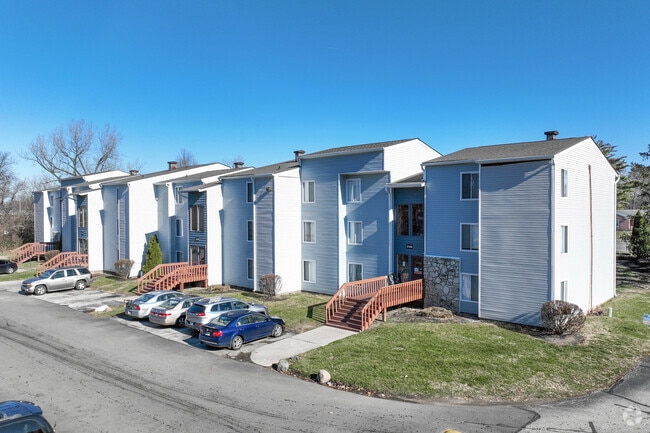
3120 Nobscot Dr
49-06-21-108-002.000-901
Oak Crossing
Taxexempt
PT NW1/4 NW1/4 S21 T16 R3 BEG 338.871FT S OF NW CORNE 460.38FT E 200.06FT SE 65.425FT SE IRR 632.054FTE 78.37FT SE 38.603FT S 533.122FT W 1343.761FT N933.925FT TO BEG 25.094AC
X
Marion
18097C0129F
Indiana
0
25.09 AC
2024
Eagledale
340500
Indianapolis
3,546 SF
Indianapolis-Carmel-Anderson, IN
DEMOGRAPHICS near 3120 Nobscot Dr
1 Mile
3 Mile
5 Mile
2024 Total Population
8,917
93,757
283,248
2029 Population
8,777
93,460
282,212
Pop Growth 2024-2029
(1.57%)
(0.32%)
(0.37%)
Average Age
35
35
36
2024 Total Households
3,380
35,622
118,827
HH Growth 2024-2029
(1.83%)
(0.27%)
(0.32%)
Median Household Inc
$56,347
$50,964
$55,659
Avg Household Size
2.30
2.50
2.30
2024 Avg HH Vehicles
2.00
2.00
2.00
Median Home Value
$230,090
$151,740
$183,961
Median Year Built
1973
1963
1968
Nearby Places
Map Layers
Map Styles
 Street
 Aerial
- Restaurants
- Banks
- Shops
- Fitness
- Groceries
PUBLIC TRANSPORTATION
COMMUTER RAIL
DRIVE
WALK
Distance
12 min
6.6 mi
AIRPORT
Indianapolis International
DRIVE
WALK
Distance
Indianapolis International
28 min
14.9 mi
Nearby Properties
Address
Land Use
TOTAL SIZE
Lot Size
Zoning
Address
Land Use
TOTAL SIZE
Lot Size
Zoning
80,249 SF
71.96 AC
ZO01
Address
Land Use
TOTAL SIZE
Lot Size
Zoning
967,690 SF
59.63 AC
ZO01
Address
Land Use
TOTAL SIZE
Lot Size
Zoning
415,877 SF
55.83 AC
ZO01
Address
Land Use
TOTAL SIZE
Lot Size
Zoning
296,086 SF
6.19 AC
ZO01
Address
Land Use
TOTAL SIZE
Lot Size
Zoning
207,800 SF
2.23 AC
ZO01
Address
Land Use
TOTAL SIZE
Lot Size
Zoning
4,808 SF
5.76 AC
ZO01
Address
Land Use
TOTAL SIZE
Lot Size
Zoning
108,872 SF
30 AC
Address
Land Use
TOTAL SIZE
Lot Size
Zoning
18,154 SF
9.40 AC
ZO01
Address
Land Use
TOTAL SIZE
Lot Size
Zoning
2,288 SF
6 AC
ZO01
Address
Land Use
TOTAL SIZE
Lot Size
Zoning
438,643 SF
43.63 AC
ZO01
Address
Land Use
TOTAL SIZE
Lot Size
Zoning
70,717 SF
7.40 AC
ZO01
Address
Land Use
TOTAL SIZE
Lot Size
Zoning
23,195 SF
31.18 AC
Address
Land Use
TOTAL SIZE
Lot Size
Zoning
42,611 SF
151.50 AC
ZO01
Address
Land Use
TOTAL SIZE
Lot Size
Zoning
2,703 SF
17.50 AC
ZO01
Address
Land Use
TOTAL SIZE
Lot Size
Zoning
73,528 SF
80 AC
ZO01
Address
Land Use
TOTAL SIZE
Lot Size
Zoning
20,746 SF
28.38 AC
ZO01
Address
Land Use
TOTAL SIZE
Lot Size
Zoning
380,355 SF
26.75 AC
ZO01
Address
Land Use
TOTAL SIZE
Lot Size
Zoning
9,094 SF
6.22 AC
ZO01
Address
Land Use
TOTAL SIZE
Lot Size
Zoning
8,496 SF
20 AC
ZO01
Address
Land Use
TOTAL SIZE
Lot Size
Zoning
4,944 SF
26.99 AC
ZO01
Address
Land Use
TOTAL SIZE
Lot Size
Zoning
8,998 SF
3.56 AC
ZO01
Address
Land Use
TOTAL SIZE
Lot Size
Zoning
28,878 SF
4.66 AC
ZO01
Address
Land Use
TOTAL SIZE
Lot Size
Zoning
76,022 SF
57.30 AC
ZO01
Address
Land Use
TOTAL SIZE
Lot Size
Zoning
16.60 AC
ZO01
Address
Land Use
TOTAL SIZE
Lot Size
Zoning
64,544 SF
1.54 AC
ZO01
Address
Land Use
TOTAL SIZE
Lot Size
Zoning
188,212 SF
28.51 AC
Address
Land Use
TOTAL SIZE
Lot Size
Zoning
25,813 SF
69.85 AC
ZO01
Address
Land Use
TOTAL SIZE
Lot Size
Zoning
19,740 SF
22.04 AC
ZO01
Address
Land Use
TOTAL SIZE
Lot Size
Zoning
4,624 SF
26.36 AC
The World's #1 Commercial Real Estate Marketplace
Connect with us
© 2026 CoStar Group
The information above has been obtained from sources believed reliable. While we do not doubt its accuracy we have not verified it and make no guarantee, warranty or representation about it. It is your responsibility to independently confirm its accuracy and completeness. Any projections, opinions, assumptions, or estimates used are for example only and do not represent the current or future performance of the property. The value of this transaction to you depends on tax and other factors which should be evaluated by your tax, financial, and legal advisors. You and your advisors should conduct a careful, independent investigation of the property to determine to your satisfaction the suitability of the property for your needs.