Property Record
31207 Denbeste Ct, Shafter, CA 93263
Property Detail
31207 Denbeste Ct
Bakersfield-Delano, CA
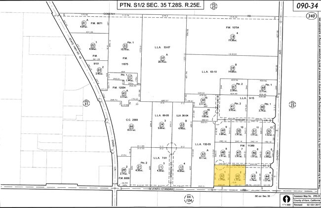
PARCEL MAP 11389 , LOT 2
090-340-53-00-0
KERN
Lightindustrial
California
B and X Area of moderate flood hazard, usually the area between the limits of the 100-year and 500-year floods.
2
2024
1.79 AC
2025
NW Outlying Kern County
003900
Bakersfield
NEARBY LISTINGS FOR SALE OR LEASE
DEMOGRAPHICS near 31207 Denbeste Ct
1 mile
3 mile
5 mile
2025 Total Population
76
1,595
25,540
2030 Population
77
1,589
26,164
Pop Growth 2025-2030
+ 1.32%
(0.38%)
+ 2.44%
Average Age
37
36
33
2025 Total Households
20
313
6,712
HH Growth 2025-2030
+ 5.00%
+ 2.24%
+ 3.05%
Median Household Inc
$79,167
$69,868
$72,491
Avg Household Size
3.60
3.50
3.60
2025 Avg HH Vehicles
2.00
2.00
2.00
Median Home Value
$425,000
$454,807
$376,140
Median Year Built
1972
1972
1993
Nearby Places
Map Layers
Map Styles
 Street
 Aerial
Layers
 Traffic
 Biking
Places
Listings with unknown addresses are not visible on the map
- Restaurants
- Banks
- Shops
- Fitness
- Groceries
PUBLIC TRANSPORTATION
AIRPORT
Meadows Field
Drive
Walk
Distance
Meadows Field
21 min
11.7 mi
Freight Ports
The Port of Hueneme
Drive
Walk
Distance
The Port of Hueneme
167 min
132.9 mi
Nearby Properties
Address
Land Use
TOTAL SIZE
Lot Size
Zoning
Address
Land Use
TOTAL SIZE
Lot Size
Zoning
622,678 SF
68.11 AC
I
Address
Land Use
TOTAL SIZE
Lot Size
Zoning
1,004,880 SF
71.87 AC
I
Address
Land Use
TOTAL SIZE
Lot Size
Zoning
19.09 AC
Address
Land Use
TOTAL SIZE
Lot Size
Zoning
1,004,800 SF
57.77 AC
I
Address
Land Use
TOTAL SIZE
Lot Size
Zoning
14.52 AC
Address
Land Use
TOTAL SIZE
Lot Size
Zoning
403,770 SF
20.31 AC
I
Address
Land Use
TOTAL SIZE
Lot Size
Zoning
4,494 SF
67.92 AC
M-1
Address
Land Use
TOTAL SIZE
Lot Size
Zoning
209,775 SF
21.23 AC
I
Address
Land Use
TOTAL SIZE
Lot Size
Zoning
3.66 AC
I
Address
Land Use
TOTAL SIZE
Lot Size
Zoning
13.82 AC
Address
Land Use
TOTAL SIZE
Lot Size
Zoning
4,263 SF
49.09 AC
A
Address
Land Use
TOTAL SIZE
Lot Size
Zoning
84,860 SF
15.35 AC
M-3
Address
Land Use
TOTAL SIZE
Lot Size
Zoning
41.47 AC
M-3
Address
Land Use
TOTAL SIZE
Lot Size
Zoning
263.80 AC
A
Address
Land Use
TOTAL SIZE
Lot Size
Zoning
35,125 SF
20.70 AC
M-2
Address
Land Use
TOTAL SIZE
Lot Size
Zoning
1,440 SF
312.47 AC
A
Address
Land Use
TOTAL SIZE
Lot Size
Zoning
15,000 SF
10.70 AC
M2
Address
Land Use
TOTAL SIZE
Lot Size
Zoning
14,834 SF
11.88 AC
M-3
Address
Land Use
TOTAL SIZE
Lot Size
Zoning
140.40 AC
A
Address
Land Use
TOTAL SIZE
Lot Size
Zoning
116.97 AC
A
Address
Land Use
TOTAL SIZE
Lot Size
Zoning
7,200 SF
15.17 AC
M3
Address
Land Use
TOTAL SIZE
Lot Size
Zoning
5,291 SF
3.64 AC
M3
Address
Land Use
TOTAL SIZE
Lot Size
Zoning
8,400 SF
45.59 AC
A
Address
Land Use
TOTAL SIZE
Lot Size
Zoning
Address
Land Use
TOTAL SIZE
Lot Size
Zoning
240.57 AC
A
Address
Land Use
TOTAL SIZE
Lot Size
Zoning
5,250 SF
38.18 AC
A
Address
Land Use
TOTAL SIZE
Lot Size
Zoning
Address
Land Use
TOTAL SIZE
Lot Size
Zoning
14,400 SF
4.98 AC
M-2 PD
Address
Land Use
TOTAL SIZE
Lot Size
Zoning
3,872 SF
37.98 AC
M2
The World's #1 Commercial Real Estate Marketplace
Connect with us
© 2026 CoStar Group
The information above has been obtained from sources believed reliable. While we do not doubt its accuracy we have not verified it and make no guarantee, warranty or representation about it. It is your responsibility to independently confirm its accuracy and completeness. Any projections, opinions, assumptions, or estimates used are for example only and do not represent the current or future performance of the property. The value of this transaction to you depends on tax and other factors which should be evaluated by your tax, financial, and legal advisors. You and your advisors should conduct a careful, independent investigation of the property to determine to your satisfaction the suitability of the property for your needs.