Property Record
3121 E Park Row Dr, Arlington, TX 76010


Property Detail
3121 E Park Row Dr
03693791
GSID SOUTH SITE 22A
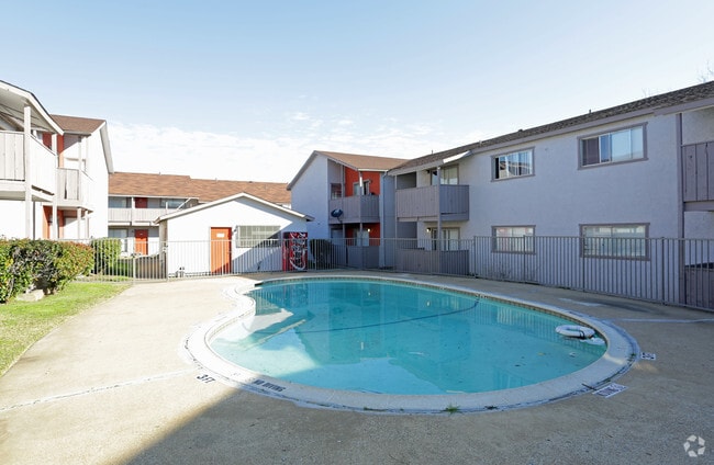
Multifamilydwelling
TARRANT
B and X Area of moderate flood hazard, usually the area between the limits of the 100-year and 500-year floods.
Texas
2024
5.04 AC
2025
Arlington
121907
Dallas/Ft Worth
118,280 SF
Dallas-Fort Worth-Arlington, TX
NEARBY LISTINGS FOR SALE OR LEASE
DEMOGRAPHICS near 3121 E Park Row Dr
1 mile
3 mile
5 mile
2025 Total Population
16,470
126,657
339,121
2030 Population
17,318
132,498
354,611
Pop Growth 2025-2030
+ 5.15%
+ 4.61%
+ 4.57%
Average Age
32
34
35
2025 Total Households
5,356
41,384
120,367
HH Growth 2025-2030
+ 5.30%
+ 4.69%
+ 4.77%
Median Household Inc
$47,919
$56,635
$62,597
Avg Household Size
3.00
3.00
2.70
2025 Avg HH Vehicles
2.00
2.00
2.00
Median Home Value
$228,936
$238,985
$265,119
Median Year Built
1976
1980
1983
Nearby Places
Map Layers
Map Styles
 Street
 Aerial
Transit
 Traffic
 Biking
Places
Listings with unknown addresses are not visible on the map
- Restaurants
- Banks
- Shops
- Fitness
- Groceries
PUBLIC TRANSPORTATION
COMMUTER RAIL
Drive
Walk
Distance
13 min
8.5 mi
Drive
Walk
Distance
13 min
8.9 mi
AIRPORT
Dallas-Fort Worth International
Drive
Walk
Distance
Dallas-Fort Worth International
22 min
14.7 mi
Dallas Love Field
Drive
Walk
Distance
Dallas Love Field
32 min
22.4 mi
Nearby Properties
Address
Land Use
TOTAL SIZE
Lot Size
Zoning
Address
Land Use
TOTAL SIZE
Lot Size
Zoning
1,700,000 SF
8.23 AC
Address
Land Use
TOTAL SIZE
Lot Size
Zoning
3,015,800 SF
72.86 AC
Address
Land Use
TOTAL SIZE
Lot Size
Zoning
1,400,000 SF
15.30 AC
Address
Land Use
TOTAL SIZE
Lot Size
Zoning
269,257 SF
21.33 AC
Address
Land Use
TOTAL SIZE
Lot Size
Zoning
378,182 SF
5.02 AC
Address
Land Use
TOTAL SIZE
Lot Size
Zoning
287,560 SF
3.28 AC
Address
Land Use
TOTAL SIZE
Lot Size
Zoning
5,995,915 SF
248.78 AC
Address
Land Use
TOTAL SIZE
Lot Size
Zoning
1,577,320 SF
122.55 AC
Z123
Address
Land Use
TOTAL SIZE
Lot Size
Zoning
860,445 SF
50.39 AC
Z123
Address
Land Use
TOTAL SIZE
Lot Size
Zoning
456,473 SF
32.79 AC
Address
Land Use
TOTAL SIZE
Lot Size
Zoning
1,261,810 SF
80.53 AC
Address
Land Use
TOTAL SIZE
Lot Size
Zoning
450,535 SF
27.23 AC
Address
Land Use
TOTAL SIZE
Lot Size
Zoning
139,821 SF
Address
Land Use
TOTAL SIZE
Lot Size
Zoning
753,721 SF
42.65 AC
Address
Land Use
TOTAL SIZE
Lot Size
Zoning
358,350 SF
13.15 AC
Address
Land Use
TOTAL SIZE
Lot Size
Zoning
247,880 SF
20.93 AC
Z236
Address
Land Use
TOTAL SIZE
Lot Size
Zoning
206,650 SF
18.92 AC
Address
Land Use
TOTAL SIZE
Lot Size
Zoning
402,935 SF
20.72 AC
Address
Land Use
TOTAL SIZE
Lot Size
Zoning
539,000 SF
3.91 AC
Address
Land Use
TOTAL SIZE
Lot Size
Zoning
1,054,767 SF
37.45 AC
Z123
Address
Land Use
TOTAL SIZE
Lot Size
Zoning
603,000 SF
32.80 AC
Z123
Address
Land Use
TOTAL SIZE
Lot Size
Zoning
387,500 SF
13.54 AC
Z313
Address
Land Use
TOTAL SIZE
Lot Size
Zoning
252,800 SF
21.59 AC
Z236
Address
Land Use
TOTAL SIZE
Lot Size
Zoning
137,878 SF
189.88 AC
Address
Land Use
TOTAL SIZE
Lot Size
Zoning
816,040 SF
41.89 AC
Address
Land Use
TOTAL SIZE
Lot Size
Zoning
362,847 SF
19.88 AC
Address
Land Use
TOTAL SIZE
Lot Size
Zoning
254,690 SF
12.18 AC
Address
Land Use
TOTAL SIZE
Lot Size
Zoning
162,537 SF
19.70 AC
Address
Land Use
TOTAL SIZE
Lot Size
Zoning
337,690 SF
20.71 AC
Address
Land Use
TOTAL SIZE
Lot Size
Zoning
283,087 SF
15.22 AC
Z236
The World's #1 Commercial Real Estate Marketplace
Connect with us
© 2026 CoStar Group
The information above has been obtained from sources believed reliable. While we do not doubt its accuracy we have not verified it and make no guarantee, warranty or representation about it. It is your responsibility to independently confirm its accuracy and completeness. Any projections, opinions, assumptions, or estimates used are for example only and do not represent the current or future performance of the property. The value of this transaction to you depends on tax and other factors which should be evaluated by your tax, financial, and legal advisors. You and your advisors should conduct a careful, independent investigation of the property to determine to your satisfaction the suitability of the property for your needs.