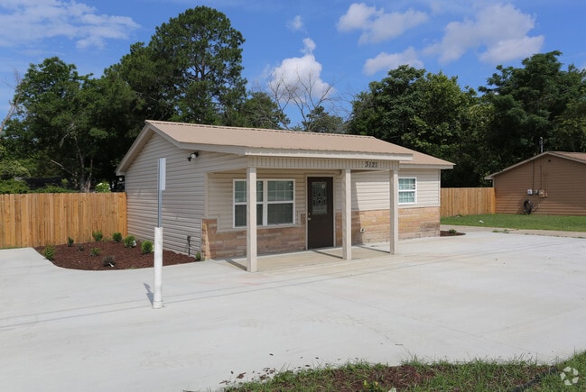
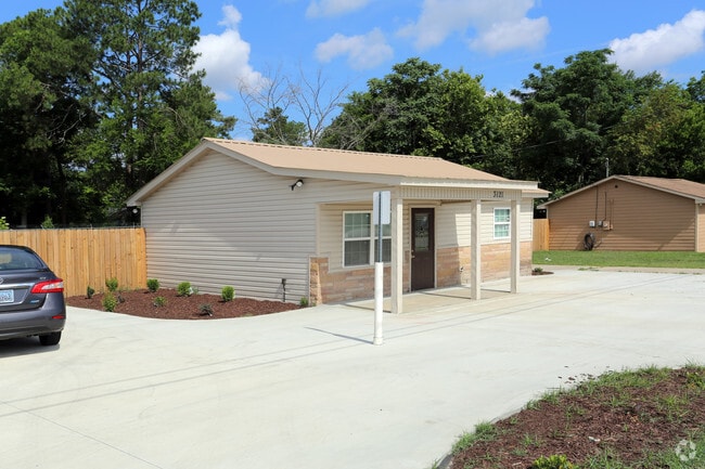
Property Record
3121 Mike Padgett Hwy, Augusta, GA 30906
Current Lease Availabilities
NEARBY LISTINGS FOR SALE OR LEASE
Property Detail
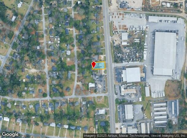
3121 Mike Padgett Hwy
Augusta-Richmond County, GA-SC
Sherwood
1231012000
SHERWOOD (00000) 029-C
Commercialacreage
Richmond
X
Georgia
13245C0117G
29
2025
0.24 AC
2025
South Richmond County
010511
Augusta/Richmond County
672 SF
DEMOGRAPHICS near 3121 Mike Padgett Hwy
1 Mile
3 Mile
5 Mile
2024 Total Population
5,868
32,762
94,629
2029 Population
5,790
32,452
94,332
Pop Growth 2024-2029
(1.33%)
(0.95%)
(0.31%)
Average Age
37
38
38
2024 Total Households
1,840
12,404
37,422
HH Growth 2024-2029
(1.63%)
(0.91%)
(0.17%)
Median Household Inc
$33,057
$31,813
$36,187
Avg Household Size
2.60
2.50
2.40
2024 Avg HH Vehicles
2.00
2.00
2.00
Median Home Value
$62,372
$81,559
$99,883
Median Year Built
1962
1966
1970
Nearby Places
- Restaurants
- Banks
- Shops
- Fitness
- Groceries
PUBLIC TRANSPORTATION
AIRPORT
Augusta Regional at Bush Field
DRIVE
WALK
Distance
Augusta Regional at Bush Field
12 min
4.5 mi
Freight Ports
Georgia Ports - Savannah
DRIVE
WALK
Distance
Georgia Ports - Savannah
147 min
112.2 mi
Nearby Properties
Address
Land Use
TOTAL SIZE
Lot Size
Zoning
Address
Land Use
TOTAL SIZE
Lot Size
Zoning
297,455 SF
45.93 AC
A
Address
Land Use
TOTAL SIZE
Lot Size
Zoning
1,428 SF
75.91 AC
R-1A
Address
Land Use
TOTAL SIZE
Lot Size
Zoning
39,200 SF
310.85 AC
A_R-1A
Address
Land Use
TOTAL SIZE
Lot Size
Zoning
99,046 SF
29.96 AC
R-1A
Address
Land Use
TOTAL SIZE
Lot Size
Zoning
87,976 SF
765.88 AC
R-1
Address
Land Use
TOTAL SIZE
Lot Size
Zoning
241,284 SF
20.61 AC
R-1A
Address
Land Use
TOTAL SIZE
Lot Size
Zoning
225,664 SF
57.13 AC
LI
Address
Land Use
TOTAL SIZE
Lot Size
Zoning
56,631 SF
11.62 AC
R-1A, B-2
Address
Land Use
TOTAL SIZE
Lot Size
Zoning
552,852 SF
215.52 AC
A_HI
Address
Land Use
TOTAL SIZE
Lot Size
Zoning
4,507 SF
56.06 AC
HI
Address
Land Use
TOTAL SIZE
Lot Size
Zoning
14,850 SF
132.49 AC
A,R
Address
Land Use
TOTAL SIZE
Lot Size
Zoning
35,263 SF
19.63 AC
B-1
Address
Land Use
TOTAL SIZE
Lot Size
Zoning
18,000 SF
27.80 AC
B-2
Address
Land Use
TOTAL SIZE
Lot Size
Zoning
38,412 SF
22.51 AC
R-1A
Address
Land Use
TOTAL SIZE
Lot Size
Zoning
24,304 SF
11 AC
R-1A
Address
Land Use
TOTAL SIZE
Lot Size
Zoning
16,790 SF
22.07 AC
B-2
Address
Land Use
TOTAL SIZE
Lot Size
Zoning
73,226 SF
6.97 AC
R-1A
Address
Land Use
TOTAL SIZE
Lot Size
Zoning
70,251 SF
9.17 AC
R-1B
Address
Land Use
TOTAL SIZE
Lot Size
Zoning
29,952 SF
13.76 AC
R-3B_B-2
Address
Land Use
TOTAL SIZE
Lot Size
Zoning
136,260 SF
14.42 AC
LI_R-1
Address
Land Use
TOTAL SIZE
Lot Size
Zoning
4,154 SF
26.88 AC
R-3A
Address
Land Use
TOTAL SIZE
Lot Size
Zoning
68,707 SF
8.26 AC
B-1
Address
Land Use
TOTAL SIZE
Lot Size
Zoning
57,408 SF
7.20 AC
R-3B
Address
Land Use
TOTAL SIZE
Lot Size
Zoning
128,882 SF
21.09 AC
B-2
Address
Land Use
TOTAL SIZE
Lot Size
Zoning
78,454 SF
10.63 AC
B-2
Address
Land Use
TOTAL SIZE
Lot Size
Zoning
443,388 SF
38.88 AC
HI
Address
Land Use
TOTAL SIZE
Lot Size
Zoning
107,996 SF
9.91 AC
R-3B
Address
Land Use
TOTAL SIZE
Lot Size
Zoning
62,379 SF
73.78 AC
HI
Address
Land Use
TOTAL SIZE
Lot Size
Zoning
96,585 SF
9.42 AC
LI
Address
Land Use
TOTAL SIZE
Lot Size
Zoning
166,400 SF
77.09 AC
HI_A
The World's #1 Commercial Real Estate Marketplace
Connect with us
© 2025 CoStar Group
The information above has been obtained from sources believed reliable. While we do not doubt its accuracy we have not verified it and make no guarantee, warranty or representation about it. It is your responsibility to independently confirm its accuracy and completeness. Any projections, opinions, assumptions, or estimates used are for example only and do not represent the current or future performance of the property. The value of this transaction to you depends on tax and other factors which should be evaluated by your tax, financial, and legal advisors. You and your advisors should conduct a careful, independent investigation of the property to determine to your satisfaction the suitability of the property for your needs.