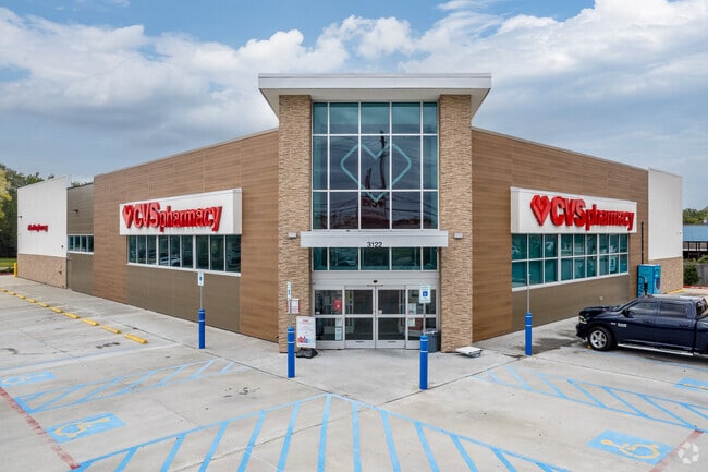
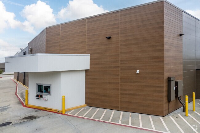
Property Record
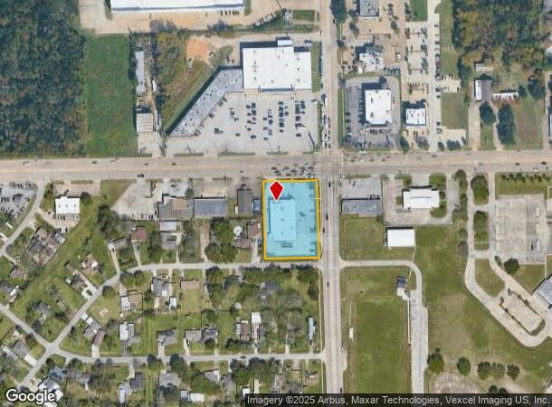
3122 Underwood Rd, La Porte, TX 77571

NEARBY LISTINGS FOR SALE OR LEASE
Property Detail
3122 Underwood Rd
1402710010001
Spenwick Place Sec 2
Storebuilding
RES A BLK 1 3122 UNDERWOOD ROAD ASSEMBLAGE AMEND
X
Harris
48201C0940M
Texas
2024
1.34 AC
2025
NASA/Clear Lake
343000
Houston
14,796 SF
Houston-The Woodlands-Sugar Land, TX
DEMOGRAPHICS near 3122 Underwood Rd
1 Mile
3 Mile
5 Mile
2024 Total Population
11,672
55,460
118,317
2029 Population
11,816
56,524
120,712
Pop Growth 2024-2029
+ 1.23%
+ 1.92%
+ 2.02%
Average Age
39
38
39
2024 Total Households
4,166
19,344
41,999
HH Growth 2024-2029
+ 1.15%
+ 1.91%
+ 1.99%
Median Household Inc
$78,927
$86,035
$82,843
Avg Household Size
2.80
2.80
2.80
2024 Avg HH Vehicles
2.00
2.00
2.00
Median Home Value
$181,677
$226,470
$229,530
Median Year Built
1984
1986
1986
Nearby Places
Map Layers
Map Styles
 Street
 Aerial
- Restaurants
- Banks
- Shops
- Fitness
- Groceries
PUBLIC TRANSPORTATION
AIRPORT
William P Hobby
DRIVE
WALK
Distance
William P Hobby
29 min
14.4 mi
George Bush Intcntl/Houston
DRIVE
WALK
Distance
George Bush Intcntl/Houston
44 min
33.7 mi
Freight Ports
Port of Houston
DRIVE
WALK
Distance
Port of Houston
27 min
15.3 mi
SALE & LEASE HISTORY
LISTING DATE
SALE/LEASE

Aug 05, 2022
For Sale
Nearby Properties
Address
Land Use
TOTAL SIZE
Lot Size
Zoning
Address
Land Use
TOTAL SIZE
Lot Size
Zoning
55.98 AC
Address
Land Use
TOTAL SIZE
Lot Size
Zoning
20.83 AC
Address
Land Use
TOTAL SIZE
Lot Size
Zoning
47.21 AC
Address
Land Use
TOTAL SIZE
Lot Size
Zoning
Address
Land Use
TOTAL SIZE
Lot Size
Zoning
61.40 AC
Address
Land Use
TOTAL SIZE
Lot Size
Zoning
900,000 SF
42.88 AC
Address
Land Use
TOTAL SIZE
Lot Size
Zoning
767,630 SF
41.71 AC
Address
Land Use
TOTAL SIZE
Lot Size
Zoning
1,120,800 SF
35.24 AC
Address
Land Use
TOTAL SIZE
Lot Size
Zoning
711,094 SF
35.47 AC
Address
Land Use
TOTAL SIZE
Lot Size
Zoning
748,500 SF
42.13 AC
Address
Land Use
TOTAL SIZE
Lot Size
Zoning
411,864 SF
12.61 AC
Address
Land Use
TOTAL SIZE
Lot Size
Zoning
562,760 SF
21.90 AC
Address
Land Use
TOTAL SIZE
Lot Size
Zoning
602,060 SF
34.15 AC
Address
Land Use
TOTAL SIZE
Lot Size
Zoning
348,294 SF
18.02 AC
Address
Land Use
TOTAL SIZE
Lot Size
Zoning
319,549 SF
20.70 AC
Address
Land Use
TOTAL SIZE
Lot Size
Zoning
102.68 AC
Address
Land Use
TOTAL SIZE
Lot Size
Zoning
371,097 SF
10.32 AC
Address
Land Use
TOTAL SIZE
Lot Size
Zoning
54.49 AC
Address
Land Use
TOTAL SIZE
Lot Size
Zoning
48.84 AC
Address
Land Use
TOTAL SIZE
Lot Size
Zoning
403,572 SF
24.68 AC
Address
Land Use
TOTAL SIZE
Lot Size
Zoning
2.17 AC
Address
Land Use
TOTAL SIZE
Lot Size
Zoning
371,072 SF
19.71 AC
Address
Land Use
TOTAL SIZE
Lot Size
Zoning
45.18 AC
Address
Land Use
TOTAL SIZE
Lot Size
Zoning
112.75 AC
Address
Land Use
TOTAL SIZE
Lot Size
Zoning
26.28 AC
Address
Land Use
TOTAL SIZE
Lot Size
Zoning
369,855 SF
21.68 AC
Address
Land Use
TOTAL SIZE
Lot Size
Zoning
356,565 SF
18.07 AC
Address
Land Use
TOTAL SIZE
Lot Size
Zoning
26.32 AC
Address
Land Use
TOTAL SIZE
Lot Size
Zoning
46.57 AC
Address
Land Use
TOTAL SIZE
Lot Size
Zoning
330,030 SF
20.14 AC
The World's #1 Commercial Real Estate Marketplace
Connect with us
© 2025 CoStar Group
The information above has been obtained from sources believed reliable. While we do not doubt its accuracy we have not verified it and make no guarantee, warranty or representation about it. It is your responsibility to independently confirm its accuracy and completeness. Any projections, opinions, assumptions, or estimates used are for example only and do not represent the current or future performance of the property. The value of this transaction to you depends on tax and other factors which should be evaluated by your tax, financial, and legal advisors. You and your advisors should conduct a careful, independent investigation of the property to determine to your satisfaction the suitability of the property for your needs.