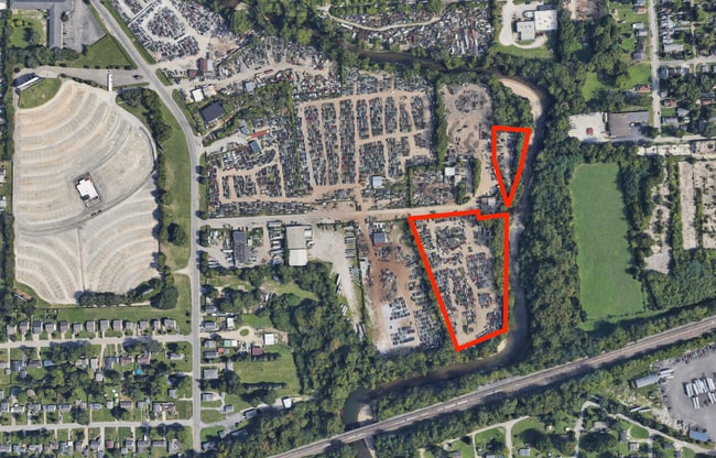
Property Record
3123 Victoria St, Indianapolis, IN 46241
NEARBY LISTINGS FOR SALE OR LEASE
Property Detail
3123 Victoria St
Indianapolis-Carmel-Anderson, IN
NW102.68', NW206.43', NW271.02' TO BEG 4.49AC.
49-11-09-117-018.000-901
Marion
Vehiclerentalsvehiclesales
Indiana
AE
2
18097C0139G
4.49 AC
2023
Airport
2024
Indianapolis
342200
DEMOGRAPHICS near 3123 Victoria St
1 Mile
3 Mile
5 Mile
2024 Total Population
9,540
80,517
232,204
2029 Population
9,766
82,316
235,357
Pop Growth 2024-2029
+ 2.37%
+ 2.23%
+ 1.36%
Average Age
35
35
36
2024 Total Households
3,424
31,863
96,994
HH Growth 2024-2029
+ 2.22%
+ 2.64%
+ 1.56%
Median Household Inc
$47,911
$47,586
$52,388
Avg Household Size
2.70
2.40
2.30
2024 Avg HH Vehicles
2.00
2.00
2.00
Median Home Value
$74,462
$92,307
$151,103
Median Year Built
1947
1958
1961
Nearby Places
Map Layers
Map Styles
 Street
 Aerial
- Restaurants
- Banks
- Shops
- Fitness
- Groceries
PUBLIC TRANSPORTATION
COMMUTER RAIL
Indianapolis (Cardinal - Amtrak)
DRIVE
WALK
Distance
Indianapolis (Cardinal - Amtrak)
9 min
4.2 mi
AIRPORT
Indianapolis International
DRIVE
WALK
Distance
Indianapolis International
21 min
10.6 mi
Freight Ports
Port of Toledo
DRIVE
WALK
Distance
Port of Toledo
278 min
229.2 mi
SALE & LEASE HISTORY
LISTING DATE
SALE/LEASE

Jul 30, 2024
For Sale
Nearby Properties
Address
Land Use
TOTAL SIZE
Lot Size
Zoning
Address
Land Use
TOTAL SIZE
Lot Size
Zoning
33.61 AC
ZO01
Address
Land Use
TOTAL SIZE
Lot Size
Zoning
1,381,492 SF
15.08 AC
ZO01
Address
Land Use
TOTAL SIZE
Lot Size
Zoning
546,391 SF
4.38 AC
ZO01
Address
Land Use
TOTAL SIZE
Lot Size
Zoning
19,536 SF
4.05 AC
ZO01
Address
Land Use
TOTAL SIZE
Lot Size
Zoning
83,966 SF
2.30 AC
ZO01
Address
Land Use
TOTAL SIZE
Lot Size
Zoning
2,273 SF
1.52 AC
ZO01
Address
Land Use
TOTAL SIZE
Lot Size
Zoning
12,392 SF
0.99 AC
ZO01
Address
Land Use
TOTAL SIZE
Lot Size
Zoning
44,485 SF
0.76 AC
ZO01
Address
Land Use
TOTAL SIZE
Lot Size
Zoning
170,000 SF
4.05 AC
ZO01
Address
Land Use
TOTAL SIZE
Lot Size
Zoning
20,422 SF
0.42 AC
ZO01
Address
Land Use
TOTAL SIZE
Lot Size
Zoning
12.63 AC
ZO01
Address
Land Use
TOTAL SIZE
Lot Size
Zoning
123,373 SF
2.14 AC
ZO01
Address
Land Use
TOTAL SIZE
Lot Size
Zoning
5,200 SF
2.43 AC
ZO01
Address
Land Use
TOTAL SIZE
Lot Size
Zoning
6,000 SF
0.47 AC
ZO01
Address
Land Use
TOTAL SIZE
Lot Size
Zoning
40,205 SF
1.58 AC
Address
Land Use
TOTAL SIZE
Lot Size
Zoning
11,775 SF
0.44 AC
ZO01
Address
Land Use
TOTAL SIZE
Lot Size
Zoning
2,674 SF
3.05 AC
ZO01
Address
Land Use
TOTAL SIZE
Lot Size
Zoning
11,230 SF
0.53 AC
ZO02
Address
Land Use
TOTAL SIZE
Lot Size
Zoning
45,971 SF
0.78 AC
Address
Land Use
TOTAL SIZE
Lot Size
Zoning
80,249 SF
71.96 AC
ZO01
Address
Land Use
TOTAL SIZE
Lot Size
Zoning
5,280 SF
97.87 AC
ZO01
Address
Land Use
TOTAL SIZE
Lot Size
Zoning
73,803 SF
0.93 AC
Address
Land Use
TOTAL SIZE
Lot Size
Zoning
17,250 SF
0.29 AC
ZO01
Address
Land Use
TOTAL SIZE
Lot Size
Zoning
111,238 SF
0.06 AC
ZO01
Address
Land Use
TOTAL SIZE
Lot Size
Zoning
176,017 SF
3.92 AC
ZO01
Address
Land Use
TOTAL SIZE
Lot Size
Zoning
1,260 SF
3.92 AC
ZO01
Address
Land Use
TOTAL SIZE
Lot Size
Zoning
67,783 SF
44.97 AC
ZO01
Address
Land Use
TOTAL SIZE
Lot Size
Zoning
31,920 SF
0.80 AC
Address
Land Use
TOTAL SIZE
Lot Size
Zoning
3,013 SF
10.80 AC
ZO01
Address
Land Use
TOTAL SIZE
Lot Size
Zoning
700 SF
1.50 AC
ZO01
The World's #1 Commercial Real Estate Marketplace
Connect with us
© 2025 CoStar Group
The information above has been obtained from sources believed reliable. While we do not doubt its accuracy we have not verified it and make no guarantee, warranty or representation about it. It is your responsibility to independently confirm its accuracy and completeness. Any projections, opinions, assumptions, or estimates used are for example only and do not represent the current or future performance of the property. The value of this transaction to you depends on tax and other factors which should be evaluated by your tax, financial, and legal advisors. You and your advisors should conduct a careful, independent investigation of the property to determine to your satisfaction the suitability of the property for your needs.