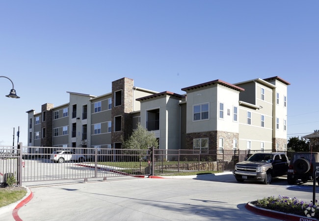
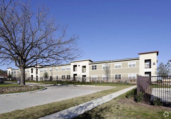
Property Record
3124 S Denley Dr, Dallas, TX 75216
NEARBY LISTINGS FOR SALE OR LEASE
Property Detail
3124 S Denley Dr
Dallas-Fort Worth-Arlington, TX
Serenity
003891000D01A0000
SERENITY BLK D/3891 PT LT 1A ACS 1.5675 TIF PORTION OF LT 1A INT201500008354 DD01092015 CO-DC 3891 00D 01A00 8DA3891 00D
Apartment
Dallas
X
Texas
48113C0485J
1a
2024
1.57 AC
2025
Cedar Crest
005700
Dallas/Ft Worth
47,210 SF
DEMOGRAPHICS near 3124 S Denley Dr
1 Mile
3 Mile
5 Mile
2024 Total Population
17,665
115,284
272,628
2029 Population
17,568
114,733
272,597
Pop Growth 2024-2029
(0.55%)
(0.48%)
(0.01%)
Average Age
36
36
37
2024 Total Households
5,253
37,082
93,872
HH Growth 2024-2029
(0.76%)
(0.69%)
+ 0.05%
Median Household Inc
$31,423
$36,486
$43,747
Avg Household Size
3.20
3.00
2.70
2024 Avg HH Vehicles
2.00
2.00
2.00
Median Home Value
$118,118
$151,810
$180,042
Median Year Built
1955
1959
1965
Nearby Places
Map Layers
Map Styles
 Street
 Aerial
- Restaurants
- Banks
- Shops
- Fitness
- Groceries
PUBLIC TRANSPORTATION
TRANSIT/SUBWAY
Kiest (Blue Line - Dallas Area Rapid Transit (DART), DART LIGHT RAIL - BLUE LINE - Dallas Area Rapid Transit (DART))
DRIVE
WALK
Distance
Kiest (Blue Line - Dallas Area Rapid Transit (DART), DART LIGHT RAIL - BLUE LINE - Dallas Area Rapid Transit (DART))
1 min
6 min
0.3 mi
Illinois (Blue Line - Dallas Area Rapid Transit (DART))
DRIVE
WALK
Distance
Illinois (Blue Line - Dallas Area Rapid Transit (DART))
3 min
20 min
1.0 mi
COMMUTER RAIL
Victory Station (DART LIGHT RAIL - GREEN LINE - Dallas Area Rapid Transit (DART), DART LIGHT RAIL - ORANGE LINE - Dallas Area Rapid Transit (DART), TRINITY RAILWAY - Dallas Area Rapid Transit (DART))
DRIVE
WALK
Distance
Victory Station (DART LIGHT RAIL - GREEN LINE - Dallas Area Rapid Transit (DART), DART LIGHT RAIL - ORANGE LINE - Dallas Area Rapid Transit (DART), TRINITY RAILWAY - Dallas Area Rapid Transit (DART))
11 min
6.5 mi
Medical/Market Ctr Station (TRINITY RAILWAY - Dallas Area Rapid Transit (DART))
DRIVE
WALK
Distance
Medical/Market Ctr Station (TRINITY RAILWAY - Dallas Area Rapid Transit (DART))
15 min
9.1 mi
AIRPORT
Dallas Love Field
DRIVE
WALK
Distance
Dallas Love Field
21 min
11.5 mi
Dallas-Fort Worth International
DRIVE
WALK
Distance
Dallas-Fort Worth International
35 min
25.7 mi
Freight Ports
Port of Shreveport
DRIVE
WALK
Distance
Port of Shreveport
216 min
198.4 mi
Nearby Properties
Address
Land Use
TOTAL SIZE
Lot Size
Zoning
Address
Land Use
TOTAL SIZE
Lot Size
Zoning
271,956 SF
23.18 AC
Z298
Address
Land Use
TOTAL SIZE
Lot Size
Zoning
179,370 SF
13.18 AC
Z248
Address
Land Use
TOTAL SIZE
Lot Size
Zoning
343,006 SF
0.53 AC
Z239
Address
Land Use
TOTAL SIZE
Lot Size
Zoning
223,496 SF
3.94 AC
Z164
Address
Land Use
TOTAL SIZE
Lot Size
Zoning
423,864 SF
3.56 AC
Z164
Address
Land Use
TOTAL SIZE
Lot Size
Zoning
260,602 SF
6.64 AC
Address
Land Use
TOTAL SIZE
Lot Size
Zoning
333,215 SF
3.04 AC
Address
Land Use
TOTAL SIZE
Lot Size
Zoning
337,587 SF
0.16 AC
Z297
Address
Land Use
TOTAL SIZE
Lot Size
Zoning
532,726 SF
64.28 AC
Z248
Address
Land Use
TOTAL SIZE
Lot Size
Zoning
353,319 SF
20.49 AC
Address
Land Use
TOTAL SIZE
Lot Size
Zoning
389,900 SF
22.88 AC
Z298
Address
Land Use
TOTAL SIZE
Lot Size
Zoning
532,564 SF
10.19 AC
Z297
Address
Land Use
TOTAL SIZE
Lot Size
Zoning
146,912 SF
2.74 AC
Z239
Address
Land Use
TOTAL SIZE
Lot Size
Zoning
361,851 SF
29.17 AC
Z164
Address
Land Use
TOTAL SIZE
Lot Size
Zoning
202,418 SF
21.43 AC
Z239
Address
Land Use
TOTAL SIZE
Lot Size
Zoning
178,050 SF
7.38 AC
Z164
Address
Land Use
TOTAL SIZE
Lot Size
Zoning
276,324 SF
19.10 AC
Z164
Address
Land Use
TOTAL SIZE
Lot Size
Zoning
172,619 SF
20.79 AC
Z164
Address
Land Use
TOTAL SIZE
Lot Size
Zoning
74,259 SF
7.81 AC
Z298
Address
Land Use
TOTAL SIZE
Lot Size
Zoning
121,312 SF
45.99 AC
Z239
Address
Land Use
TOTAL SIZE
Lot Size
Zoning
56,278 SF
4.18 AC
Z413
Address
Land Use
TOTAL SIZE
Lot Size
Zoning
181,865 SF
5.38 AC
Z149
Address
Land Use
TOTAL SIZE
Lot Size
Zoning
116,712 SF
7.55 AC
Z297
Address
Land Use
TOTAL SIZE
Lot Size
Zoning
261,965 SF
20.02 AC
Z248
Address
Land Use
TOTAL SIZE
Lot Size
Zoning
100 SF
86.88 AC
Z298
Address
Land Use
TOTAL SIZE
Lot Size
Zoning
263,200 SF
13.84 AC
Z59
Address
Land Use
TOTAL SIZE
Lot Size
Zoning
175,414 SF
16.05 AC
Z248
Address
Land Use
TOTAL SIZE
Lot Size
Zoning
91,000 SF
7.65 AC
Z239
Address
Land Use
TOTAL SIZE
Lot Size
Zoning
81,622 SF
4.61 AC
Z239
Address
Land Use
TOTAL SIZE
Lot Size
Zoning
101,353 SF
0.61 AC
Z239
The World's #1 Commercial Real Estate Marketplace
Connect with us
© 2025 CoStar Group
The information above has been obtained from sources believed reliable. While we do not doubt its accuracy we have not verified it and make no guarantee, warranty or representation about it. It is your responsibility to independently confirm its accuracy and completeness. Any projections, opinions, assumptions, or estimates used are for example only and do not represent the current or future performance of the property. The value of this transaction to you depends on tax and other factors which should be evaluated by your tax, financial, and legal advisors. You and your advisors should conduct a careful, independent investigation of the property to determine to your satisfaction the suitability of the property for your needs.