Property Record
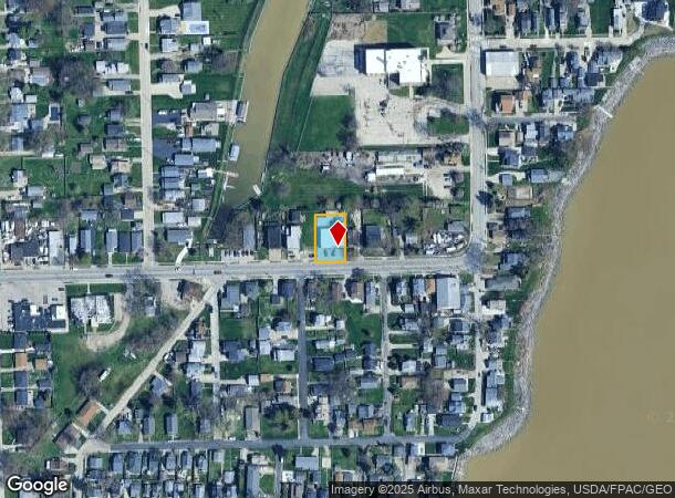
3125 131St St, Toledo, OH 43611


NEARBY LISTINGS FOR SALE OR LEASE
Property Detail
3125 131St St
Toledo, OH
Kemp & Millards Addn
09-03344
KEMP & MILLARDS ADDN LOT 9 & 10
Parkingstructure
Lucas
X
Ohio
39095C0101F
9,10
0
0.23 AC
2025
North Toledo
005501
Toledo
3,655 SF
DEMOGRAPHICS near 3125 131St St
1 mile
3 mile
5 mile
2024 Total Population
6,560
18,997
61,762
2029 Population
6,369
18,694
61,582
Pop Growth 2024-2029
(2.91%)
(1.59%)
(0.29%)
Average Age
44
41
40
2024 Total Households
2,933
7,783
25,308
HH Growth 2024-2029
(3.03%)
(1.73%)
(0.45%)
Median Household Inc
$58,863
$56,947
$42,149
Avg Household Size
2.20
2.30
2.30
2024 Avg HH Vehicles
2.00
2.00
2.00
Median Home Value
$107,006
$113,611
$90,437
Median Year Built
1952
1959
1955
Nearby Places
Map Layers
Map Styles
 Street
 Aerial
Transit
 Traffic
 Biking
Places
Listings with unknown addresses are not visible on the map
- Restaurants
- Banks
- Shops
- Fitness
- Groceries
PUBLIC TRANSPORTATION
COMMUTER RAIL
Drive
Walk
Distance
16 min
7.6 mi
AIRPORT
Eugene F Kranz Toledo Express
Drive
Walk
Distance
Eugene F Kranz Toledo Express
46 min
25.9 mi
Detroit Metro Wayne County
Drive
Walk
Distance
Detroit Metro Wayne County
52 min
40.2 mi
Freight Ports
Drive
Walk
Distance
21 min
8.9 mi
Nearby Properties
Address
Land Use
TOTAL SIZE
Lot Size
Zoning
Address
Land Use
TOTAL SIZE
Lot Size
Zoning
286,525 SF
105.33 AC
10-RS6
Address
Land Use
TOTAL SIZE
Lot Size
Zoning
33.48 AC
10-IG
Address
Land Use
TOTAL SIZE
Lot Size
Zoning
28.51 AC
10-IG
Address
Land Use
TOTAL SIZE
Lot Size
Zoning
230,400 SF
18 AC
10-CR
Address
Land Use
TOTAL SIZE
Lot Size
Zoning
90,113 SF
8.12 AC
21-PO
Address
Land Use
TOTAL SIZE
Lot Size
Zoning
175,978 SF
10.02 AC
10-IL
Address
Land Use
TOTAL SIZE
Lot Size
Zoning
106.75 AC
AC = AG
Address
Land Use
TOTAL SIZE
Lot Size
Zoning
92,888 SF
20.24 AC
10-IL
Address
Land Use
TOTAL SIZE
Lot Size
Zoning
159,798 SF
8.32 AC
10-IL
Address
Land Use
TOTAL SIZE
Lot Size
Zoning
191,297 SF
28.74 AC
10-CRSO
Address
Land Use
TOTAL SIZE
Lot Size
Zoning
53,306 SF
2 AC
10-CO
Address
Land Use
TOTAL SIZE
Lot Size
Zoning
70,404 SF
8.07 AC
10-RS6
Address
Land Use
TOTAL SIZE
Lot Size
Zoning
454,080 SF
54.59 AC
10-IG
Address
Land Use
TOTAL SIZE
Lot Size
Zoning
22.56 AC
10-IG
Address
Land Use
TOTAL SIZE
Lot Size
Zoning
398,978 SF
79.82 AC
40-M2
Address
Land Use
TOTAL SIZE
Lot Size
Zoning
42,780 SF
1 AC
10-CO
Address
Land Use
TOTAL SIZE
Lot Size
Zoning
202,584 SF
15.12 AC
10-IG
Address
Land Use
TOTAL SIZE
Lot Size
Zoning
79,128 SF
9.01 AC
10-CRSO
Address
Land Use
TOTAL SIZE
Lot Size
Zoning
322,018 SF
20.24 AC
10-IG
Address
Land Use
TOTAL SIZE
Lot Size
Zoning
220,400 SF
13.32 AC
10-IG
Address
Land Use
TOTAL SIZE
Lot Size
Zoning
181,828 SF
17.74 AC
10-IG
Address
Land Use
TOTAL SIZE
Lot Size
Zoning
6,696 SF
81.72 AC
MARINA
Address
Land Use
TOTAL SIZE
Lot Size
Zoning
163,319 SF
66.75 AC
10-IG
Address
Land Use
TOTAL SIZE
Lot Size
Zoning
61,940 SF
8 AC
10-IL
Address
Land Use
TOTAL SIZE
Lot Size
Zoning
48,403 SF
3.80 AC
10-RD6
Address
Land Use
TOTAL SIZE
Lot Size
Zoning
41,492 SF
6.13 AC
10-IL
Address
Land Use
TOTAL SIZE
Lot Size
Zoning
49,839 SF
2 AC
10-CO
Address
Land Use
TOTAL SIZE
Lot Size
Zoning
225,222 SF
20.57 AC
10-IG
Address
Land Use
TOTAL SIZE
Lot Size
Zoning
205,638 SF
17.22 AC
10-IG
Address
Land Use
TOTAL SIZE
Lot Size
Zoning
35.77 AC
10-IG
The World's #1 Commercial Real Estate Marketplace
Connect with us
© 2026 CoStar Group
The information above has been obtained from sources believed reliable. While we do not doubt its accuracy we have not verified it and make no guarantee, warranty or representation about it. It is your responsibility to independently confirm its accuracy and completeness. Any projections, opinions, assumptions, or estimates used are for example only and do not represent the current or future performance of the property. The value of this transaction to you depends on tax and other factors which should be evaluated by your tax, financial, and legal advisors. You and your advisors should conduct a careful, independent investigation of the property to determine to your satisfaction the suitability of the property for your needs.