Property Record
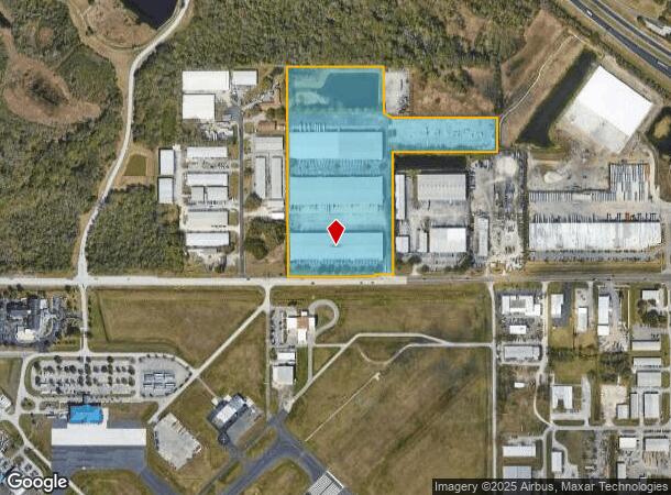
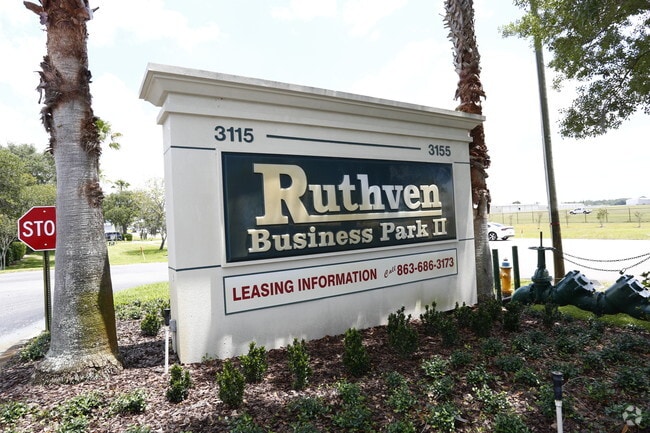
3115 Drane Field Rd, Lakeland, FL 33811

Current Lease Availabilities
NEARBY LISTINGS FOR SALE OR LEASE
Property Detail
3115 Drane Field Rd
23-28-33-000000-022010
Alameda Heights
Warehouse
SE1/4 OF SE1/4 LESS DRANE FIELD RD R/W ON SOUTH SIDE & LESS S 800 FT OF E1/2 OF SE1/4 OF SE1/4 & LESS COMM SE COR OF SEC RUN N01-25-16W 1015 FT TO POB S88-53-09W 661.55 FT N62-22-31W 59.78 FT N01-25-16W 292.05 FT N88-51-30E 713.80 FT S01-25-16E 321.1
A
Polk
12105C0460G
Florida
2024
22.83 AC
2025
Polk County
012003
Tampa/St Petersburg
278,400 SF
Lakeland-Winter Haven, FL
DEMOGRAPHICS near 3115 Drane Field Rd
1 Mile
3 Mile
5 Mile
2024 Total Population
628
31,451
115,361
2029 Population
764
37,650
136,580
Pop Growth 2024-2029
+ 21.66%
+ 19.71%
+ 18.39%
Average Age
36
43
40
2024 Total Households
206
13,312
44,910
HH Growth 2024-2029
+ 21.36%
+ 19.67%
+ 18.82%
Median Household Inc
$67,279
$61,338
$62,319
Avg Household Size
2.80
2.30
2.40
2024 Avg HH Vehicles
2.00
2.00
2.00
Median Home Value
$261,764
$207,365
$226,254
Median Year Built
1987
1986
1982
Nearby Places
Map Layers
Map Styles
 Street
 Aerial
- Restaurants
- Banks
- Shops
- Fitness
- Groceries
PUBLIC TRANSPORTATION
COMMUTER RAIL
DRIVE
WALK
Distance
12 min
6.4 mi
AIRPORT
Tampa International
DRIVE
WALK
Distance
Tampa International
52 min
38.7 mi
Freight Ports
Port of Tampa Bay
DRIVE
WALK
Distance
Port of Tampa Bay
45 min
33.0 mi
Nearby Properties
Address
Land Use
TOTAL SIZE
Lot Size
Zoning
Address
Land Use
TOTAL SIZE
Lot Size
Zoning
2,095,234 SF
102.45 AC
PUD
Address
Land Use
TOTAL SIZE
Lot Size
Zoning
1,210,880 SF
405.82 AC
PUD
Address
Land Use
TOTAL SIZE
Lot Size
Zoning
518,028 SF
195.69 AC
Address
Land Use
TOTAL SIZE
Lot Size
Zoning
705,615 SF
33.05 AC
Address
Land Use
TOTAL SIZE
Lot Size
Zoning
711,568 SF
42.87 AC
PD
Address
Land Use
TOTAL SIZE
Lot Size
Zoning
595,473 SF
47.29 AC
Address
Land Use
TOTAL SIZE
Lot Size
Zoning
711,568 SF
43.33 AC
PD
Address
Land Use
TOTAL SIZE
Lot Size
Zoning
315,901 SF
20.55 AC
Address
Land Use
TOTAL SIZE
Lot Size
Zoning
655,123 SF
45.28 AC
Address
Land Use
TOTAL SIZE
Lot Size
Zoning
1,004,426 SF
93.42 AC
C4
Address
Land Use
TOTAL SIZE
Lot Size
Zoning
492,960 SF
22.09 AC
Address
Land Use
TOTAL SIZE
Lot Size
Zoning
602,125 SF
43.97 AC
Address
Land Use
TOTAL SIZE
Lot Size
Zoning
364,518 SF
23.38 AC
Address
Land Use
TOTAL SIZE
Lot Size
Zoning
417,890 SF
14.59 AC
Address
Land Use
TOTAL SIZE
Lot Size
Zoning
387,165 SF
37 AC
I2
Address
Land Use
TOTAL SIZE
Lot Size
Zoning
492,859 SF
135.58 AC
Address
Land Use
TOTAL SIZE
Lot Size
Zoning
296,264 SF
26.74 AC
Address
Land Use
TOTAL SIZE
Lot Size
Zoning
363,147 SF
76.15 AC
Address
Land Use
TOTAL SIZE
Lot Size
Zoning
277,272 SF
19.35 AC
RA4
Address
Land Use
TOTAL SIZE
Lot Size
Zoning
172,176 SF
8.93 AC
RE2
Address
Land Use
TOTAL SIZE
Lot Size
Zoning
300,411 SF
18.77 AC
I
Address
Land Use
TOTAL SIZE
Lot Size
Zoning
441,480 SF
24.28 AC
Address
Land Use
TOTAL SIZE
Lot Size
Zoning
432,087 SF
626.03 AC
PUD
Address
Land Use
TOTAL SIZE
Lot Size
Zoning
333,560 SF
44.88 AC
IND
Address
Land Use
TOTAL SIZE
Lot Size
Zoning
221,500 SF
19.54 AC
XX
Address
Land Use
TOTAL SIZE
Lot Size
Zoning
215,557 SF
13.27 AC
I
Address
Land Use
TOTAL SIZE
Lot Size
Zoning
200,200 SF
17.40 AC
XX
Address
Land Use
TOTAL SIZE
Lot Size
Zoning
187,247 SF
10.19 AC
PD
Address
Land Use
TOTAL SIZE
Lot Size
Zoning
77,358 SF
8.34 AC
PUD
Address
Land Use
TOTAL SIZE
Lot Size
Zoning
76,250 SF
5.25 AC
The World's #1 Commercial Real Estate Marketplace
Connect with us
© 2025 CoStar Group
The information above has been obtained from sources believed reliable. While we do not doubt its accuracy we have not verified it and make no guarantee, warranty or representation about it. It is your responsibility to independently confirm its accuracy and completeness. Any projections, opinions, assumptions, or estimates used are for example only and do not represent the current or future performance of the property. The value of this transaction to you depends on tax and other factors which should be evaluated by your tax, financial, and legal advisors. You and your advisors should conduct a careful, independent investigation of the property to determine to your satisfaction the suitability of the property for your needs.