Property Record
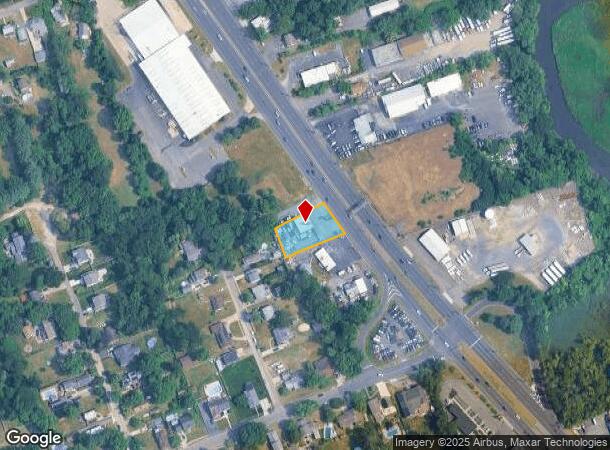
3125 Route 73 S, Maple Shade, NJ 08052

NEARBY LISTINGS FOR SALE OR LEASE
Property Detail
3125 Route 73 S
19-00006-0000-00004
Burlington
Storemultistory
New Jersey
X
4
34005C0207F
0.38 AC
2024
North Burlington County
2025
Philadelphia
700401
Philadelphia-Camden-Wilmington, PA-NJ-DE-MD
2,000 SF
DEMOGRAPHICS near 3125 Route 73 S
1 Mile
3 Mile
5 Mile
2024 Total Population
7,022
88,238
297,028
2029 Population
7,233
89,357
294,851
Pop Growth 2024-2029
+ 3.00%
+ 1.27%
(0.73%)
Average Age
43
41
39
2024 Total Households
2,839
34,195
110,632
HH Growth 2024-2029
+ 3.84%
+ 1.32%
(0.69%)
Median Household Inc
$96,477
$94,278
$75,567
Avg Household Size
2.40
2.50
2.60
2024 Avg HH Vehicles
2.00
2.00
2.00
Median Home Value
$248,268
$260,550
$237,740
Median Year Built
1968
1963
1957
Nearby Places
Map Layers
Map Styles
 Street
 Aerial
- Restaurants
- Banks
- Shops
- Fitness
- Groceries
PUBLIC TRANSPORTATION
COMMUTER RAIL
DRIVE
WALK
Distance
8 min
3.6 mi
Tacony (R7 - Southeastern Pennsylvania Transportation Authority Regional Rail (SEPTA Regional Rail))
DRIVE
WALK
Distance
Tacony (R7 - Southeastern Pennsylvania Transportation Authority Regional Rail (SEPTA Regional Rail))
10 min
4.8 mi
AIRPORT
Philadelphia International
DRIVE
WALK
Distance
Philadelphia International
34 min
18.8 mi
Trenton Mercer
DRIVE
WALK
Distance
Trenton Mercer
46 min
29.6 mi
Freight Ports
Port of Philadelphia
DRIVE
WALK
Distance
Port of Philadelphia
13 min
6.4 mi
Nearby Properties
Address
Land Use
TOTAL SIZE
Lot Size
Zoning
Address
Land Use
TOTAL SIZE
Lot Size
Zoning
66.02 AC
Address
Land Use
TOTAL SIZE
Lot Size
Zoning
Address
Land Use
TOTAL SIZE
Lot Size
Zoning
90.41 AC
Address
Land Use
TOTAL SIZE
Lot Size
Zoning
72.46 AC
Address
Land Use
TOTAL SIZE
Lot Size
Zoning
54.54 AC
Address
Land Use
TOTAL SIZE
Lot Size
Zoning
1 SF
42.23 AC
Address
Land Use
TOTAL SIZE
Lot Size
Zoning
50.73 AC
C73A
Address
Land Use
TOTAL SIZE
Lot Size
Zoning
37.60 AC
Address
Land Use
TOTAL SIZE
Lot Size
Zoning
Address
Land Use
TOTAL SIZE
Lot Size
Zoning
12.80 AC
R20
Address
Land Use
TOTAL SIZE
Lot Size
Zoning
5.35 AC
Address
Land Use
TOTAL SIZE
Lot Size
Zoning
28.96 AC
Address
Land Use
TOTAL SIZE
Lot Size
Zoning
Address
Land Use
TOTAL SIZE
Lot Size
Zoning
82.32 AC
Address
Land Use
TOTAL SIZE
Lot Size
Zoning
3.59 AC
Address
Land Use
TOTAL SIZE
Lot Size
Zoning
22.45 AC
MD
Address
Land Use
TOTAL SIZE
Lot Size
Zoning
37.39 AC
Address
Land Use
TOTAL SIZE
Lot Size
Zoning
39.53 AC
Address
Land Use
TOTAL SIZE
Lot Size
Zoning
26.17 AC
Address
Land Use
TOTAL SIZE
Lot Size
Zoning
27.77 AC
Address
Land Use
TOTAL SIZE
Lot Size
Zoning
150.59 AC
Address
Land Use
TOTAL SIZE
Lot Size
Zoning
25.37 AC
Address
Land Use
TOTAL SIZE
Lot Size
Zoning
26.25 AC
Address
Land Use
TOTAL SIZE
Lot Size
Zoning
12.19 AC
Address
Land Use
TOTAL SIZE
Lot Size
Zoning
37.21 AC
Address
Land Use
TOTAL SIZE
Lot Size
Zoning
39.58 AC
Address
Land Use
TOTAL SIZE
Lot Size
Zoning
22.91 AC
Address
Land Use
TOTAL SIZE
Lot Size
Zoning
Address
Land Use
TOTAL SIZE
Lot Size
Zoning
7.38 AC
Address
Land Use
TOTAL SIZE
Lot Size
Zoning
The World's #1 Commercial Real Estate Marketplace
Connect with us
© 2025 CoStar Group
The information above has been obtained from sources believed reliable. While we do not doubt its accuracy we have not verified it and make no guarantee, warranty or representation about it. It is your responsibility to independently confirm its accuracy and completeness. Any projections, opinions, assumptions, or estimates used are for example only and do not represent the current or future performance of the property. The value of this transaction to you depends on tax and other factors which should be evaluated by your tax, financial, and legal advisors. You and your advisors should conduct a careful, independent investigation of the property to determine to your satisfaction the suitability of the property for your needs.