Property Record
31280 The Old Rd, Castaic, CA 91384
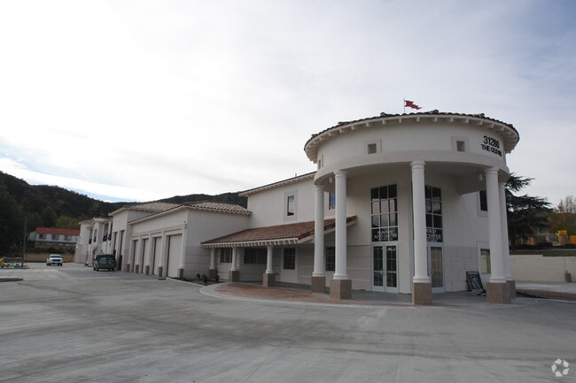
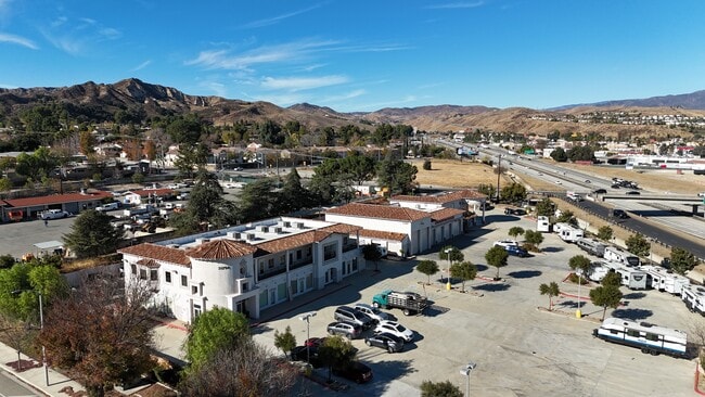

Property Detail
31280 The Old Rd
2865-012-008
FOR DESC SEE ASSESSORS MAPS
Storesoffices
Los Angeles
LCA12OOOO*
California
C and X Area of minimal flood hazard, usually depicted on FIRMs as above the 500-year flood level.
2.53 AC
2024
Santa Clarita Valley
2025
Los Angeles
920116
Los Angeles-Long Beach-Glendale, CA
22,227 SF
NEARBY LISTINGS FOR SALE OR LEASE
DEMOGRAPHICS near 31280 The Old Rd
1 mile
3 mile
5 mile
2025 Total Population
11,292
23,890
51,432
2030 Population
11,117
23,625
51,014
Pop Growth 2025-2030
(1.55%)
(1.11%)
(0.81%)
Average Age
40
40
39
2025 Total Households
1,961
5,766
14,700
HH Growth 2025-2030
(3.42%)
(1.91%)
(1.07%)
Median Household Inc
$102,898
$138,432
$147,634
Avg Household Size
2.90
3.20
3.10
2025 Avg HH Vehicles
2.00
3.00
2.00
Median Home Value
$720,531
$761,889
$779,508
Median Year Built
1985
1991
2000
Nearby Places
Map Layers
Map Styles
 Street
 Aerial
Layers
 Traffic
 Biking
Places
Listings with unknown addresses are not visible on the map
- Restaurants
- Banks
- Shops
- Fitness
- Groceries
PUBLIC TRANSPORTATION
COMMUTER RAIL
Santa Clarita (Antelope Valley Line - Southern California Regional Rail Authority (Metrolink))
Drive
Walk
Distance
Santa Clarita (Antelope Valley Line - Southern California Regional Rail Authority (Metrolink))
15 min
9.5 mi
AIRPORT
Bob Hope
Drive
Walk
Distance
Bob Hope
34 min
26.7 mi
Freight Ports
The Port of Hueneme
Drive
Walk
Distance
The Port of Hueneme
71 min
51.0 mi
SALE & LEASE HISTORY
LISTING DATE
SALE/LEASE

Sep 25, 2016
For Lease
Sep 14, 2017
For Lease
Nov 18, 2024
For Lease
Nearby Properties
Address
Land Use
TOTAL SIZE
Lot Size
Zoning
Address
Land Use
TOTAL SIZE
Lot Size
Zoning
180,629 SF
40.68 AC
SCBP
Address
Land Use
TOTAL SIZE
Lot Size
Zoning
174,750 SF
9 AC
LCM1.5
Address
Land Use
TOTAL SIZE
Lot Size
Zoning
164,964 SF
7.70 AC
LCM1.5
Address
Land Use
TOTAL SIZE
Lot Size
Zoning
229,179 SF
6.04 AC
LCA22-A25*
Address
Land Use
TOTAL SIZE
Lot Size
Zoning
187,404 SF
10.08 AC
MPD
Address
Land Use
TOTAL SIZE
Lot Size
Zoning
133,787 SF
6.17 AC
LCA22-A25*
Address
Land Use
TOTAL SIZE
Lot Size
Zoning
116,225 SF
6.83 AC
LCA22-A25*
Address
Land Use
TOTAL SIZE
Lot Size
Zoning
125,154 SF
6.42 AC
LAC2
Address
Land Use
TOTAL SIZE
Lot Size
Zoning
207,378 SF
11.05 AC
LCA22-A25*
Address
Land Use
TOTAL SIZE
Lot Size
Zoning
111,324 SF
5.28 AC
LCA22-A25*
Address
Land Use
TOTAL SIZE
Lot Size
Zoning
180,000 SF
3.63 AC
LCA22-A25*
Address
Land Use
TOTAL SIZE
Lot Size
Zoning
174,709 SF
10.59 AC
LCA2
Address
Land Use
TOTAL SIZE
Lot Size
Zoning
42,104 SF
2.56 AC
LCA2
Address
Land Use
TOTAL SIZE
Lot Size
Zoning
44,609 SF
2.44 AC
LCA2
Address
Land Use
TOTAL SIZE
Lot Size
Zoning
75,757 SF
3.81 AC
LCA25*
Address
Land Use
TOTAL SIZE
Lot Size
Zoning
70,764 SF
5.55 AC
LCA22-A25*
Address
Land Use
TOTAL SIZE
Lot Size
Zoning
75,247 SF
3.76 AC
LCA25*
Address
Land Use
TOTAL SIZE
Lot Size
Zoning
88,095 SF
5.68 AC
LCA22-A25*
Address
Land Use
TOTAL SIZE
Lot Size
Zoning
37,478 SF
1.74 AC
LCA25*
Address
Land Use
TOTAL SIZE
Lot Size
Zoning
3,588 SF
1.93 AC
LCC3*
Address
Land Use
TOTAL SIZE
Lot Size
Zoning
46,275 SF
2.15 AC
LCA2
Address
Land Use
TOTAL SIZE
Lot Size
Zoning
31,753 SF
2.05 AC
LCM1.5
Address
Land Use
TOTAL SIZE
Lot Size
Zoning
83,811 SF
4.80 AC
LCA22-A25*
Address
Land Use
TOTAL SIZE
Lot Size
Zoning
71,790 SF
3.69 AC
LCA22*
Address
Land Use
TOTAL SIZE
Lot Size
Zoning
93,100 SF
4.73 AC
LCA22-A25*
Address
Land Use
TOTAL SIZE
Lot Size
Zoning
37,110 SF
2.37 AC
LCM1*
Address
Land Use
TOTAL SIZE
Lot Size
Zoning
93,498 SF
5.46 AC
LCA22*
Address
Land Use
TOTAL SIZE
Lot Size
Zoning
74,372 SF
3.28 AC
The World's #1 Commercial Real Estate Marketplace
Connect with us
© 2026 CoStar Group
The information above has been obtained from sources believed reliable. While we do not doubt its accuracy we have not verified it and make no guarantee, warranty or representation about it. It is your responsibility to independently confirm its accuracy and completeness. Any projections, opinions, assumptions, or estimates used are for example only and do not represent the current or future performance of the property. The value of this transaction to you depends on tax and other factors which should be evaluated by your tax, financial, and legal advisors. You and your advisors should conduct a careful, independent investigation of the property to determine to your satisfaction the suitability of the property for your needs.