Property Record
313 Main St, Boylston, MA 01505

Save to a Folder
{{folder.Name}}
{{folder.ListingIds.length}} Properties
{{folder.ListingIds.length}} Property
Create a New Folder
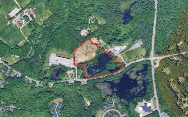
Property Detail
313 Main St
Worcester, MA
WORCESTER
BOYL-000011-000002-000001
Massachusetts
Industrialacreage
1
B and X Area of moderate flood hazard, usually the area between the limits of the 100-year and 500-year floods.
15.58 AC
2025
Worcester Metro
2025
Boston
718100
NEARBY LISTINGS FOR SALE OR LEASE
DEMOGRAPHICS near 313 Main St
1 mile
3 mile
5 mile
2025 Total Population
2,209
38,085
119,797
2030 Population
2,303
38,944
122,128
Pop Growth 2025-2030
+ 4.26%
+ 2.26%
+ 1.95%
Average Age
44
41
41
2025 Total Households
862
14,765
46,574
HH Growth 2025-2030
+ 4.41%
+ 2.30%
+ 1.98%
Median Household Inc
$120,059
$98,401
$100,942
Avg Household Size
2.60
2.50
2.40
2025 Avg HH Vehicles
2.00
2.00
2.00
Median Home Value
$644,953
$449,504
$475,798
Median Year Built
1980
1960
1963
Nearby Places
Map Layers
Map Styles
 Street
 Aerial
Layers
 Traffic
 Biking
Places
Listings with unknown addresses are not visible on the map
- Restaurants
- Banks
- Shops
- Fitness
- Groceries
PUBLIC TRANSPORTATION
COMMUTER RAIL
Worcester (Framingham/Worcester Line - Massachusetts Bay Transportation Authority Commuter Rail (Purple Line))
Drive
Walk
Distance
Worcester (Framingham/Worcester Line - Massachusetts Bay Transportation Authority Commuter Rail (Purple Line))
11 min
6.0 mi
Worcester Union Station (Lake Shore Limited - Amtrak)
Drive
Walk
Distance
Worcester Union Station (Lake Shore Limited - Amtrak)
10 min
6.1 mi
AIRPORT
Worcester Regional
Drive
Walk
Distance
Worcester Regional
21 min
10.6 mi
Freight Ports
Port of Boston
Drive
Walk
Distance
Port of Boston
63 min
47.5 mi
SALE & LEASE HISTORY
LISTING DATE
SALE/LEASE

May 01, 2025
For Lease
Jun 02, 2022
For Sale
Nearby Properties
Address
Land Use
TOTAL SIZE
Lot Size
Zoning
Address
Land Use
TOTAL SIZE
Lot Size
Zoning
155,421 SF
65.04 AC
RL-7
Address
Land Use
TOTAL SIZE
Lot Size
Zoning
362,937 SF
91.58 AC
Address
Land Use
TOTAL SIZE
Lot Size
Zoning
295,000 SF
194.17 AC
RUR B
Address
Land Use
TOTAL SIZE
Lot Size
Zoning
50.11 AC
RS-7
Address
Land Use
TOTAL SIZE
Lot Size
Zoning
30.93 AC
RG-5
Address
Land Use
TOTAL SIZE
Lot Size
Zoning
15.37 AC
RS-7
Address
Land Use
TOTAL SIZE
Lot Size
Zoning
13.95 AC
RG-5
Address
Land Use
TOTAL SIZE
Lot Size
Zoning
217,500 SF
51.71 AC
LIM CO
Address
Land Use
TOTAL SIZE
Lot Size
Zoning
1,839.82 AC
Address
Land Use
TOTAL SIZE
Lot Size
Zoning
373,550 SF
29.05 AC
Address
Land Use
TOTAL SIZE
Lot Size
Zoning
6.70 AC
RG-5
Address
Land Use
TOTAL SIZE
Lot Size
Zoning
96,541 SF
5.24 AC
MG-5
Address
Land Use
TOTAL SIZE
Lot Size
Zoning
24,243 SF
168.59 AC
Address
Land Use
TOTAL SIZE
Lot Size
Zoning
423,883 SF
59.55 AC
Address
Land Use
TOTAL SIZE
Lot Size
Zoning
40,733 SF
4.93 AC
LIM CO
Address
Land Use
TOTAL SIZE
Lot Size
Zoning
299,228 SF
32.39 AC
Address
Land Use
TOTAL SIZE
Lot Size
Zoning
5.67 AC
RG-5
Address
Land Use
TOTAL SIZE
Lot Size
Zoning
6.09 AC
RG-5
Address
Land Use
TOTAL SIZE
Lot Size
Zoning
83,148 SF
2.63 AC
ML-.5
Address
Land Use
TOTAL SIZE
Lot Size
Zoning
84.73 AC
RES A
Address
Land Use
TOTAL SIZE
Lot Size
Zoning
2,144 SF
8.14 AC
RG-5
Address
Land Use
TOTAL SIZE
Lot Size
Zoning
20.50 AC
LIM IN
Address
Land Use
TOTAL SIZE
Lot Size
Zoning
206,734 SF
13.49 AC
RS-7
Address
Land Use
TOTAL SIZE
Lot Size
Zoning
32,844 SF
13.30 AC
Address
Land Use
TOTAL SIZE
Lot Size
Zoning
99,584 SF
5.72 AC
RS-7
Address
Land Use
TOTAL SIZE
Lot Size
Zoning
69,375 SF
3.07 AC
RG-5
Address
Land Use
TOTAL SIZE
Lot Size
Zoning
3.39 AC
RG-5
Address
Land Use
TOTAL SIZE
Lot Size
Zoning
72,596 SF
18.14 AC
Address
Land Use
TOTAL SIZE
Lot Size
Zoning
12.99 AC
ML-5
Address
Land Use
TOTAL SIZE
Lot Size
Zoning
59,839 SF
17.30 AC
The World's #1 Commercial Real Estate Marketplace
Connect with us
© 2026 CoStar Group
The information above has been obtained from sources believed reliable. While we do not doubt its accuracy we have not verified it and make no guarantee, warranty or representation about it. It is your responsibility to independently confirm its accuracy and completeness. Any projections, opinions, assumptions, or estimates used are for example only and do not represent the current or future performance of the property. The value of this transaction to you depends on tax and other factors which should be evaluated by your tax, financial, and legal advisors. You and your advisors should conduct a careful, independent investigation of the property to determine to your satisfaction the suitability of the property for your needs.