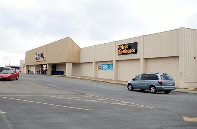
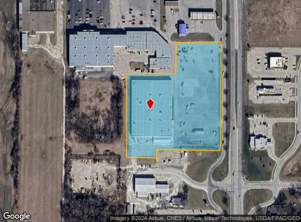
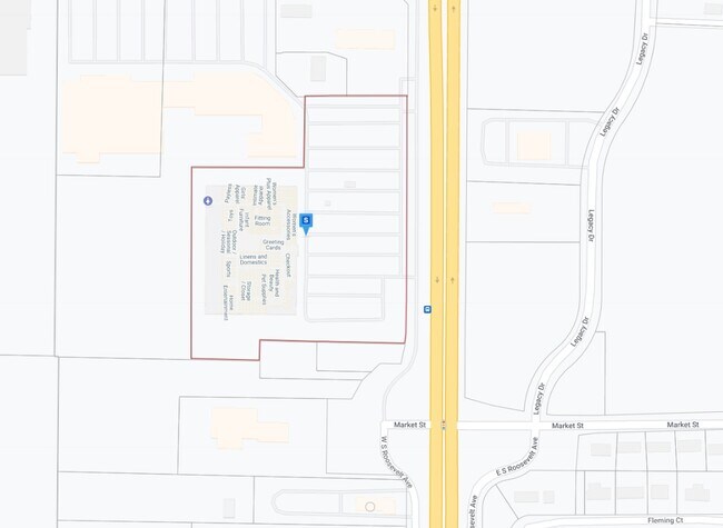
Property Record
313 N Roosevelt Ave, Burlington, IA 52601
Current Lease Availabilities
NEARBY LISTINGS FOR SALE OR LEASE
Property Detail
313 N Roosevelt Ave
Burlington, IA-IL
Regency Sub
10-36-476-020
REGENCY SUB LOT3 EXC E50'BURLINGTON PIERSON ESTATE SUB LOT 1 PT
Storebuilding
Des Moines
X
Iowa
19057C0267F
3
2024
7.23 AC
2025
Iowa Southeast Area
000300
Other Market Areas
84,736 SF
DEMOGRAPHICS near 313 N Roosevelt Ave
1 Mile
3 Mile
5 Mile
2024 Total Population
4,018
26,206
30,087
2029 Population
3,883
25,564
29,464
Pop Growth 2024-2029
(3.36%)
(2.45%)
(2.07%)
Average Age
42
42
43
2024 Total Households
1,904
11,569
13,268
HH Growth 2024-2029
(3.57%)
(2.52%)
(2.14%)
Median Household Inc
$36,500
$49,325
$51,627
Avg Household Size
2.10
2.20
2.20
2024 Avg HH Vehicles
1.00
2.00
2.00
Median Home Value
$126,066
$107,985
$119,717
Median Year Built
1963
1950
1953
Nearby Places
Map Layers
Map Styles
 Street
 Aerial
- Restaurants
- Banks
- Shops
- Fitness
- Groceries
PUBLIC TRANSPORTATION
COMMUTER RAIL
Burlington Amtrak Station (California Zephyr - Amtrak)
DRIVE
WALK
Distance
Burlington Amtrak Station (California Zephyr - Amtrak)
6 min
2.5 mi
Freight Ports
Port Milwaukee
DRIVE
WALK
Distance
Port Milwaukee
323 min
284.6 mi
Nearby Properties
Address
Land Use
TOTAL SIZE
Lot Size
Zoning
Address
Land Use
TOTAL SIZE
Lot Size
Zoning
166,761 SF
39.52 AC
I1
Address
Land Use
TOTAL SIZE
Lot Size
Zoning
76,750 SF
37.58 AC
I1
Address
Land Use
TOTAL SIZE
Lot Size
Zoning
162,378 SF
9.47 AC
Address
Land Use
TOTAL SIZE
Lot Size
Zoning
411,660 SF
35.16 AC
Address
Land Use
TOTAL SIZE
Lot Size
Zoning
12,768 SF
489.69 AC
R1
Address
Land Use
TOTAL SIZE
Lot Size
Zoning
198,771 SF
13.31 AC
B2
Address
Land Use
TOTAL SIZE
Lot Size
Zoning
114,426 SF
20.77 AC
A1
Address
Land Use
TOTAL SIZE
Lot Size
Zoning
25,884 SF
13.02 AC
Address
Land Use
TOTAL SIZE
Lot Size
Zoning
82,296 SF
31.76 AC
Address
Land Use
TOTAL SIZE
Lot Size
Zoning
205,237 SF
23.10 AC
B2
Address
Land Use
TOTAL SIZE
Lot Size
Zoning
22,460 SF
21.33 AC
R2
Address
Land Use
TOTAL SIZE
Lot Size
Zoning
140,614 SF
31.84 AC
M2
Address
Land Use
TOTAL SIZE
Lot Size
Zoning
25,818 SF
2.66 AC
C3
Address
Land Use
TOTAL SIZE
Lot Size
Zoning
77,637 SF
13.99 AC
Address
Land Use
TOTAL SIZE
Lot Size
Zoning
113,727 SF
9.64 AC
Address
Land Use
TOTAL SIZE
Lot Size
Zoning
873,791 SF
139.78 AC
M2
Address
Land Use
TOTAL SIZE
Lot Size
Zoning
407 SF
10.24 AC
Address
Land Use
TOTAL SIZE
Lot Size
Zoning
28,120 SF
2.90 AC
Address
Land Use
TOTAL SIZE
Lot Size
Zoning
391,962 SF
17.04 AC
M2
Address
Land Use
TOTAL SIZE
Lot Size
Zoning
95,304 SF
10.29 AC
Address
Land Use
TOTAL SIZE
Lot Size
Zoning
169,419 SF
28.67 AC
B2
Address
Land Use
TOTAL SIZE
Lot Size
Zoning
39,668 SF
3.41 AC
Address
Land Use
TOTAL SIZE
Lot Size
Zoning
52,730 SF
6.53 AC
R1
Address
Land Use
TOTAL SIZE
Lot Size
Zoning
88,783 SF
11.03 AC
B2
Address
Land Use
TOTAL SIZE
Lot Size
Zoning
61,245 SF
2.72 AC
Address
Land Use
TOTAL SIZE
Lot Size
Zoning
42,306 SF
0.33 AC
Address
Land Use
TOTAL SIZE
Lot Size
Zoning
25,584 SF
1.21 AC
Address
Land Use
TOTAL SIZE
Lot Size
Zoning
134,068 SF
40.60 AC
R2
Address
Land Use
TOTAL SIZE
Lot Size
Zoning
58,769 SF
7.56 AC
C2
Address
Land Use
TOTAL SIZE
Lot Size
Zoning
45,054 SF
14.15 AC
M2
The World's #1 Commercial Real Estate Marketplace
Connect with us
© 2026 CoStar Group
The information above has been obtained from sources believed reliable. While we do not doubt its accuracy we have not verified it and make no guarantee, warranty or representation about it. It is your responsibility to independently confirm its accuracy and completeness. Any projections, opinions, assumptions, or estimates used are for example only and do not represent the current or future performance of the property. The value of this transaction to you depends on tax and other factors which should be evaluated by your tax, financial, and legal advisors. You and your advisors should conduct a careful, independent investigation of the property to determine to your satisfaction the suitability of the property for your needs.