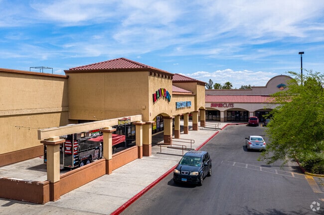
Property Record
3130 N Rainbow Blvd, Las Vegas, NV 89108


NEARBY LISTINGS FOR SALE OR LEASE
Property Detail
3130 N Rainbow Blvd
Las Vegas-Henderson-North Las Vegas, NV
Parcel Map File 62 Page 68
138-14-101-006
PARCEL MAP FILE 62 PAGE 68 LOT B
Storebuilding
Clark
X
Nevada
32003C2155F
b
2026
2.80 AC
2026
North Las Vegas
003416
Las Vegas
32,174 SF
DEMOGRAPHICS near 3130 N Rainbow Blvd
1 Mile
3 Mile
5 Mile
2024 Total Population
18,382
181,216
423,303
2029 Population
19,734
193,993
453,279
Pop Growth 2024-2029
+ 7.36%
+ 7.05%
+ 7.08%
Average Age
39
40
40
2024 Total Households
6,903
69,082
157,105
HH Growth 2024-2029
+ 7.42%
+ 7.04%
+ 7.08%
Median Household Inc
$52,263
$57,348
$61,466
Avg Household Size
2.50
2.60
2.60
2024 Avg HH Vehicles
2.00
2.00
2.00
Median Home Value
$302,117
$332,173
$341,702
Median Year Built
1987
1991
1993
Nearby Places
Map Layers
Map Styles
 Street
 Aerial
- Restaurants
- Banks
- Shops
- Fitness
- Groceries
PUBLIC TRANSPORTATION
AIRPORT
Harry Reid International
DRIVE
WALK
Distance
Harry Reid International
25 min
13.2 mi
Boulder City Municipal
DRIVE
WALK
Distance
Boulder City Municipal
45 min
33.2 mi
Freight Ports
Port of Long Beach
DRIVE
WALK
Distance
Port of Long Beach
326 min
288.7 mi
SALE & LEASE HISTORY
LISTING DATE
SALE/LEASE

Sep 25, 2016
For Lease
Apr 06, 2018
For Lease
Apr 05, 2018
For Sale
Nearby Properties
Address
Land Use
TOTAL SIZE
Lot Size
Zoning
Address
Land Use
TOTAL SIZE
Lot Size
Zoning
647,754 SF
38.57 AC
C2
Address
Land Use
TOTAL SIZE
Lot Size
Zoning
161.14 AC
CV
Address
Land Use
TOTAL SIZE
Lot Size
Zoning
5,643 SF
10.29 AC
Address
Land Use
TOTAL SIZE
Lot Size
Zoning
3,193 SF
11.77 AC
Address
Land Use
TOTAL SIZE
Lot Size
Zoning
37.31 AC
CV
Address
Land Use
TOTAL SIZE
Lot Size
Zoning
7,148 SF
7.26 AC
Address
Land Use
TOTAL SIZE
Lot Size
Zoning
14,793 SF
9.57 AC
CPB
Address
Land Use
TOTAL SIZE
Lot Size
Zoning
346,277 SF
37.61 AC
PUD
Address
Land Use
TOTAL SIZE
Lot Size
Zoning
5,057 SF
9.46 AC
RE
Address
Land Use
TOTAL SIZE
Lot Size
Zoning
3,518 SF
11.95 AC
Address
Land Use
TOTAL SIZE
Lot Size
Zoning
263,881 SF
7.49 AC
R-4
Address
Land Use
TOTAL SIZE
Lot Size
Zoning
5,750 SF
19.67 AC
R3
Address
Land Use
TOTAL SIZE
Lot Size
Zoning
21.12 AC
RE
Address
Land Use
TOTAL SIZE
Lot Size
Zoning
4,084 SF
1.84 AC
CPB
Address
Land Use
TOTAL SIZE
Lot Size
Zoning
52,058 SF
6.44 AC
C1
Address
Land Use
TOTAL SIZE
Lot Size
Zoning
285,929 SF
5.06 AC
C1
Address
Land Use
TOTAL SIZE
Lot Size
Zoning
211,331 SF
6.70 AC
USC
Address
Land Use
TOTAL SIZE
Lot Size
Zoning
329,442 SF
32.53 AC
C1
Address
Land Use
TOTAL SIZE
Lot Size
Zoning
86,946 SF
162.05 AC
M2
Address
Land Use
TOTAL SIZE
Lot Size
Zoning
1,883 SF
18.13 AC
C2
Address
Land Use
TOTAL SIZE
Lot Size
Zoning
6,280 SF
8.72 AC
RPD18
Address
Land Use
TOTAL SIZE
Lot Size
Zoning
3,618 SF
10 AC
L:R-3
Address
Land Use
TOTAL SIZE
Lot Size
Zoning
40,434 SF
25.37 AC
C3
Address
Land Use
TOTAL SIZE
Lot Size
Zoning
99,487 SF
22.61 AC
PC
Address
Land Use
TOTAL SIZE
Lot Size
Zoning
7,103 SF
14.27 AC
L:R-3
Address
Land Use
TOTAL SIZE
Lot Size
Zoning
7,148 SF
15.33 AC
L:R-PD20
Address
Land Use
TOTAL SIZE
Lot Size
Zoning
1,838 SF
24.69 AC
R3
Address
Land Use
TOTAL SIZE
Lot Size
Zoning
2,006 SF
13.79 AC
RPD20
The World's #1 Commercial Real Estate Marketplace
Connect with us
© 2026 CoStar Group
The information above has been obtained from sources believed reliable. While we do not doubt its accuracy we have not verified it and make no guarantee, warranty or representation about it. It is your responsibility to independently confirm its accuracy and completeness. Any projections, opinions, assumptions, or estimates used are for example only and do not represent the current or future performance of the property. The value of this transaction to you depends on tax and other factors which should be evaluated by your tax, financial, and legal advisors. You and your advisors should conduct a careful, independent investigation of the property to determine to your satisfaction the suitability of the property for your needs.