Property Record
3130 Sapp Rd, Conroe, TX 77304


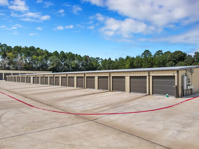
Property Detail
3130 Sapp Rd
0009-01-12000
A0009 - CORNER MARY, TRACT 120, 124, 128 (AKA AA-AFFORDABLE STORAGE CONROE, BLOCK 1, RES A #2017077691), ACRES 6.586
Commercialnec
Montgomery
1
Texas
B and X Area of moderate flood hazard, usually the area between the limits of the 100-year and 500-year floods.
43
2024
6.59 AC
2025
The Woodlands/Conroe
694401
Houston
38,112 SF
Houston-Pasadena-The Woodlands, TX
NEARBY LISTINGS FOR SALE OR LEASE
DEMOGRAPHICS near 3130 Sapp Rd
1 mile
3 mile
5 mile
2025 Total Population
1,966
21,173
80,351
2030 Population
2,326
25,151
95,344
Pop Growth 2025-2030
+ 18.31%
+ 18.79%
+ 18.66%
Average Age
38
40
40
2025 Total Households
769
8,254
31,735
HH Growth 2025-2030
+ 18.86%
+ 19.26%
+ 19.12%
Median Household Inc
$81,303
$100,570
$92,597
Avg Household Size
2.60
2.60
2.50
2025 Avg HH Vehicles
2.00
2.00
2.00
Median Home Value
$267,876
$419,508
$393,334
Median Year Built
2011
2010
2010
Nearby Places
Map Layers
Map Styles
 Street
 Aerial
Transit
 Traffic
 Biking
Places
Listings with unknown addresses are not visible on the map
- Restaurants
- Banks
- Shops
- Fitness
- Groceries
PUBLIC TRANSPORTATION
AIRPORT
George Bush Intcntl/Houston
Drive
Walk
Distance
George Bush Intcntl/Houston
47 min
37.0 mi
Freight Ports
Port of Houston
Drive
Walk
Distance
Port of Houston
70 min
52.7 mi
SALE & LEASE HISTORY
LISTING DATE
SALE/LEASE

Jul 14, 2021
For Sale
Nearby Properties
Address
Land Use
TOTAL SIZE
Lot Size
Zoning
Address
Land Use
TOTAL SIZE
Lot Size
Zoning
294,336 SF
20.39 AC
Address
Land Use
TOTAL SIZE
Lot Size
Zoning
204,716 SF
15.51 AC
Address
Land Use
TOTAL SIZE
Lot Size
Zoning
229,345 SF
12.36 AC
1
Address
Land Use
TOTAL SIZE
Lot Size
Zoning
134,935 SF
10.50 AC
1
Address
Land Use
TOTAL SIZE
Lot Size
Zoning
134,621 SF
26.37 AC
Address
Land Use
TOTAL SIZE
Lot Size
Zoning
313,974 SF
25.03 AC
1
Address
Land Use
TOTAL SIZE
Lot Size
Zoning
157,996 SF
9 AC
Address
Land Use
TOTAL SIZE
Lot Size
Zoning
287,364 SF
23.45 AC
4
Address
Land Use
TOTAL SIZE
Lot Size
Zoning
203,934 SF
11.75 AC
Address
Land Use
TOTAL SIZE
Lot Size
Zoning
382,810 SF
18.58 AC
1
Address
Land Use
TOTAL SIZE
Lot Size
Zoning
239,104 SF
65.54 AC
1
Address
Land Use
TOTAL SIZE
Lot Size
Zoning
114,547 SF
57.94 AC
1
Address
Land Use
TOTAL SIZE
Lot Size
Zoning
114,101 SF
43.80 AC
Address
Land Use
TOTAL SIZE
Lot Size
Zoning
402,840 SF
26.73 AC
Address
Land Use
TOTAL SIZE
Lot Size
Zoning
81,011 SF
21.53 AC
Address
Land Use
TOTAL SIZE
Lot Size
Zoning
170,050 SF
10.80 AC
Address
Land Use
TOTAL SIZE
Lot Size
Zoning
68,576 SF
26.39 AC
Address
Land Use
TOTAL SIZE
Lot Size
Zoning
74,395 SF
8.44 AC
Address
Land Use
TOTAL SIZE
Lot Size
Zoning
35,816 SF
251.16 AC
1
Address
Land Use
TOTAL SIZE
Lot Size
Zoning
104,735 SF
29.96 AC
1
Address
Land Use
TOTAL SIZE
Lot Size
Zoning
26,278 SF
9.39 AC
Address
Land Use
TOTAL SIZE
Lot Size
Zoning
54,511 SF
14.42 AC
1
Address
Land Use
TOTAL SIZE
Lot Size
Zoning
14,628 SF
1.33 AC
Address
Land Use
TOTAL SIZE
Lot Size
Zoning
29,500 SF
1.59 AC
Address
Land Use
TOTAL SIZE
Lot Size
Zoning
18,630 SF
11.34 AC
1
Address
Land Use
TOTAL SIZE
Lot Size
Zoning
77,850 SF
6.11 AC
1
Address
Land Use
TOTAL SIZE
Lot Size
Zoning
39,210 SF
3.50 AC
Address
Land Use
TOTAL SIZE
Lot Size
Zoning
24,420 SF
2.13 AC
Address
Land Use
TOTAL SIZE
Lot Size
Zoning
50,008 SF
8.86 AC
1
The World's #1 Commercial Real Estate Marketplace
Connect with us
© 2026 CoStar Group
The information above has been obtained from sources believed reliable. While we do not doubt its accuracy we have not verified it and make no guarantee, warranty or representation about it. It is your responsibility to independently confirm its accuracy and completeness. Any projections, opinions, assumptions, or estimates used are for example only and do not represent the current or future performance of the property. The value of this transaction to you depends on tax and other factors which should be evaluated by your tax, financial, and legal advisors. You and your advisors should conduct a careful, independent investigation of the property to determine to your satisfaction the suitability of the property for your needs.