Property Record
3130 State Line Rd, North Bend, OH 45052
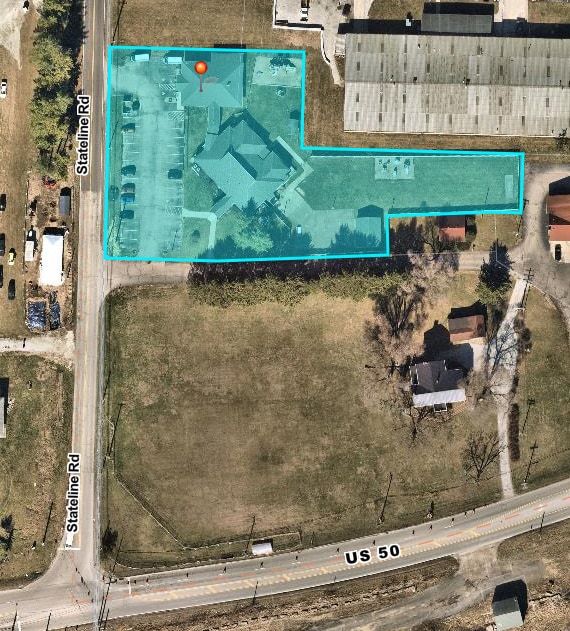


Property Detail
3130 State Line Rd
630-0300-0231
E S STATE LINE RD 1.4450 ACSR1- T1- S30
Privateschool
Hamilton
C and X Area of minimal flood hazard, usually depicted on FIRMs as above the 500-year flood level.
Ohio
2025
1.45 AC
2025
Forest Park/West
026102
Cincinnati/Dayton
3,769 SF
Cincinnati, OH-KY-IN
NEARBY LISTINGS FOR SALE OR LEASE
-
-
View all North Bend listings for sale on LoopNet.com
DEMOGRAPHICS near 3130 State Line Rd
1 mile
3 mile
5 mile
2025 Total Population
708
9,478
29,323
2030 Population
722
9,601
29,833
Pop Growth 2025-2030
+ 1.98%
+ 1.30%
+ 1.74%
Average Age
42
43
41
2025 Total Households
272
3,582
11,172
HH Growth 2025-2030
+ 1.84%
+ 1.31%
+ 1.72%
Median Household Inc
$77,678
$97,464
$88,637
Avg Household Size
2.50
2.60
2.50
2025 Avg HH Vehicles
2.00
2.00
2.00
Median Home Value
$286,904
$266,048
$257,643
Median Year Built
1983
1992
1988
Nearby Places
Map Layers
Map Styles
 Street
 Aerial
Layers
 Traffic
 Biking
Places
Listings with unknown addresses are not visible on the map
- Restaurants
- Banks
- Shops
- Fitness
- Groceries
PUBLIC TRANSPORTATION
AIRPORT
Cincinnati/Northern Kentucky International
Drive
Walk
Distance
Cincinnati/Northern Kentucky International
32 min
19.1 mi
Freight Ports
Port of Toledo
Drive
Walk
Distance
Port of Toledo
253 min
216.3 mi
SALE & LEASE HISTORY
LISTING DATE
SALE/LEASE

Nov 15, 2023
For Sale
Nearby Properties
Address
Land Use
TOTAL SIZE
Lot Size
Zoning
Address
Land Use
TOTAL SIZE
Lot Size
Zoning
2.10 AC
G
Address
Land Use
TOTAL SIZE
Lot Size
Zoning
24,487 SF
9.29 AC
Address
Land Use
TOTAL SIZE
Lot Size
Zoning
3.30 AC
Address
Land Use
TOTAL SIZE
Lot Size
Zoning
43,895 SF
59.12 AC
Address
Land Use
TOTAL SIZE
Lot Size
Zoning
88,130 SF
5.27 AC
Address
Land Use
TOTAL SIZE
Lot Size
Zoning
32,169 SF
5.49 AC
Address
Land Use
TOTAL SIZE
Lot Size
Zoning
40,872 SF
1.31 AC
Address
Land Use
TOTAL SIZE
Lot Size
Zoning
800 SF
501.94 AC
A
Address
Land Use
TOTAL SIZE
Lot Size
Zoning
5,166 SF
8.01 AC
Address
Land Use
TOTAL SIZE
Lot Size
Zoning
20,544 SF
2.43 AC
Address
Land Use
TOTAL SIZE
Lot Size
Zoning
10,415 SF
1.95 AC
Address
Land Use
TOTAL SIZE
Lot Size
Zoning
35,004 SF
1.25 AC
Address
Land Use
TOTAL SIZE
Lot Size
Zoning
14,684 SF
1.37 AC
Address
Land Use
TOTAL SIZE
Lot Size
Zoning
6,476 SF
2.60 AC
Address
Land Use
TOTAL SIZE
Lot Size
Zoning
10,500 SF
5.39 AC
Address
Land Use
TOTAL SIZE
Lot Size
Zoning
10,000 SF
4.67 AC
Address
Land Use
TOTAL SIZE
Lot Size
Zoning
17,952 SF
15.08 AC
Address
Land Use
TOTAL SIZE
Lot Size
Zoning
17,460 SF
2.70 AC
Address
Land Use
TOTAL SIZE
Lot Size
Zoning
282.17 AC
H
Address
Land Use
TOTAL SIZE
Lot Size
Zoning
45.41 AC
Address
Land Use
TOTAL SIZE
Lot Size
Zoning
5,845 SF
2 AC
Address
Land Use
TOTAL SIZE
Lot Size
Zoning
6,541 SF
1.50 AC
Address
Land Use
TOTAL SIZE
Lot Size
Zoning
7,734 SF
1.18 AC
Address
Land Use
TOTAL SIZE
Lot Size
Zoning
3,648 SF
113.89 AC
A
Address
Land Use
TOTAL SIZE
Lot Size
Zoning
9,412 SF
0.50 AC
Address
Land Use
TOTAL SIZE
Lot Size
Zoning
7,390 SF
3.01 AC
Address
Land Use
TOTAL SIZE
Lot Size
Zoning
17,286 SF
4.26 AC
Address
Land Use
TOTAL SIZE
Lot Size
Zoning
13,591 SF
2.17 AC
Address
Land Use
TOTAL SIZE
Lot Size
Zoning
21,752 SF
3.41 AC
Address
Land Use
TOTAL SIZE
Lot Size
Zoning
5,424 SF
1.50 AC
The World's #1 Commercial Real Estate Marketplace
Connect with us
© 2026 CoStar Group
The information above has been obtained from sources believed reliable. While we do not doubt its accuracy we have not verified it and make no guarantee, warranty or representation about it. It is your responsibility to independently confirm its accuracy and completeness. Any projections, opinions, assumptions, or estimates used are for example only and do not represent the current or future performance of the property. The value of this transaction to you depends on tax and other factors which should be evaluated by your tax, financial, and legal advisors. You and your advisors should conduct a careful, independent investigation of the property to determine to your satisfaction the suitability of the property for your needs.