Property Record
3131 La Posta Rd, Campo, CA 91906
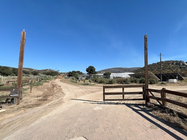

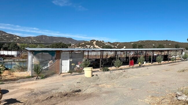
This Property Is For Sale
Property Detail
3131 La Posta Rd
605-050-16
SEC 1-17-5E TCT 39 IN
Agriculturalland
SAN DIEGO
A72
California
D Areas with possible but undetermined flood hazards.
40.12 AC
2024
Outlying SD County S
2025
San Diego
021101
San Diego-Chula Vista-Carlsbad, CA
1,160 SF
NEARBY LISTINGS FOR SALE OR LEASE
DEMOGRAPHICS near 3131 La Posta Rd
1 mile
3 mile
5 mile
2025 Total Population
33
145
668
2030 Population
32
143
662
Pop Growth 2025-2030
(3.03%)
(1.38%)
(0.90%)
Average Age
41
40
41
2025 Total Households
11
49
227
HH Growth 2025-2030
0.00%
0.00%
(1.32%)
Median Household Inc
$55,000
$67,500
$70,384
Avg Household Size
2.70
2.90
2.80
2025 Avg HH Vehicles
3.00
3.00
3.00
Median Home Value
$350,000
$312,500
$357,142
Median Year Built
1989
1993
1979
Nearby Places
Map Layers
Map Styles
 Street
 Aerial
Transit
 Traffic
 Biking
Places
Listings with unknown addresses are not visible on the map
- Restaurants
- Banks
- Shops
- Fitness
- Groceries
Nearby Properties
Address
Land Use
TOTAL SIZE
Lot Size
Zoning
Address
Land Use
TOTAL SIZE
Lot Size
Zoning
321.76 AC
A70
Address
Land Use
TOTAL SIZE
Lot Size
Zoning
1,660 SF
38.83 AC
A70
Address
Land Use
TOTAL SIZE
Lot Size
Zoning
162 AC
S92
Address
Land Use
TOTAL SIZE
Lot Size
Zoning
280 AC
S92
Address
Land Use
TOTAL SIZE
Lot Size
Zoning
2,112 SF
1.43 AC
A72
Address
Land Use
TOTAL SIZE
Lot Size
Zoning
160 AC
S92
Address
Land Use
TOTAL SIZE
Lot Size
Zoning
160 AC
S92
Address
Land Use
TOTAL SIZE
Lot Size
Zoning
37.63 AC
S92
Address
Land Use
TOTAL SIZE
Lot Size
Zoning
51.42 AC
A72
Address
Land Use
TOTAL SIZE
Lot Size
Zoning
446 SF
37.91 AC
A72
Address
Land Use
TOTAL SIZE
Lot Size
Zoning
29.09 AC
S92
Address
Land Use
TOTAL SIZE
Lot Size
Zoning
4.78 AC
S92
Address
Land Use
TOTAL SIZE
Lot Size
Zoning
160 AC
S92
Address
Land Use
TOTAL SIZE
Lot Size
Zoning
80 AC
S92
Address
Land Use
TOTAL SIZE
Lot Size
Zoning
80 AC
S92
Address
Land Use
TOTAL SIZE
Lot Size
Zoning
480 SF
2.10 AC
S92
Address
Land Use
TOTAL SIZE
Lot Size
Zoning
37.10 AC
A72
Address
Land Use
TOTAL SIZE
Lot Size
Zoning
35.34 AC
S92
Address
Land Use
TOTAL SIZE
Lot Size
Zoning
80 AC
S92
Address
Land Use
TOTAL SIZE
Lot Size
Zoning
36.79 AC
S92
Address
Land Use
TOTAL SIZE
Lot Size
Zoning
40 AC
A72
Address
Land Use
TOTAL SIZE
Lot Size
Zoning
39.02 AC
A72
Address
Land Use
TOTAL SIZE
Lot Size
Zoning
80 AC
S92
Address
Land Use
TOTAL SIZE
Lot Size
Zoning
80 AC
S80
Address
Land Use
TOTAL SIZE
Lot Size
Zoning
80 AC
S92
Address
Land Use
TOTAL SIZE
Lot Size
Zoning
80 AC
S80
Address
Land Use
TOTAL SIZE
Lot Size
Zoning
80 AC
S92
Address
Land Use
TOTAL SIZE
Lot Size
Zoning
27.60 AC
S92
The World's #1 Commercial Real Estate Marketplace
Connect with us
© 2026 CoStar Group
The information above has been obtained from sources believed reliable. While we do not doubt its accuracy we have not verified it and make no guarantee, warranty or representation about it. It is your responsibility to independently confirm its accuracy and completeness. Any projections, opinions, assumptions, or estimates used are for example only and do not represent the current or future performance of the property. The value of this transaction to you depends on tax and other factors which should be evaluated by your tax, financial, and legal advisors. You and your advisors should conduct a careful, independent investigation of the property to determine to your satisfaction the suitability of the property for your needs.