Property Record
3131 Simpson Stuart Rd, Dallas, TX 75241
NEARBY LISTINGS FOR SALE OR LEASE
-
-
View all Dallas listings for sale on LoopNet.com
Property Detail
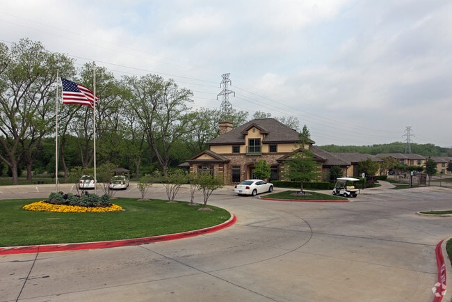
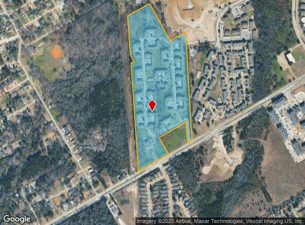
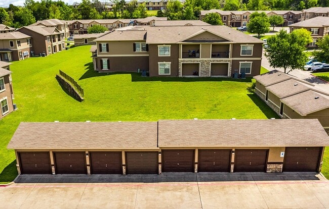
3131 Simpson Stuart Rd
Dallas-Fort Worth-Arlington, TX
Pecan Grove Town Homes
00687200000010000
PECAN GROVE TOWN HOMES BLK 6872 LT 1 ACS 28.2110 VOL2004098/684 DD05142004 CO-DC 6872 000 00100 2DA6872 000
Apartment
Dallas
AE
Texas
48113C0495K
1
2024
28.21 AC
2025
Highland Hills
011401
Dallas/Ft Worth
275,128 SF
DEMOGRAPHICS near 3131 Simpson Stuart Rd
1 mile
3 mile
5 mile
2024 Total Population
14,661
56,781
173,945
2029 Population
14,960
56,896
173,134
Pop Growth 2024-2029
+ 2.04%
+ 0.20%
(0.47%)
Average Age
35
36
36
2024 Total Households
4,689
18,473
55,607
HH Growth 2024-2029
+ 1.94%
0.00%
(0.70%)
Median Household Inc
$31,924
$29,539
$37,229
Avg Household Size
2.90
2.90
3.00
2024 Avg HH Vehicles
1.00
2.00
2.00
Median Home Value
$111,692
$129,174
$147,701
Median Year Built
1978
1969
1969
Nearby Places
Map Layers
Map Styles
 Street
 Aerial
Transit
 Traffic
 Biking
Places
Listings with unknown addresses are not visible on the map
- Restaurants
- Banks
- Shops
- Fitness
- Groceries
PUBLIC TRANSPORTATION
AIRPORT
Dallas Love Field
Drive
Walk
Distance
Dallas Love Field
27 min
15.4 mi
Dallas-Fort Worth International
Drive
Walk
Distance
Dallas-Fort Worth International
42 min
31.3 mi
Freight Ports
Port of Shreveport
Drive
Walk
Distance
Port of Shreveport
211 min
194.9 mi
Nearby Properties
Address
Land Use
TOTAL SIZE
Lot Size
Zoning
Address
Land Use
TOTAL SIZE
Lot Size
Zoning
1,200,000 SF
60.01 AC
Z125
Address
Land Use
TOTAL SIZE
Lot Size
Zoning
1,044,647 SF
65.80 AC
Z239
Address
Land Use
TOTAL SIZE
Lot Size
Zoning
1,025,640 SF
82.26 AC
Z125
Address
Land Use
TOTAL SIZE
Lot Size
Zoning
917,700 SF
44.27 AC
Z125
Address
Land Use
TOTAL SIZE
Lot Size
Zoning
1,108,100 SF
65.25 AC
Z125
Address
Land Use
TOTAL SIZE
Lot Size
Zoning
527,731 SF
56.12 AC
Z298
Address
Land Use
TOTAL SIZE
Lot Size
Zoning
776,630 SF
58.40 AC
Z239
Address
Land Use
TOTAL SIZE
Lot Size
Zoning
713,000 SF
52.25 AC
Z125
Address
Land Use
TOTAL SIZE
Lot Size
Zoning
554,600 SF
50.31 AC
Z298
Address
Land Use
TOTAL SIZE
Lot Size
Zoning
550,800 SF
26.52 AC
Z239
Address
Land Use
TOTAL SIZE
Lot Size
Zoning
362,767 SF
101.01 AC
Z115
Address
Land Use
TOTAL SIZE
Lot Size
Zoning
659,523 SF
35.33 AC
Z04
Address
Land Use
TOTAL SIZE
Lot Size
Zoning
648,960 SF
52.23 AC
Z06
Address
Land Use
TOTAL SIZE
Lot Size
Zoning
245,554 SF
12 AC
Z59
Address
Land Use
TOTAL SIZE
Lot Size
Zoning
627,000 SF
37.09 AC
Z125
Address
Land Use
TOTAL SIZE
Lot Size
Zoning
590,200 SF
31.83 AC
Z04
Address
Land Use
TOTAL SIZE
Lot Size
Zoning
696,622 SF
37.79 AC
Z116
Address
Land Use
TOTAL SIZE
Lot Size
Zoning
1,084,462 SF
66.17 AC
Address
Land Use
TOTAL SIZE
Lot Size
Zoning
502,000 SF
79.24 AC
Z239
Address
Land Use
TOTAL SIZE
Lot Size
Zoning
488,780 SF
41.74 AC
Z06
Address
Land Use
TOTAL SIZE
Lot Size
Zoning
248,634 SF
16.30 AC
Z297
Address
Land Use
TOTAL SIZE
Lot Size
Zoning
353,319 SF
20.49 AC
Address
Land Use
TOTAL SIZE
Lot Size
Zoning
273,914 SF
46.58 AC
Z413
Address
Land Use
TOTAL SIZE
Lot Size
Zoning
111,111 SF
10.07 AC
Z202
Address
Land Use
TOTAL SIZE
Lot Size
Zoning
403,200 SF
29.07 AC
Z248
Address
Land Use
TOTAL SIZE
Lot Size
Zoning
532,564 SF
10.19 AC
Z297
Address
Land Use
TOTAL SIZE
Lot Size
Zoning
253,985 SF
15.09 AC
Address
Land Use
TOTAL SIZE
Lot Size
Zoning
416,967 SF
22.88 AC
MF2A
Address
Land Use
TOTAL SIZE
Lot Size
Zoning
410,800 SF
30.01 AC
Z06
Address
Land Use
TOTAL SIZE
Lot Size
Zoning
250,638 SF
19.94 AC
The World's #1 Commercial Real Estate Marketplace
Connect with us
© 2026 CoStar Group
The information above has been obtained from sources believed reliable. While we do not doubt its accuracy we have not verified it and make no guarantee, warranty or representation about it. It is your responsibility to independently confirm its accuracy and completeness. Any projections, opinions, assumptions, or estimates used are for example only and do not represent the current or future performance of the property. The value of this transaction to you depends on tax and other factors which should be evaluated by your tax, financial, and legal advisors. You and your advisors should conduct a careful, independent investigation of the property to determine to your satisfaction the suitability of the property for your needs.