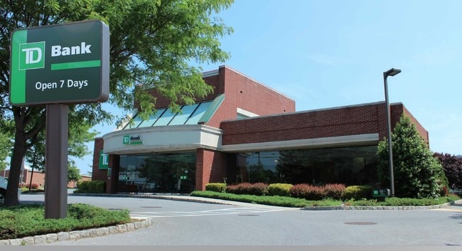
Property Record
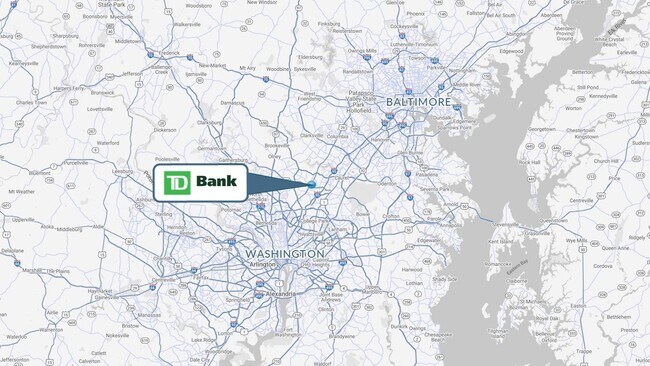
3132 Briggs Chaney Rd, Silver Spring, MD 20904

Property Detail
3132 Briggs Chaney Rd
05-03586207
PAR K SILVER SPRING COUNTRY CLUB
Financialbuilding
Montgomery
CRN0.
Maryland
B and X Area of moderate flood hazard, usually the area between the limits of the 100-year and 500-year floods.
0.89 AC
2024
North Silver Spring/Rt 29
2025
Washington, DC
701422
Washington-Arlington-Alexandria, DC-VA-MD-WV
4,100 SF
NEARBY LISTINGS FOR SALE OR LEASE
-
-
View all Silver Spring listings for sale on LoopNet.com
DEMOGRAPHICS near 3132 Briggs Chaney Rd
1 mile
3 mile
5 mile
2025 Total Population
20,100
87,951
207,845
2030 Population
20,663
89,811
211,890
Pop Growth 2025-2030
+ 2.80%
+ 2.11%
+ 1.95%
Average Age
37
41
41
2025 Total Households
7,396
30,206
72,106
HH Growth 2025-2030
+ 2.89%
+ 2.17%
+ 1.93%
Median Household Inc
$86,229
$103,729
$109,242
Avg Household Size
2.70
2.80
2.80
2025 Avg HH Vehicles
2.00
2.00
2.00
Median Home Value
$417,288
$519,285
$541,646
Median Year Built
1984
1982
1981
Nearby Places
Map Layers
Map Styles
 Street
 Aerial
Layers
 Traffic
 Biking
Places
Listings with unknown addresses are not visible on the map
- Restaurants
- Banks
- Shops
- Fitness
- Groceries
PUBLIC TRANSPORTATION
COMMUTER RAIL
Drive
Walk
Distance
8 min
4.8 mi
Drive
Walk
Distance
14 min
8.7 mi
AIRPORT
Ronald Reagan Washington Ntl
Drive
Walk
Distance
Ronald Reagan Washington Ntl
40 min
20.8 mi
Baltimore/Washington International Thurgood Marshall
Drive
Walk
Distance
Baltimore/Washington International Thurgood Marshall
32 min
23.5 mi
Washington Dulles International
Drive
Walk
Distance
Washington Dulles International
55 min
36.1 mi
Freight Ports
Port of Baltimore
Drive
Walk
Distance
Port of Baltimore
35 min
26.1 mi
SALE & LEASE HISTORY
LISTING DATE
SALE/LEASE

Mar 08, 2022
For Sale
Mar 01, 2018
For Sale
Jun 12, 2018
For Sale
Aug 28, 2020
For Sale
Nearby Properties
Address
Land Use
TOTAL SIZE
Lot Size
Zoning
Address
Land Use
TOTAL SIZE
Lot Size
Zoning
456,429 SF
35.07 AC
I3
Address
Land Use
TOTAL SIZE
Lot Size
Zoning
1,244,733 SF
38.03 AC
RE2
Address
Land Use
TOTAL SIZE
Lot Size
Zoning
1,146,407 SF
60.25 AC
AG
Address
Land Use
TOTAL SIZE
Lot Size
Zoning
218,406 SF
26.80 AC
LAUR
Address
Land Use
TOTAL SIZE
Lot Size
Zoning
66,150 SF
6.79 AC
CRF
Address
Land Use
TOTAL SIZE
Lot Size
Zoning
531,312 SF
25.70 AC
R30
Address
Land Use
TOTAL SIZE
Lot Size
Zoning
559,944 SF
11.89 AC
IE
Address
Land Use
TOTAL SIZE
Lot Size
Zoning
385,000 SF
16.42 AC
RH
Address
Land Use
TOTAL SIZE
Lot Size
Zoning
482,799 SF
17.79 AC
R30
Address
Land Use
TOTAL SIZE
Lot Size
Zoning
166,410 SF
26.25 AC
CRT1.
Address
Land Use
TOTAL SIZE
Lot Size
Zoning
310,052 SF
9.63 AC
R20
Address
Land Use
TOTAL SIZE
Lot Size
Zoning
371,939 SF
21.54 AC
EOF1.
Address
Land Use
TOTAL SIZE
Lot Size
Zoning
285,116 SF
14.62 AC
AG
Address
Land Use
TOTAL SIZE
Lot Size
Zoning
222,345 SF
14.21 AC
R30
Address
Land Use
TOTAL SIZE
Lot Size
Zoning
545,265 SF
9.51 AC
R10
Address
Land Use
TOTAL SIZE
Lot Size
Zoning
16.09 AC
RMF20
Address
Land Use
TOTAL SIZE
Lot Size
Zoning
235,616 SF
12.81 AC
R30
Address
Land Use
TOTAL SIZE
Lot Size
Zoning
4,380 SF
17.89 AC
CRT22
Address
Land Use
TOTAL SIZE
Lot Size
Zoning
169,000 SF
0.65 AC
I3
Address
Land Use
TOTAL SIZE
Lot Size
Zoning
92,294 SF
3.22 AC
CR0.7
Address
Land Use
TOTAL SIZE
Lot Size
Zoning
291,413 SF
12.07 AC
R20
Address
Land Use
TOTAL SIZE
Lot Size
Zoning
254,416 SF
24.98 AC
CR1.0
Address
Land Use
TOTAL SIZE
Lot Size
Zoning
350,684 SF
36.50 AC
EOF1.
Address
Land Use
TOTAL SIZE
Lot Size
Zoning
456,896 SF
8.96 AC
R20
Address
Land Use
TOTAL SIZE
Lot Size
Zoning
11.01 AC
RMF20
Address
Land Use
TOTAL SIZE
Lot Size
Zoning
11.01 AC
RMF20
Address
Land Use
TOTAL SIZE
Lot Size
Zoning
239,072 SF
10.41 AC
R20
Address
Land Use
TOTAL SIZE
Lot Size
Zoning
155,461 SF
6.33 AC
CGO
Address
Land Use
TOTAL SIZE
Lot Size
Zoning
17.56 AC
RMF20
Address
Land Use
TOTAL SIZE
Lot Size
Zoning
177,712 SF
13.89 AC
GR1.5
The World's #1 Commercial Real Estate Marketplace
Connect with us
© 2026 CoStar Group
The information above has been obtained from sources believed reliable. While we do not doubt its accuracy we have not verified it and make no guarantee, warranty or representation about it. It is your responsibility to independently confirm its accuracy and completeness. Any projections, opinions, assumptions, or estimates used are for example only and do not represent the current or future performance of the property. The value of this transaction to you depends on tax and other factors which should be evaluated by your tax, financial, and legal advisors. You and your advisors should conduct a careful, independent investigation of the property to determine to your satisfaction the suitability of the property for your needs.