Property Record
3133 Bath Pike, Nazareth, PA 18064

NEARBY LISTINGS FOR SALE OR LEASE
Property Detail
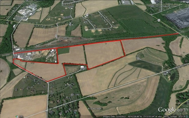
3133 Bath Pike
K6 11 1 0432
Northampton
Agriculturalland
Pennsylvania
X
22.09 AC
42095C0255E
Lehigh Valley
2025
Philadelphia
2025
Allentown-Bethlehem-Easton, PA-NJ
016700
DEMOGRAPHICS near 3133 Bath Pike
1 Mile
3 Mile
5 Mile
2024 Total Population
2,604
24,406
70,415
2029 Population
2,674
24,734
70,930
Pop Growth 2024-2029
+ 2.69%
+ 1.34%
+ 0.73%
Average Age
45
44
44
2024 Total Households
651
8,729
26,376
HH Growth 2024-2029
+ 2.00%
+ 1.07%
+ 0.64%
Median Household Inc
$113,210
$85,216
$93,753
Avg Household Size
3.00
2.50
2.50
2024 Avg HH Vehicles
2.00
2.00
2.00
Median Home Value
$359,336
$313,555
$306,412
Median Year Built
2005
1974
1981
Nearby Places
Map Layers
Map Styles
 Street
 Aerial
- Restaurants
- Banks
- Shops
- Fitness
- Groceries
PUBLIC TRANSPORTATION
AIRPORT
Lehigh Valley International
DRIVE
WALK
Distance
Lehigh Valley International
16 min
8.6 mi
Freight Ports
Port of Philadelphia
DRIVE
WALK
Distance
Port of Philadelphia
101 min
74.5 mi
SALE & LEASE HISTORY
LISTING DATE
SALE/LEASE

Sep 24, 2016
For Sale
Nearby Properties
Address
Land Use
TOTAL SIZE
Lot Size
Zoning
Address
Land Use
TOTAL SIZE
Lot Size
Zoning
605,906 SF
94.28 AC
A
Address
Land Use
TOTAL SIZE
Lot Size
Zoning
302,378 SF
83.53 AC
A
Address
Land Use
TOTAL SIZE
Lot Size
Zoning
82.80 AC
I2
Address
Land Use
TOTAL SIZE
Lot Size
Zoning
533,165 SF
54.66 AC
LI/BP
Address
Land Use
TOTAL SIZE
Lot Size
Zoning
437,612 SF
42.26 AC
LI/BP
Address
Land Use
TOTAL SIZE
Lot Size
Zoning
508,835 SF
34.92 AC
A
Address
Land Use
TOTAL SIZE
Lot Size
Zoning
307,425 SF
37.13 AC
A
Address
Land Use
TOTAL SIZE
Lot Size
Zoning
294,412 SF
28.72 AC
A
Address
Land Use
TOTAL SIZE
Lot Size
Zoning
48,894 SF
34.10 AC
EI
Address
Land Use
TOTAL SIZE
Lot Size
Zoning
243,750 SF
23.97 AC
A
Address
Land Use
TOTAL SIZE
Lot Size
Zoning
129,491 SF
12.52 AC
LIBP
Address
Land Use
TOTAL SIZE
Lot Size
Zoning
116,536 SF
7.31 AC
C
Address
Land Use
TOTAL SIZE
Lot Size
Zoning
5,482 SF
316.60 AC
EI
Address
Land Use
TOTAL SIZE
Lot Size
Zoning
178,074 SF
15.82 AC
EX1
Address
Land Use
TOTAL SIZE
Lot Size
Zoning
81,288 SF
30.83 AC
R1
Address
Land Use
TOTAL SIZE
Lot Size
Zoning
64,964 SF
24.68 AC
UR
Address
Land Use
TOTAL SIZE
Lot Size
Zoning
6,336 SF
68.77 AC
EI
Address
Land Use
TOTAL SIZE
Lot Size
Zoning
3,136 SF
63.32 AC
LI/BP
Address
Land Use
TOTAL SIZE
Lot Size
Zoning
121,206 SF
1.76 AC
R7
Address
Land Use
TOTAL SIZE
Lot Size
Zoning
67,366 SF
5.14 AC
PIC
Address
Land Use
TOTAL SIZE
Lot Size
Zoning
27,583 SF
20.47 AC
LI/BP
Address
Land Use
TOTAL SIZE
Lot Size
Zoning
51,894 SF
2.46 AC
M2
Address
Land Use
TOTAL SIZE
Lot Size
Zoning
21,711 SF
1.30 AC
GC
Address
Land Use
TOTAL SIZE
Lot Size
Zoning
43,812 SF
0.56 AC
R7
Address
Land Use
TOTAL SIZE
Lot Size
Zoning
1,920 SF
92.42 AC
PIC
Address
Land Use
TOTAL SIZE
Lot Size
Zoning
12,000 SF
6.19 AC
R2
Address
Land Use
TOTAL SIZE
Lot Size
Zoning
65,876 SF
2.69 AC
R7
Address
Land Use
TOTAL SIZE
Lot Size
Zoning
19,972 SF
69.59 AC
EI
Address
Land Use
TOTAL SIZE
Lot Size
Zoning
59,090 SF
31.18 AC
C
Address
Land Use
TOTAL SIZE
Lot Size
Zoning
43,335 SF
2.43 AC
M2
The World's #1 Commercial Real Estate Marketplace
Connect with us
© 2025 CoStar Group
The information above has been obtained from sources believed reliable. While we do not doubt its accuracy we have not verified it and make no guarantee, warranty or representation about it. It is your responsibility to independently confirm its accuracy and completeness. Any projections, opinions, assumptions, or estimates used are for example only and do not represent the current or future performance of the property. The value of this transaction to you depends on tax and other factors which should be evaluated by your tax, financial, and legal advisors. You and your advisors should conduct a careful, independent investigation of the property to determine to your satisfaction the suitability of the property for your needs.