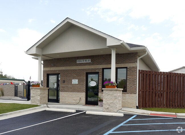
Property Record
3135 N State Road 267, Brownsburg, IN 46112
NEARBY LISTINGS FOR SALE OR LEASE
Property Detail
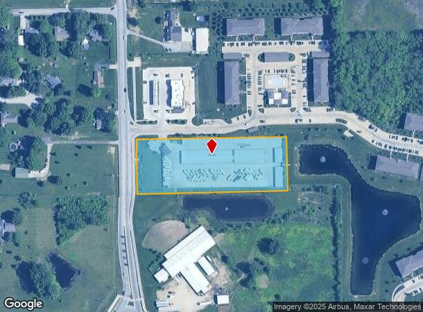
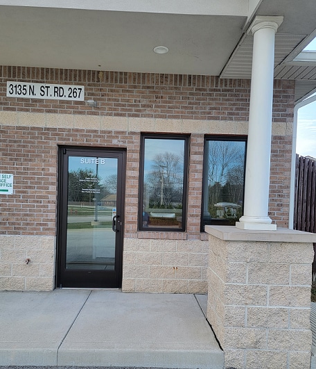
3135 N State Road 267
Indianapolis-Carmel-Anderson, IN
West Wynne Farms Secondary Pla
32-07-23-306-004.000-016
WEST WYNNE FARMS SEC 4 LOT 2 3.53AC DBA: AMAZON SELF STORAGE
Industrialgeneral
Hendricks
X
Indiana
18063C0167D
2
2024
3.53 AC
2024
Hendricks County
210105
Indianapolis
744 SF
DEMOGRAPHICS near 3135 N State Road 267
1 Mile
3 Mile
5 Mile
2024 Total Population
5,829
43,275
110,855
2029 Population
6,470
48,470
122,372
Pop Growth 2024-2029
+ 11.00%
+ 12.00%
+ 10.39%
Average Age
37
39
39
2024 Total Households
2,076
16,063
40,858
HH Growth 2024-2029
+ 11.03%
+ 12.09%
+ 10.37%
Median Household Inc
$98,718
$101,726
$97,149
Avg Household Size
2.80
2.60
2.70
2024 Avg HH Vehicles
2.00
2.00
2.00
Median Home Value
$271,311
$256,072
$241,943
Median Year Built
2003
1998
1998
Nearby Places
Map Layers
Map Styles
 Street
 Aerial
- Restaurants
- Banks
- Shops
- Fitness
- Groceries
PUBLIC TRANSPORTATION
AIRPORT
Indianapolis International
DRIVE
WALK
Distance
Indianapolis International
26 min
13.9 mi
Freight Ports
Port of Toledo
DRIVE
WALK
Distance
Port of Toledo
289 min
236.6 mi
SALE & LEASE HISTORY
LISTING DATE
SALE/LEASE

Oct 31, 2016
For Lease
May 31, 2019
For Lease
Nearby Properties
Address
Land Use
TOTAL SIZE
Lot Size
Zoning
Address
Land Use
TOTAL SIZE
Lot Size
Zoning
805,018 SF
48.20 AC
Address
Land Use
TOTAL SIZE
Lot Size
Zoning
683,528 SF
43.54 AC
Address
Land Use
TOTAL SIZE
Lot Size
Zoning
3,039 SF
20.30 AC
Address
Land Use
TOTAL SIZE
Lot Size
Zoning
773,129 SF
36.12 AC
Address
Land Use
TOTAL SIZE
Lot Size
Zoning
4,632 SF
17.77 AC
Address
Land Use
TOTAL SIZE
Lot Size
Zoning
244,838 SF
3.01 AC
Address
Land Use
TOTAL SIZE
Lot Size
Zoning
26,460 SF
24.91 AC
Address
Land Use
TOTAL SIZE
Lot Size
Zoning
225,712 SF
2.22 AC
Address
Land Use
TOTAL SIZE
Lot Size
Zoning
5,189 SF
19.05 AC
Address
Land Use
TOTAL SIZE
Lot Size
Zoning
526,200 SF
28.31 AC
Address
Land Use
TOTAL SIZE
Lot Size
Zoning
21.15 AC
Address
Land Use
TOTAL SIZE
Lot Size
Zoning
456 SF
50.27 AC
Address
Land Use
TOTAL SIZE
Lot Size
Zoning
396,768 SF
20.88 AC
Address
Land Use
TOTAL SIZE
Lot Size
Zoning
24.15 AC
Address
Land Use
TOTAL SIZE
Lot Size
Zoning
7,568 SF
14.47 AC
Address
Land Use
TOTAL SIZE
Lot Size
Zoning
18.29 AC
Address
Land Use
TOTAL SIZE
Lot Size
Zoning
17,500 SF
33.72 AC
Address
Land Use
TOTAL SIZE
Lot Size
Zoning
Address
Land Use
TOTAL SIZE
Lot Size
Zoning
75,809 SF
7.91 AC
Address
Land Use
TOTAL SIZE
Lot Size
Zoning
5,670 SF
16 AC
Address
Land Use
TOTAL SIZE
Lot Size
Zoning
41,586 SF
10.30 AC
Address
Land Use
TOTAL SIZE
Lot Size
Zoning
122,044 SF
15.52 AC
Address
Land Use
TOTAL SIZE
Lot Size
Zoning
10,976 SF
8.42 AC
Address
Land Use
TOTAL SIZE
Lot Size
Zoning
43,770 SF
6.16 AC
Address
Land Use
TOTAL SIZE
Lot Size
Zoning
8,379 SF
80 AC
Address
Land Use
TOTAL SIZE
Lot Size
Zoning
34,510 SF
12 AC
Address
Land Use
TOTAL SIZE
Lot Size
Zoning
44,412 SF
4.87 AC
Address
Land Use
TOTAL SIZE
Lot Size
Zoning
37,813 SF
2.70 AC
Address
Land Use
TOTAL SIZE
Lot Size
Zoning
74,106 SF
5.36 AC
Address
Land Use
TOTAL SIZE
Lot Size
Zoning
38,720 SF
11.06 AC
The World's #1 Commercial Real Estate Marketplace
Connect with us
© 2025 CoStar Group
The information above has been obtained from sources believed reliable. While we do not doubt its accuracy we have not verified it and make no guarantee, warranty or representation about it. It is your responsibility to independently confirm its accuracy and completeness. Any projections, opinions, assumptions, or estimates used are for example only and do not represent the current or future performance of the property. The value of this transaction to you depends on tax and other factors which should be evaluated by your tax, financial, and legal advisors. You and your advisors should conduct a careful, independent investigation of the property to determine to your satisfaction the suitability of the property for your needs.