Property Record
3128 Sw 59Th St, Oklahoma City, OK 73119


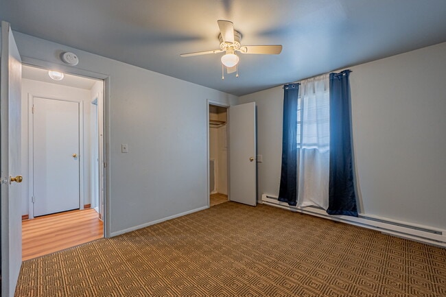
This Property Is For Sale
NEARBY LISTINGS FOR SALE OR LEASE
Property Detail
3128 Sw 59Th St
Oklahoma City, OK
Mclemore Addition
143601005
MCLEMORE ADDITION 001 000 LOTS 1 THRU 3
Multifamilydwelling
Oklahoma
X
Oklahoma
40027C0040J
1-3
2023
1.99 AC
2024
W South Oklahoma City
107213
Oklahoma City
33,300 SF
DEMOGRAPHICS near 3128 Sw 59Th St
1 Mile
3 Mile
5 Mile
2024 Total Population
14,867
93,724
168,782
2029 Population
15,144
96,124
173,787
Pop Growth 2024-2029
+ 1.86%
+ 2.56%
+ 2.97%
Average Age
34
35
36
2024 Total Households
5,152
33,196
61,540
HH Growth 2024-2029
+ 2.00%
+ 2.64%
+ 3.10%
Median Household Inc
$42,065
$43,804
$46,929
Avg Household Size
2.70
2.70
2.60
2024 Avg HH Vehicles
2.00
2.00
2.00
Median Home Value
$78,499
$96,339
$126,663
Median Year Built
1964
1966
1972
Nearby Places
Map Layers
Map Styles
 Street
 Aerial
- Restaurants
- Banks
- Shops
- Fitness
- Groceries
PUBLIC TRANSPORTATION
COMMUTER RAIL
Oklahoma City (Heartland Flyer - Amtrak)
DRIVE
WALK
Distance
Oklahoma City (Heartland Flyer - Amtrak)
12 min
8.3 mi
AIRPORT
Will Rogers World
DRIVE
WALK
Distance
Will Rogers World
10 min
3.2 mi
Freight Ports
Tulsa Port Of Catoosa
DRIVE
WALK
Distance
Tulsa Port Of Catoosa
144 min
131.2 mi
Nearby Properties
Address
Land Use
TOTAL SIZE
Lot Size
Zoning
Address
Land Use
TOTAL SIZE
Lot Size
Zoning
192.48 AC
Address
Land Use
TOTAL SIZE
Lot Size
Zoning
64,658 SF
1.86 AC
SPUD
Address
Land Use
TOTAL SIZE
Lot Size
Zoning
Address
Land Use
TOTAL SIZE
Lot Size
Zoning
384,708 SF
17.05 AC
R-4
Address
Land Use
TOTAL SIZE
Lot Size
Zoning
27,056 SF
40.77 AC
Address
Land Use
TOTAL SIZE
Lot Size
Zoning
232,037 SF
18.80 AC
C-3
Address
Land Use
TOTAL SIZE
Lot Size
Zoning
239,760 SF
18.52 AC
PUD
Address
Land Use
TOTAL SIZE
Lot Size
Zoning
93,886 SF
8.57 AC
CO
Address
Land Use
TOTAL SIZE
Lot Size
Zoning
192,405 SF
24.38 AC
Address
Land Use
TOTAL SIZE
Lot Size
Zoning
259,726 SF
19.94 AC
PUD
Address
Land Use
TOTAL SIZE
Lot Size
Zoning
Address
Land Use
TOTAL SIZE
Lot Size
Zoning
192,771 SF
11.20 AC
I-3
Address
Land Use
TOTAL SIZE
Lot Size
Zoning
39,734 SF
5.16 AC
C-3
Address
Land Use
TOTAL SIZE
Lot Size
Zoning
10,110 SF
10 AC
Address
Land Use
TOTAL SIZE
Lot Size
Zoning
203,880 SF
9.93 AC
R-4
Address
Land Use
TOTAL SIZE
Lot Size
Zoning
11,850 SF
1.49 AC
R-2
Address
Land Use
TOTAL SIZE
Lot Size
Zoning
158,150 SF
15.18 AC
I-2
Address
Land Use
TOTAL SIZE
Lot Size
Zoning
233,288 SF
24.24 AC
C-3
Address
Land Use
TOTAL SIZE
Lot Size
Zoning
124,208 SF
21.48 AC
I-2
Address
Land Use
TOTAL SIZE
Lot Size
Zoning
204,885 SF
24.62 AC
C-3
Address
Land Use
TOTAL SIZE
Lot Size
Zoning
7,496 SF
4.20 AC
Address
Land Use
TOTAL SIZE
Lot Size
Zoning
198,631 SF
13.26 AC
C-3
Address
Land Use
TOTAL SIZE
Lot Size
Zoning
66,705 SF
7.64 AC
RM
Address
Land Use
TOTAL SIZE
Lot Size
Zoning
204,532 SF
12.46 AC
R-4
Address
Land Use
TOTAL SIZE
Lot Size
Zoning
Address
Land Use
TOTAL SIZE
Lot Size
Zoning
235,670 SF
10.38 AC
R-4
Address
Land Use
TOTAL SIZE
Lot Size
Zoning
271,312 SF
13.06 AC
R-4
Address
Land Use
TOTAL SIZE
Lot Size
Zoning
92,222 SF
6.40 AC
R-4
Address
Land Use
TOTAL SIZE
Lot Size
Zoning
164,114 SF
21.70 AC
I-3
Address
Land Use
TOTAL SIZE
Lot Size
Zoning
149,745 SF
6.37 AC
R-4
The World's #1 Commercial Real Estate Marketplace
Connect with us
© 2025 CoStar Group
The information above has been obtained from sources believed reliable. While we do not doubt its accuracy we have not verified it and make no guarantee, warranty or representation about it. It is your responsibility to independently confirm its accuracy and completeness. Any projections, opinions, assumptions, or estimates used are for example only and do not represent the current or future performance of the property. The value of this transaction to you depends on tax and other factors which should be evaluated by your tax, financial, and legal advisors. You and your advisors should conduct a careful, independent investigation of the property to determine to your satisfaction the suitability of the property for your needs.