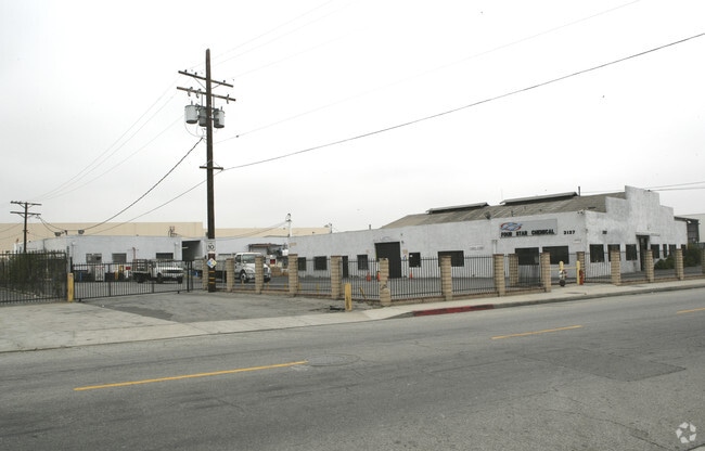
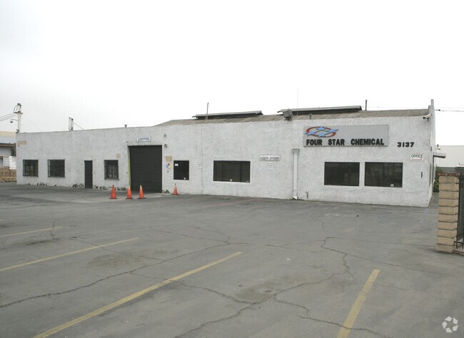
Property Record
3137 E 26Th St, Vernon, CA 90058

NEARBY LISTINGS FOR SALE OR LEASE
Property Detail
3137 E 26Th St
5169-032-015
Sepulveda Maria Antonio Lugo De 07 34
Lightindustrial
SAN ANTONIO RANCHO FOR DESC SEE ASSESSORS MAPS POR OF SD RO
X
Los Angeles
06037C1639F
California
2024
2.11 AC
2025
Vernon
980016
Los Angeles
18,732 SF
Los Angeles-Long Beach-Glendale, CA
DEMOGRAPHICS near 3137 E 26Th St
1 Mile
3 Mile
5 Mile
2024 Total Population
11,077
303,429
997,006
2029 Population
10,574
287,952
953,726
Pop Growth 2024-2029
(4.54%)
(5.10%)
(4.34%)
Average Age
35
36
36
2024 Total Households
2,847
83,084
294,514
HH Growth 2024-2029
(4.92%)
(5.32%)
(4.20%)
Median Household Inc
$45,016
$50,406
$50,766
Avg Household Size
3.70
3.40
3.10
2024 Avg HH Vehicles
2.00
2.00
2.00
Median Home Value
$683,333
$597,562
$632,713
Median Year Built
1948
1950
1955
Nearby Places
Map Layers
Map Styles
 Street
 Aerial
- Restaurants
- Banks
- Shops
- Fitness
- Groceries
PUBLIC TRANSPORTATION
COMMUTER RAIL
DRIVE
WALK
Distance
8 min
4.0 mi
Union Station (91 Line - Southern California Regional Rail Authority (Metrolink), Antelope Valley Line - Southern California Regional Rail Authority (Metrolink), Orange County Line - Southern California Regional Rail Authority (Metrolink), Riverside Line - Southern California Regional Rail Authority (Metrolink), San Bernardino Line - Southern California Regional Rail Authority (Metrolink), Ventura County Line - Southern California Regional Rail Authority (Metrolink))
DRIVE
WALK
Distance
Union Station (91 Line - Southern California Regional Rail Authority (Metrolink), Antelope Valley Line - Southern California Regional Rail Authority (Metrolink), Orange County Line - Southern California Regional Rail Authority (Metrolink), Riverside Line - Southern California Regional Rail Authority (Metrolink), San Bernardino Line - Southern California Regional Rail Authority (Metrolink), Ventura County Line - Southern California Regional Rail Authority (Metrolink))
10 min
4.2 mi
AIRPORT
Long Beach (Daugherty Field)
DRIVE
WALK
Distance
Long Beach (Daugherty Field)
28 min
18.8 mi
Bob Hope
DRIVE
WALK
Distance
Bob Hope
29 min
19.6 mi
Los Angeles International
DRIVE
WALK
Distance
Los Angeles International
30 min
19.6 mi
Freight Ports
Port of Long Beach
DRIVE
WALK
Distance
Port of Long Beach
31 min
20.7 mi
Nearby Properties
Address
Land Use
TOTAL SIZE
Lot Size
Zoning
Address
Land Use
TOTAL SIZE
Lot Size
Zoning
2,697,158 SF
20.18 AC
LAM2
Address
Land Use
TOTAL SIZE
Lot Size
Zoning
635,233 SF
12.02 AC
LAR5
Address
Land Use
TOTAL SIZE
Lot Size
Zoning
329,487 SF
0.94 AC
LAC2
Address
Land Use
TOTAL SIZE
Lot Size
Zoning
320,925 SF
0.88 AC
LAC2
Address
Land Use
TOTAL SIZE
Lot Size
Zoning
444,139 SF
3.63 AC
LAM3
Address
Land Use
TOTAL SIZE
Lot Size
Zoning
479,272 SF
16.14 AC
LAM3
Address
Land Use
TOTAL SIZE
Lot Size
Zoning
1,088,170 SF
15.98 AC
LAM3
Address
Land Use
TOTAL SIZE
Lot Size
Zoning
535,949 SF
5.85 AC
LAM3
Address
Land Use
TOTAL SIZE
Lot Size
Zoning
1,810,830 SF
4.28 AC
LAM2
Address
Land Use
TOTAL SIZE
Lot Size
Zoning
327,061 SF
2.18 AC
LAM3
Address
Land Use
TOTAL SIZE
Lot Size
Zoning
322,080 SF
2.85 AC
LAC2
Address
Land Use
TOTAL SIZE
Lot Size
Zoning
182,700 SF
8.29 AC
LAM3
Address
Land Use
TOTAL SIZE
Lot Size
Zoning
318,903 SF
1.10 AC
LAC4
Address
Land Use
TOTAL SIZE
Lot Size
Zoning
252,825 SF
1.74 AC
LAC2
Address
Land Use
TOTAL SIZE
Lot Size
Zoning
235,102 SF
1.71 AC
LAC2
Address
Land Use
TOTAL SIZE
Lot Size
Zoning
397,866 SF
3.51 AC
LAM3
Address
Land Use
TOTAL SIZE
Lot Size
Zoning
227,179 SF
10.46 AC
VEM*
Address
Land Use
TOTAL SIZE
Lot Size
Zoning
527,173 SF
12.36 AC
CMM2*
Address
Land Use
TOTAL SIZE
Lot Size
Zoning
276,452 SF
1.21 AC
LAM3
Address
Land Use
TOTAL SIZE
Lot Size
Zoning
326,472 SF
14.53 AC
VEM*
Address
Land Use
TOTAL SIZE
Lot Size
Zoning
388,144 SF
1.43 AC
LAC2
Address
Land Use
TOTAL SIZE
Lot Size
Zoning
218,680 SF
1.82 AC
LAR5
Address
Land Use
TOTAL SIZE
Lot Size
Zoning
188,319 SF
11.25 AC
VEM&MS1*
Address
Land Use
TOTAL SIZE
Lot Size
Zoning
190,082 SF
1.84 AC
LAC4
Address
Land Use
TOTAL SIZE
Lot Size
Zoning
108,598 SF
15.93 AC
LCC3*
Address
Land Use
TOTAL SIZE
Lot Size
Zoning
318,388 SF
11.07 AC
LAM2
Address
Land Use
TOTAL SIZE
Lot Size
Zoning
104,676 SF
4.32 AC
LAM3
Address
Land Use
TOTAL SIZE
Lot Size
Zoning
Address
Land Use
TOTAL SIZE
Lot Size
Zoning
285,189 SF
1.58 AC
LAC2
Address
Land Use
TOTAL SIZE
Lot Size
Zoning
279,682 SF
6.98 AC
VEM*
The World's #1 Commercial Real Estate Marketplace
Connect with us
© 2026 CoStar Group
The information above has been obtained from sources believed reliable. While we do not doubt its accuracy we have not verified it and make no guarantee, warranty or representation about it. It is your responsibility to independently confirm its accuracy and completeness. Any projections, opinions, assumptions, or estimates used are for example only and do not represent the current or future performance of the property. The value of this transaction to you depends on tax and other factors which should be evaluated by your tax, financial, and legal advisors. You and your advisors should conduct a careful, independent investigation of the property to determine to your satisfaction the suitability of the property for your needs.