Property Record
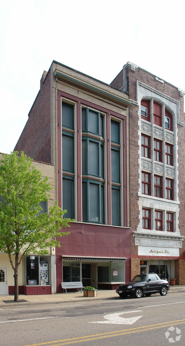
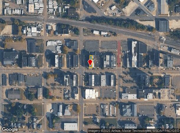
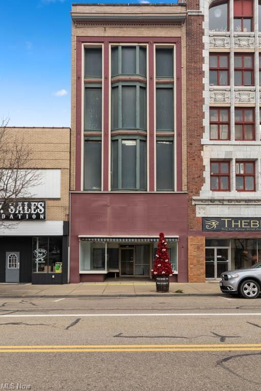
314 E Main St, Alliance, OH 44601
Property Detail
314 E Main St
Canton-Massillon, OH
522 24.50MP
00100237
Stark
Commercialnec
Ohio
0
0.07 AC
2025
Stark County
710400
Cleveland
14,400 SF
NEARBY LISTINGS FOR SALE OR LEASE
DEMOGRAPHICS near 314 E Main St
1 mile
3 mile
5 mile
2024 Total Population
9,753
27,971
37,704
2029 Population
9,820
27,941
37,554
Pop Growth 2024-2029
+ 0.69%
(0.11%)
(0.40%)
Average Age
38
41
42
2024 Total Households
3,827
11,223
15,445
HH Growth 2024-2029
+ 0.73%
(0.10%)
(0.36%)
Median Household Inc
$37,074
$50,500
$51,126
Avg Household Size
2.40
2.30
2.30
2024 Avg HH Vehicles
1.00
2.00
2.00
Median Home Value
$63,819
$114,732
$124,633
Median Year Built
1946
1952
1954
Nearby Places
Map Layers
Map Styles
 Street
 Aerial
Transit
 Traffic
 Biking
Places
Listings with unknown addresses are not visible on the map
- Restaurants
- Banks
- Shops
- Fitness
- Groceries
PUBLIC TRANSPORTATION
COMMUTER RAIL
Drive
Walk
Distance
2 min
12 min
0.6 mi
AIRPORT
Akron-Canton Regional
Drive
Walk
Distance
Akron-Canton Regional
34 min
20.3 mi
SALE & LEASE HISTORY
LISTING DATE
SALE/LEASE

Jun 02, 2023
For Sale
Nearby Properties
Address
Land Use
TOTAL SIZE
Lot Size
Zoning
Address
Land Use
TOTAL SIZE
Lot Size
Zoning
1,015,253 SF
83.25 AC
Address
Land Use
TOTAL SIZE
Lot Size
Zoning
294,532 SF
7.73 AC
Address
Land Use
TOTAL SIZE
Lot Size
Zoning
121,669 SF
27.80 AC
Address
Land Use
TOTAL SIZE
Lot Size
Zoning
275,422 SF
10 AC
Address
Land Use
TOTAL SIZE
Lot Size
Zoning
402,113 SF
25.10 AC
Address
Land Use
TOTAL SIZE
Lot Size
Zoning
93,477 SF
8.21 AC
Address
Land Use
TOTAL SIZE
Lot Size
Zoning
295,254 SF
29.02 AC
Address
Land Use
TOTAL SIZE
Lot Size
Zoning
79,700 SF
1.80 AC
Address
Land Use
TOTAL SIZE
Lot Size
Zoning
120,552 SF
10.37 AC
Address
Land Use
TOTAL SIZE
Lot Size
Zoning
69,467 SF
18.25 AC
Address
Land Use
TOTAL SIZE
Lot Size
Zoning
60,037 SF
6.38 AC
Address
Land Use
TOTAL SIZE
Lot Size
Zoning
398,637 SF
60.59 AC
Address
Land Use
TOTAL SIZE
Lot Size
Zoning
65,108 SF
164.87 AC
Address
Land Use
TOTAL SIZE
Lot Size
Zoning
73,853 SF
3.83 AC
Address
Land Use
TOTAL SIZE
Lot Size
Zoning
80,163 SF
6.99 AC
Address
Land Use
TOTAL SIZE
Lot Size
Zoning
75,318 SF
4.59 AC
Address
Land Use
TOTAL SIZE
Lot Size
Zoning
56,112 SF
6.37 AC
Address
Land Use
TOTAL SIZE
Lot Size
Zoning
134,368 SF
10.30 AC
Address
Land Use
TOTAL SIZE
Lot Size
Zoning
73,764 SF
1.52 AC
Address
Land Use
TOTAL SIZE
Lot Size
Zoning
29,455 SF
8 AC
Address
Land Use
TOTAL SIZE
Lot Size
Zoning
62,767 SF
2.85 AC
Address
Land Use
TOTAL SIZE
Lot Size
Zoning
106,914 SF
11.10 AC
Address
Land Use
TOTAL SIZE
Lot Size
Zoning
189,096 SF
21.15 AC
Address
Land Use
TOTAL SIZE
Lot Size
Zoning
130,339 SF
10.28 AC
Address
Land Use
TOTAL SIZE
Lot Size
Zoning
53,959 SF
3.58 AC
Address
Land Use
TOTAL SIZE
Lot Size
Zoning
49,226 SF
10.57 AC
Address
Land Use
TOTAL SIZE
Lot Size
Zoning
52,644 SF
1.03 AC
Address
Land Use
TOTAL SIZE
Lot Size
Zoning
34,078 SF
28.41 AC
Address
Land Use
TOTAL SIZE
Lot Size
Zoning
10,800 SF
6.60 AC
Address
Land Use
TOTAL SIZE
Lot Size
Zoning
56,474 SF
9.80 AC
The World's #1 Commercial Real Estate Marketplace
Connect with us
© 2026 CoStar Group
The information above has been obtained from sources believed reliable. While we do not doubt its accuracy we have not verified it and make no guarantee, warranty or representation about it. It is your responsibility to independently confirm its accuracy and completeness. Any projections, opinions, assumptions, or estimates used are for example only and do not represent the current or future performance of the property. The value of this transaction to you depends on tax and other factors which should be evaluated by your tax, financial, and legal advisors. You and your advisors should conduct a careful, independent investigation of the property to determine to your satisfaction the suitability of the property for your needs.