Property Record
314 Rolkin Rd, Charlottesville, VA 22911

Property Detail
314 Rolkin Rd
07800-00-00-012B0
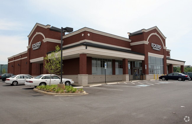
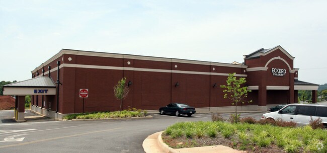
WALGREENS STORE #17626-S
Storebuilding
Albemarle
C1 COMMERC
Virginia
B and X Area of moderate flood hazard, usually the area between the limits of the 100-year and 500-year floods.
1.75 AC
2025
Charlottesville
2025
Other Market Areas
010502
Charlottesville, VA
14,823 SF
NEARBY LISTINGS FOR SALE OR LEASE
DEMOGRAPHICS near 314 Rolkin Rd
1 mile
3 mile
5 mile
2025 Total Population
5,529
36,042
98,914
2030 Population
5,721
35,992
99,939
Pop Growth 2025-2030
+ 3.47%
(0.14%)
+ 1.04%
Average Age
45
40
38
2025 Total Households
2,700
16,593
40,338
HH Growth 2025-2030
+ 3.85%
(0.02%)
+ 1.15%
Median Household Inc
$123,528
$91,445
$78,656
Avg Household Size
2.00
2.10
2.20
2025 Avg HH Vehicles
2.00
2.00
2.00
Median Home Value
$494,594
$495,114
$471,613
Median Year Built
2002
1984
1985
Nearby Places
Map Layers
Map Styles
 Street
 Aerial
Transit
 Traffic
 Biking
Places
Listings with unknown addresses are not visible on the map
- Restaurants
- Banks
- Shops
- Fitness
- Groceries
PUBLIC TRANSPORTATION
COMMUTER RAIL
Drive
Walk
Distance
9 min
3.2 mi
AIRPORT
Charlottesville-Albemarle
Drive
Walk
Distance
Charlottesville-Albemarle
23 min
10.9 mi
Nearby Properties
Address
Land Use
TOTAL SIZE
Lot Size
Zoning
Address
Land Use
TOTAL SIZE
Lot Size
Zoning
429,500 SF
38.49 AC
PDMC
Address
Land Use
TOTAL SIZE
Lot Size
Zoning
167,708 SF
1.05 AC
CM
Address
Land Use
TOTAL SIZE
Lot Size
Zoning
3,465 SF
145.17 AC
CV
Address
Land Use
TOTAL SIZE
Lot Size
Zoning
160,621 SF
55.78 AC
PLANNED RE
Address
Land Use
TOTAL SIZE
Lot Size
Zoning
3,803 SF
266.70 AC
CV
Address
Land Use
TOTAL SIZE
Lot Size
Zoning
578,208 SF
2.06 AC
CX-8
Address
Land Use
TOTAL SIZE
Lot Size
Zoning
43,616 SF
2.24 AC
CX-8
Address
Land Use
TOTAL SIZE
Lot Size
Zoning
393,960 SF
16.14 AC
NMD
Address
Land Use
TOTAL SIZE
Lot Size
Zoning
30,896 SF
0.97 AC
DX
Address
Land Use
TOTAL SIZE
Lot Size
Zoning
240,936 SF
1.26 AC
NX-10
Address
Land Use
TOTAL SIZE
Lot Size
Zoning
14,000 SF
6.45 AC
CX-5
Address
Land Use
TOTAL SIZE
Lot Size
Zoning
336,000 SF
20.20 AC
R15 RESIDE
Address
Land Use
TOTAL SIZE
Lot Size
Zoning
20.41 AC
Address
Land Use
TOTAL SIZE
Lot Size
Zoning
218,660 SF
1.27 AC
CX-8
Address
Land Use
TOTAL SIZE
Lot Size
Zoning
1.38 AC
CX-3
Address
Land Use
TOTAL SIZE
Lot Size
Zoning
222,253 SF
0.73 AC
NX-10
Address
Land Use
TOTAL SIZE
Lot Size
Zoning
5,136 SF
4.27 AC
RX-5
Address
Land Use
TOTAL SIZE
Lot Size
Zoning
82,308 SF
97.43 AC
R1 RESIDEN
Address
Land Use
TOTAL SIZE
Lot Size
Zoning
249,740 SF
42.40 AC
CM
Address
Land Use
TOTAL SIZE
Lot Size
Zoning
42,336 SF
0.90 AC
CV
Address
Land Use
TOTAL SIZE
Lot Size
Zoning
12,495 SF
4.50 AC
NX-10
Address
Land Use
TOTAL SIZE
Lot Size
Zoning
223,492 SF
35 AC
COMMERCIAL
Address
Land Use
TOTAL SIZE
Lot Size
Zoning
73,068 SF
13.39 AC
PLANNED DE
Address
Land Use
TOTAL SIZE
Lot Size
Zoning
100 SF
51.71 AC
LIGHT INDU
Address
Land Use
TOTAL SIZE
Lot Size
Zoning
1,066,515 SF
0.45 AC
CX-8
Address
Land Use
TOTAL SIZE
Lot Size
Zoning
173,868 SF
4.38 AC
DX
Address
Land Use
TOTAL SIZE
Lot Size
Zoning
48,500 SF
1.40 AC
CM
Address
Land Use
TOTAL SIZE
Lot Size
Zoning
117,270 SF
14.62 AC
CV
Address
Land Use
TOTAL SIZE
Lot Size
Zoning
265,117 SF
1.44 AC
CM
Address
Land Use
TOTAL SIZE
Lot Size
Zoning
111,306 SF
1.08 AC
CX-8
The World's #1 Commercial Real Estate Marketplace
Connect with us
© 2026 CoStar Group
The information above has been obtained from sources believed reliable. While we do not doubt its accuracy we have not verified it and make no guarantee, warranty or representation about it. It is your responsibility to independently confirm its accuracy and completeness. Any projections, opinions, assumptions, or estimates used are for example only and do not represent the current or future performance of the property. The value of this transaction to you depends on tax and other factors which should be evaluated by your tax, financial, and legal advisors. You and your advisors should conduct a careful, independent investigation of the property to determine to your satisfaction the suitability of the property for your needs.