Property Record
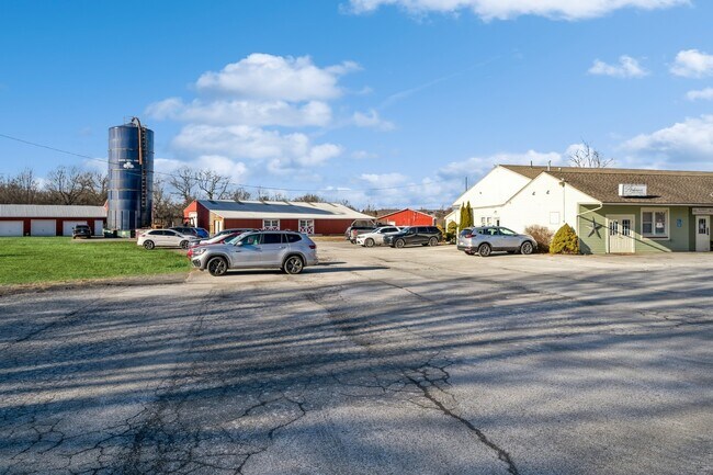
3142 State Route 207, Campbell Hall, NY 10916


NEARBY LISTINGS FOR SALE OR LEASE
Property Detail
3142 State Route 207
New York-Jersey City-White Plains, NY-NJ
Minor Subdivision Lands Pat Kat Inc
333489-009-000-0001-047.510-0000
LT1 PAT KAT INC SUB MAP 110-95
Storebuilding
Orange
X
New York
36071C0283E
47.51
2024
6 AC
2024
Orange County
012300
Northern New Jersey
12,544 SF
DEMOGRAPHICS near 3142 State Route 207
1 Mile
3 Mile
5 Mile
2024 Total Population
591
8,041
32,032
2029 Population
599
8,134
32,637
Pop Growth 2024-2029
+ 1.35%
+ 1.16%
+ 1.89%
Average Age
44
42
42
2024 Total Households
190
2,693
11,360
HH Growth 2024-2029
+ 1.05%
+ 1.23%
+ 2.09%
Median Household Inc
$114,999
$110,319
$97,729
Avg Household Size
2.90
2.80
2.60
2024 Avg HH Vehicles
2.00
2.00
2.00
Median Home Value
$474,285
$403,437
$341,175
Median Year Built
1987
1978
1977
Nearby Places
Map Layers
Map Styles
 Street
 Aerial
- Restaurants
- Banks
- Shops
- Fitness
- Groceries
PUBLIC TRANSPORTATION
COMMUTER RAIL
Campbell Hall (Bergen County/Port Jervis Line - NJ Transit Commuter Rail (NJ Transit), Main/Port Jervis Line - NJ Transit Commuter Rail (NJ Transit))
DRIVE
WALK
Distance
Campbell Hall (Bergen County/Port Jervis Line - NJ Transit Commuter Rail (NJ Transit), Main/Port Jervis Line - NJ Transit Commuter Rail (NJ Transit))
5 min
2.1 mi
Middletown New York (Bergen County/Port Jervis Line - NJ Transit Commuter Rail (NJ Transit), Main/Port Jervis Line - NJ Transit Commuter Rail (NJ Transit))
DRIVE
WALK
Distance
Middletown New York (Bergen County/Port Jervis Line - NJ Transit Commuter Rail (NJ Transit), Main/Port Jervis Line - NJ Transit Commuter Rail (NJ Transit))
16 min
7.1 mi
AIRPORT
New York Stewart International
DRIVE
WALK
Distance
New York Stewart International
21 min
13.0 mi
Freight Ports
Port Newark Container Terminal
DRIVE
WALK
Distance
Port Newark Container Terminal
91 min
68.9 mi
SALE & LEASE HISTORY
LISTING DATE
SALE/LEASE

Jan 09, 2025
For Lease
Nearby Properties
Address
Land Use
TOTAL SIZE
Lot Size
Zoning
Address
Land Use
TOTAL SIZE
Lot Size
Zoning
145,831 SF
15.30 AC
04023
Address
Land Use
TOTAL SIZE
Lot Size
Zoning
157,558 SF
37.40 AC
2034
Address
Land Use
TOTAL SIZE
Lot Size
Zoning
134,566 SF
60 AC
02092
Address
Land Use
TOTAL SIZE
Lot Size
Zoning
116,353 SF
22.50 AC
2034
Address
Land Use
TOTAL SIZE
Lot Size
Zoning
24.10 AC
04023
Address
Land Use
TOTAL SIZE
Lot Size
Zoning
330.10 AC
R4A*
Address
Land Use
TOTAL SIZE
Lot Size
Zoning
41.40 AC
R4A
Address
Land Use
TOTAL SIZE
Lot Size
Zoning
55,200 SF
11.80 AC
R3A*
Address
Land Use
TOTAL SIZE
Lot Size
Zoning
136,784 SF
6 AC
O/R
Address
Land Use
TOTAL SIZE
Lot Size
Zoning
430,275 SF
35.60 AC
O/R
Address
Land Use
TOTAL SIZE
Lot Size
Zoning
30,085 SF
1 AC
04023
Address
Land Use
TOTAL SIZE
Lot Size
Zoning
10 AC
HRC4*
Address
Land Use
TOTAL SIZE
Lot Size
Zoning
1,240 SF
188 AC
R4A*
Address
Land Use
TOTAL SIZE
Lot Size
Zoning
250 AC
R4A*
Address
Land Use
TOTAL SIZE
Lot Size
Zoning
22,518 SF
1.90 AC
04023
Address
Land Use
TOTAL SIZE
Lot Size
Zoning
60,120 SF
7.70 AC
O/R
Address
Land Use
TOTAL SIZE
Lot Size
Zoning
108,915 SF
6.20 AC
02034
Address
Land Use
TOTAL SIZE
Lot Size
Zoning
6,910 SF
186.70 AC
R4A
Address
Land Use
TOTAL SIZE
Lot Size
Zoning
33,890 SF
1.30 AC
04023
Address
Land Use
TOTAL SIZE
Lot Size
Zoning
7,080 SF
72.40 AC
R4A
Address
Land Use
TOTAL SIZE
Lot Size
Zoning
1,100 SF
203.20 AC
R4A*
Address
Land Use
TOTAL SIZE
Lot Size
Zoning
62,770 SF
10.60 AC
IP
Address
Land Use
TOTAL SIZE
Lot Size
Zoning
6,562 SF
104.80 AC
01092
Address
Land Use
TOTAL SIZE
Lot Size
Zoning
33,920 SF
0.12 AC
04023
Address
Land Use
TOTAL SIZE
Lot Size
Zoning
11,645 SF
84.20 AC
R4A
Address
Land Use
TOTAL SIZE
Lot Size
Zoning
Address
Land Use
TOTAL SIZE
Lot Size
Zoning
264,708 SF
37.10 AC
O/R
Address
Land Use
TOTAL SIZE
Lot Size
Zoning
26,617 SF
11.40 AC
HRC4*
Address
Land Use
TOTAL SIZE
Lot Size
Zoning
19,705 SF
1.12 AC
04023
Address
Land Use
TOTAL SIZE
Lot Size
Zoning
20,263 SF
0.55 AC
04023
The World's #1 Commercial Real Estate Marketplace
Connect with us
© 2026 CoStar Group
The information above has been obtained from sources believed reliable. While we do not doubt its accuracy we have not verified it and make no guarantee, warranty or representation about it. It is your responsibility to independently confirm its accuracy and completeness. Any projections, opinions, assumptions, or estimates used are for example only and do not represent the current or future performance of the property. The value of this transaction to you depends on tax and other factors which should be evaluated by your tax, financial, and legal advisors. You and your advisors should conduct a careful, independent investigation of the property to determine to your satisfaction the suitability of the property for your needs.