Property Record
3143 State Rd, La Crosse, WI 54601
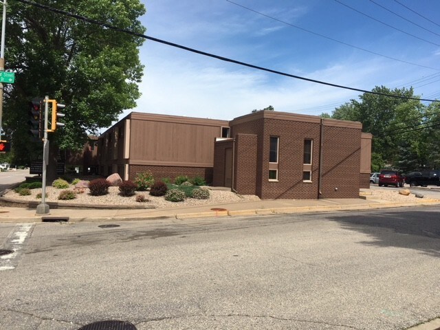

Property Detail
3143 State Rd
017-040097-010
SHELBY HEIGHTS ADDITION LOTS 1, 2 & 3 BLOCK 1 EX PRT FOR ST SUBJ TO AGREE IN V1220 P462 LOT SZ: IRR
Commercialnec
La Crosse
MZA
Wisconsin
B and X Area of moderate flood hazard, usually the area between the limits of the 100-year and 500-year floods.
1-3
2025
0.59 AC
2025
Other Market Areas
000700
La Crosse-Onalaska, WI-MN
3,600 SF
NEARBY LISTINGS FOR SALE OR LEASE
DEMOGRAPHICS near 3143 State Rd
1 mile
3 mile
5 mile
2025 Total Population
7,316
47,873
62,466
2030 Population
7,293
48,687
63,200
Pop Growth 2025-2030
(0.31%)
+ 1.70%
+ 1.18%
Average Age
42
38
39
2025 Total Households
3,238
20,472
27,117
HH Growth 2025-2030
(0.46%)
+ 2.05%
+ 1.36%
Median Household Inc
$72,711
$56,861
$56,384
Avg Household Size
2.20
2.00
2.10
2025 Avg HH Vehicles
2.00
2.00
2.00
Median Home Value
$236,043
$235,640
$232,487
Median Year Built
1960
1971
1970
Nearby Places
Map Layers
Map Styles
 Street
 Aerial
Layers
 Traffic
 Biking
Places
Listings with unknown addresses are not visible on the map
- Restaurants
- Banks
- Shops
- Fitness
- Groceries
PUBLIC TRANSPORTATION
COMMUTER RAIL
Drive
Walk
Distance
12 min
4.2 mi
AIRPORT
La Crosse Regional
Drive
Walk
Distance
La Crosse Regional
23 min
10.9 mi
SALE & LEASE HISTORY
LISTING DATE
SALE/LEASE

Jun 25, 2018
For Sale
Nearby Properties
Address
Land Use
TOTAL SIZE
Lot Size
Zoning
Address
Land Use
TOTAL SIZE
Lot Size
Zoning
38,407 SF
3.12 AC
MZA
Address
Land Use
TOTAL SIZE
Lot Size
Zoning
4.65 AC
Address
Land Use
TOTAL SIZE
Lot Size
Zoning
131,552 SF
0.89 AC
Address
Land Use
TOTAL SIZE
Lot Size
Zoning
3.91 AC
Address
Land Use
TOTAL SIZE
Lot Size
Zoning
0.75 AC
MZA
Address
Land Use
TOTAL SIZE
Lot Size
Zoning
0.12 AC
Address
Land Use
TOTAL SIZE
Lot Size
Zoning
11.56 AC
Address
Land Use
TOTAL SIZE
Lot Size
Zoning
0.56 AC
MZA
Address
Land Use
TOTAL SIZE
Lot Size
Zoning
10.21 AC
MZA
Address
Land Use
TOTAL SIZE
Lot Size
Zoning
5.79 AC
MZA
Address
Land Use
TOTAL SIZE
Lot Size
Zoning
2.43 AC
Address
Land Use
TOTAL SIZE
Lot Size
Zoning
186,812 SF
15.04 AC
MZA
Address
Land Use
TOTAL SIZE
Lot Size
Zoning
73,056 SF
0.62 AC
Address
Land Use
TOTAL SIZE
Lot Size
Zoning
15.48 AC
MZA
Address
Land Use
TOTAL SIZE
Lot Size
Zoning
81,664 SF
1.06 AC
MZA
Address
Land Use
TOTAL SIZE
Lot Size
Zoning
2.10 AC
MZA
Address
Land Use
TOTAL SIZE
Lot Size
Zoning
32,153 SF
3.16 AC
MZA
Address
Land Use
TOTAL SIZE
Lot Size
Zoning
64,480 SF
0.69 AC
MZA
Address
Land Use
TOTAL SIZE
Lot Size
Zoning
1.20 AC
MZA
Address
Land Use
TOTAL SIZE
Lot Size
Zoning
1.19 AC
Address
Land Use
TOTAL SIZE
Lot Size
Zoning
0.50 AC
Address
Land Use
TOTAL SIZE
Lot Size
Zoning
2.12 AC
MZA
Address
Land Use
TOTAL SIZE
Lot Size
Zoning
5.01 AC
MZA
Address
Land Use
TOTAL SIZE
Lot Size
Zoning
0.96 AC
MZA
Address
Land Use
TOTAL SIZE
Lot Size
Zoning
0.78 AC
MZA
Address
Land Use
TOTAL SIZE
Lot Size
Zoning
9,330 SF
1.42 AC
MZA
Address
Land Use
TOTAL SIZE
Lot Size
Zoning
0.62 AC
Address
Land Use
TOTAL SIZE
Lot Size
Zoning
4.71 AC
Address
Land Use
TOTAL SIZE
Lot Size
Zoning
3.46 AC
MZA
Address
Land Use
TOTAL SIZE
Lot Size
Zoning
3.04 AC
MZA
The World's #1 Commercial Real Estate Marketplace
Connect with us
© 2026 CoStar Group
The information above has been obtained from sources believed reliable. While we do not doubt its accuracy we have not verified it and make no guarantee, warranty or representation about it. It is your responsibility to independently confirm its accuracy and completeness. Any projections, opinions, assumptions, or estimates used are for example only and do not represent the current or future performance of the property. The value of this transaction to you depends on tax and other factors which should be evaluated by your tax, financial, and legal advisors. You and your advisors should conduct a careful, independent investigation of the property to determine to your satisfaction the suitability of the property for your needs.